
Access Guide
Introduction
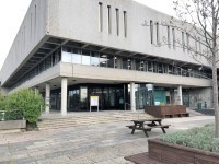
- Related link Hugh Owen Library.
- Https://www.disabledgo.com/access-guide/aberystwyth-university/hugh-owen-building
-
Comments
View
- This is a route from the Hugh Owen Library to the Pantycelyn Building.
- This route is approximately 900m and will take approximately 10 minutes to complete by foot.
- This route uses university access roads and paths and passes the Piazza, Students Union, Arts Centre, International Politics Building, Hugh Owen Building, Llandinam Building, Physical Sciences and Edward Llwyd.
- The main hazards on this route are uncontrolled road crossings, the Edward Llwyd car park and steep gradients.
Hugh Owen Library to Llandinam
- Exit the Hugh Owen Library via the main entrance leading into the Piazza.
- Cross the Piazza, exit via the lower lift and turn right onto the pavement.
- The pavement here has an even tarmac surface and is 120cm wide with a level gradient.
- After approximately 60m there is a barriered section, located at the bottom of the Piazza steps.
- In the centre of the barriered section is a section of tactile paving for a zebra crossing to the International Politics Building.
- This barriered section and crossing is shown in photographs 3 and 4.
- Continue straight along the pavement.
- After approximately 30m the gradient becomes slight, leading down away from you.
- After approximately 120m cross at the zebra crossing on your left.
- This crossing is a split zebra crossing with level and tactile paving on both sides. There is a level central island with tactile paving on both sides.
- This crossing is shown in photographs 7, 8, 9 and 10.
- Turn right after crossing and follow the path around to the left.
- The pavement has an uneven tarmac surface with a level gradient becoming steep.
- Approximately 20m down the pavement after the left bend there is a dropped kerb with tactile paving on the right side of the pavement.
- This is shown in photograph 13.
- After the tactile paving and dropped kerb the pavement bends around to the left.
- Approximately 80m down the pavement there is a level crossing with tactile paving on the right.
- This crossing is shown in photographs 15 and 16.
Llandinam to Edward Llwyd
- Continue past the crossing.
- The path has a level, even tarmac surface.
- After approximately 60m follow the path around to the right
- This is an even tarmac surface with a steep gradient and is 58cm wide at its approximately 100m, this is an even tarmac path with a steep gradient.
- At the end of the path there is a crossing on the right.
- This crossing has tactile paving and dropped kerbs on both sides.
- This crossing is shown in photographs 7 and 8.
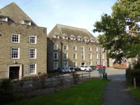
Edward Llwyd to Pantycelyn
- Turn left after the crossing and follow the pavement for approximately 40m.
- At the road junction cross the university access road directly in front of you.
- This crossing has tactile paving and dropped kerbs on both sides.
- This crossing is shown in photographs 3 and 4.
- After crossing the access road turn right.
- Follow the path around to the right into the Edward Llwyd car park.
- The path here has an uneven tarmac surface, 105cm wide with a level gradient gradually becoming steep.
- At the end of the path there is a section of tactile paving with a dropped kerb leading into Edward Llwyd car park.
- This section is shown in photograph 8.
- Cross the car park to rear left corner.
- The car park has an even tarmac surface with a level gradient.
- There are no designated pedestrian paths through the car park and can be busy between from 08:00 to 09:30 and from 16:00 to 17:30.
- The car park is shown in photographs 9 and 10.
- Enter the path in the rear left corner of the car park as you entered.
- There is a hashed yellow area in the corner of the car park at the paths entrance, shown in photographs 10 and 11.
- The entrance to the path has level tactile paving leading off the car park.
- The path entrance is shown in photograph 12.
- The path bends around to the left and has an even tarmac surface with a varying gradient between level and slight.
- There is bench seating available at intervals along the route, as shown in photograph 14.
- The path ends with a section of tactile paving and a dropped kerb leading to the front left side of the Pantycelyn Building.
- This area is shown in photograph 17.
- The area in front of the building is the building carpark and has an even tarmac surface with a level gradient.