
Access Guide
Overview (Covent Garden)
- This Access Guide covers the Covent Garden area, including the pedestrianised Piazza around the Market Building and James Street, the surrounding streets bounded by Shelton Street to the north, Drury Lane to the east, Maiden Lane and Tavistock Street to the south and Bedford Street, Garrick Street and Upper St Martin's Lane to the west.
The area is approximately 500m north to south and approximately 600m east to west to the extremes.
The constantly changing nature of the area may mean that the on-street conditions vary from the description in this Access Guide.
The Access Guide survey was undertaken in November 2022.
For detailed information about the Covent Garden Market Building please click here (new tab).
Notable buildings in the area include The Covent Garden Market Building, including the Apple Market, the Jubilee Market, the Royal Opera House on Bow Street, St Paul's Church, The Theatre Royal, The Fortune Theatre, the London Transport Museum and the London Film Museum.
The area is noted for a variety of high end fashion boutiques, perfume stores, jewellery stores and similar retail outlets together with restaurants and cafés, many with outside or pavement seating areas. - This guide is divided into three areas:
1. Covent Garden - Central Pedestrianised Streets.
2. Covent Garden - Central Non-pedestrianised Streets.
3. Covent Garden - North.
The guides include information for the following streets:
1. Covent Garden - Central Pedestrianised Streets;
- Covent Garden Piazza (new tab)
- Tavistock Court (new tab)
- James Street (new tab)
- Tavistock Street (new tab)
- Maiden Lane(new tab)
- Southampton Street (new tab)
- Henrietta Street (new tab)
- Rose Street / Lazenby Court (new tab)
- King Street (new tab)
2. Covent Garden - Central Non-pedestrianised Streets;
- Garrick Street - Bedford Street (new tab)
- Floral Street (new tab)
- Floral Court (new tab)
- Conduit Court / Banbury Court / Langley Court/ Hanover Place (new tab)
- Wellington Street – Bow Street (new tab)
- Russell Street (new tab)
- Crown Court / Martlett Court / Broad Court (new tab)
- Drury Lane (new tab)
3. Covent Garden - North;
- Long Acre (new tab)
- Upper St Martin's Lane (new tab)
- Mercer Street (new tab)
- Langley Street (new tab)
- Neal Street (new tab)
- Endell Street (new tab)
- Arne Street and Dryden Street (new tab)
- Shelton Street (new tab) together with side streets, passageways, and pedestrianised areas.
Other West End shopping areas are covered in their own separate guides, including Regent Street and New Bond Street, Oxford Street, Piccadilly Circus, Carnaby and Leicester Square. - As this is a popular tourist destination, the streets around Covent Garden can be busy and some areas particularly congested which may be daunting for some people.
The Piazza and Market Hall are known for street performers and musicians and many shops in the area also play music. This means that the area can be both vibrant but noisy, particularly around the Jubilee Market.
The mixture of shopping and restaurants mean that during normal shopping hours the area can be busy, with restaurants and bars staying opening until the late evening hours. - The central pedestrianised area, including Covent Garden Piazza, James Street, King Street and Floral Street has cobbled or block paving. Elsewhere there is a mixture of stone and concrete slabs or tarmac to pavements, with tarmac to streets and block paving at crossings. In places this traditional paving can be worn or uneven, which may be a slip or trip hazard to those with mobility problems.
- There are a number of Legible London wayfinding signs at key road intersections.
Other than James Street and around The Piazza and Market Building, there is generally a lack of public seating, however, many cafés, bars and restaurants have outside seating. - The main methods of getting to Covent Garden include tube, mainline train, bus or taxi.
The nearest underground station is Covent Garden which is central to the area. However, there is stepped access only to the platforms, similarly with the next nearest tube stations, Leicester Square and Charing Cross.
The nearest step-free station is Tottenham Court Road to the north west of Covent Garden, approximately 1km from the Market Hall, 15 minutes walk away.
The nearest mainline train station is Charing Cross, to the south of Covent Garden, approximately 550m (0.3 miles) from the Market Hall, 7 minutes away.
There are bus stops on The Strand at the south end of Southampton Street.
Additional bus stops may be found in Charing Cross Road near Leicester Square tube station.
There is a taxi rank in Russell Street just off the East Piazza. - Parking in the area, particularly on-street parking, is limited and visitors are encouraged to use public transport.
There are public car parks in Shelton Street (attendant parking), Q-Park Covent Garden in St Martin's Lane, NCP London Covent Garden in Parker Street off Drury Lane and Q-Park Chinatown in Newport Place.
On-street Blue Badge parking bays may be found in Bow Street, Floral Street, Long Acre and Tavistock Street, subject to any access restrictions.
Additional Blue Badge bays are just outside the area on Tavistock Street and Wellington Street.
Pay by Phone standard parking may be found in Southampton Street, Tavistock Street, Maiden Lane, Russell Street, Wellington Street, Drury Lane and Shelton Street. - There is an accessible toilet in Tavistock Court, at the side of the Jubilee Market.
There are female and male public toilets in the West Piazza by St Paul's, in the pedestrianised area of Covent Garden. These have stepped access only.
There are additional privately run public toilets within the Market Building in the Lower South Hall, operated by "2theloo". - To view the Access Guide for Covent Garden - Central Pedestrianised Streets please click here (new tab)..
- To view the Access Guide for Covent Garden - Central Non-pedestrianised Streets please click here (new tab)..
- To view the Access Guide for Covent Garden - North please click here (new tab)..
Related West End Venues (Attractions, Parking, Transport, Hotels)
-
Attractions
View
- Covent Garden - Market Building - To view the Access Guide please click here (new tab).
- Apple Market - To view the Access Guide please click here (new tab).
- Jubilee Market - To view the Access Guide please click here (new tab).
- London Transport Museum - To view the Access Guide please click here (new tab).
- London Transport Museum Shop - To view the Access Guide please click here (new tab).
-
Hotels and Conference Facilities
View
- Hilton - The Waldorf - To view the Access Guide please click here (new tab).
- Z Hotel - Piccadilly - To view the Access Guide please click here (new tab).
- Sea Containers Hotel - To view the Access Guide please click here (new tab).
- Union Jack Club - To view the Access Guide please click here (new tab).
- Parking View
- Public Transport View
Related West End Venues (Shopping (1), Eating and Drinking, and Other Services)
-
Shopping
View
- Allbirds - To view the Access Guide please click here (new tab).
- Barbour - To view the Access Guide please click here (new tab).
- Boots - To view the Access Guide please click here (new tab).
- Brandy Melville - To view the Access Guide please click here (new tab).
- Calvin Klein Underwear - To view the Access Guide please click here (new tab).
- Cos - To view the Access Guide please click here (new tab).
- Dr Marten's - To view the Access Guide please click here (new tab).
- Hobbs - To view the Access Guide please click here (new tab).
- iSmash - To view the Access Guide please click here (new tab).
- Jack Wolfskin - To view the Access Guide please click here (new tab).
- Levi's - To view the Access Guide please click here (new tab).
- London Graphic Centre - To view the Access Guide please click here (new tab).
-
Eating and Drinking
View
- 28-50 Wine Bar & Kitchen Covent Garden - To view the Access Guide please click here (new tab).
- Bill's Covent Garden - To view the Access Guide please click here (new tab).
- Hawksmoor - To view the Access Guide please click here (new tab).
- Maison Bab - To view the Access Guide please click here (new tab).
- Stanfords - To view the Access Guide please click here (new tab).
- Parking View
- Other Services View
Related West End Venues (Shopping (2))
-
Shopping
View
- Reiss - To view the Access Guide please click here (new tab).
- Rohan - To view the Access Guide please click here (new tab).
- Russell & Bromley - To view the Access Guide please click here (new tab).
- Snow + Rock - To view the Access Guide please click here (new tab).
- Space NK - To view the Access Guide please click here (new tab).
- Three. - To view the Access Guide please click here (new tab).
- TK Maxx - To view the Access Guide please click here (new tab).
- Vans - To view the Access Guide please click here (new tab).
Getting Here (Covent Garden)
-
By Bus
View
- The nearest bus stop to the south of Covent Garden is Southampton Street Covent Garden (Stop A), located on The Strand eastbound, or Savoy Street (Stop U) located on The Strand westbound.
Bus routes 6, 9, 11, 15, 24, 87, 88, 91, 139, 176 and 453 serve The Strand.
It is also served by night buses N11, N15, N21, N44, N87, N89, N91, N155, N199, N343, N550 and N551.
The nearest bus stop to the west of Covent Garden is Leicester Square (Stop J), located in Charing Cross Road southbound, or Leicester Square (Stop L) located in Charing Cross Road northbound.
Bus routes 24, 29 and 176 serve Charing Cross Road.
It is also served by night buses N5, N20, N29, N41 and N276.
All London buses have ramped access and dedicated space for wheelchair users. - For more information on London buses (Transport for London) please click here (opens new tab).
- The nearest bus stop to the south of Covent Garden is Southampton Street Covent Garden (Stop A), located on The Strand eastbound, or Savoy Street (Stop U) located on The Strand westbound.
-
By Underground
View
- The nearest underground station is Covent Garden.
Covent Garden is served by the Piccadilly line.
There are no lifts to the platforms.
Access is via a staircase with 190 steps which can become congested.
The next nearest tube station, Leicester Square which is served by the Northern line and Piccadilly line.
Leicester Square does not have lift access to platforms.
The nearest accessible step-free station is Tottenham Court Road which is served by the Central line and Northern line.
This station is approximately 1km (0.6 miles), 13-15 minutes walk away.
Other stations within 10 minutes walk include:
Charing Cross, served by the Northern line and Bakerloo line, approximately 6 minutes walk away.
This station has no lift access to platforms.
Holborn, served by the Central line and Piccadilly line, approximately 10 minutes walk away.
This station has no lift access to platforms.
Embankment, served by the Circle line, District line and Bakerloo line, approximately 10 minutes walk away.
This station has no lift access to platforms. - For more information on London Underground (Transport for London) please click here (opens new tab).
- The nearest underground station is Covent Garden.
-
By Train
View
- The nearest railway station is Charing Cross.
- Charing Cross Station has step-free access throughout the station and the platforms. Staff are available to assist with ramps between the platform and the train.
Waterloo Station is the next nearest London terminus and has step-free access to all platforms. Staff are available to assist with ramps between the platforms and the train. - For more information on access and facilities at Charing Cross Station please click here (opens new tab).
- For more information on access and facilities at Waterloo Station please click here (opens new tab).
-
By Road
View
- Covent Garden is located just north of the A4 Strand, near Waterloo Bridge.
If possible, it is best to avoid driving to Covent Garden as parking is very restricted.
When driving it is essential to remember to pay the Congestion Charge.
The charge can be paid online, in selected shops and petrol stations, by post, by SMS from your mobile phone or by phone on +44 (0)20 7649 9122.
Blue Badge holders are not exempt from the charge.
There is a White Badge scheme for residents and Green Badge scheme for those who work in the area but live elsewhere.
The Covent Garden Piazza and James Street area is pedestrianised.
This area can be accessed on foot from Floral Street, Long Acre, King Street, Henrietta Street, Southampton Street and Russell Street. - For more information on driving in London please click here (opens new tab).
- Parking in the area is very limited and visitors are encouraged to use public transport.
The nearest available public car parks (and distances to the Market Hall) are:
Q-Park Covent Garden (new tab) located on St Martin's Lane under the St Martin's Lane Hotel (300m / 0.2 miles, 4 minutes walk). The height restriction is 183cm. There are no Blue Badge parking bays within this car park.
Q-Park Chinatown (new tab) located underground on Newport Place (650m / 0.4 miles, 7 minutes walk). The height restriction is 1.98m. This car park has lift access and accessible toilet facilities. There are 3 Blue Badge bays. There are on-street Blue Badge parking bays available in Floral Street, Bow Street, Long Acre and Tavistock Street east of Wellington Street. There is a 4 hour maximum parking limit.
There is limited standard Pay by Phone parking bays in Southampton Street, Wellington Street, Russell Street, Drury Lane, Maiden Lane, Tavistock Street and Shelton Street. On-street parking in the area can be expensive. There is no free Blue Badge parking in standard bays, although for paid parking, 1 hour of additional parking is provided free after the expiry of your parking session.
Most parking in the area is for residential parking permit holders only during controlled hours. - For more information on the Blue Badge Scheme and parking in London please click here (opens new tab).
- For more information on Blue Badge parking in Westminster Council controlled streets (south of Shelton Street and west of Drury Lane) please click here (opens new tab).
- For more information on paying to use Pay by Phone standard parking bays by phone, text or smartphone RingGo app please click here (opens new tab).
- London Black Cabs can be hailed in any location or summoned by phone.
The nearest taxi rank is located in Russell Street to the east of the Covent Garden Market Hall.
- Covent Garden is located just north of the A4 Strand, near Waterloo Bridge.
-
By River
View
- Six TFL River Bus routes run from 22 piers between Putney and Woolwich.
The nearest pier is Embankment, 650m (0.4 miles) south of the Market Hall, approximately 10 minutes walk away.
This is close to Embankment Underground Station on the Piccadilly line which connects to Covent Garden tube station.
There is step-free access onto the river buses, except at three piers.
All boats are wheelchair accessible.
Please see the TFL website for details. - For more information on London River Bus services please click here (opens new tab).
- Six TFL River Bus routes run from 22 piers between Putney and Woolwich.
-
By Air
View
- The nearest airports to central London are London City Airport, London Gatwick and London Heathrow.
London City Airport is connected to the centre by the Docklands Light Railway (DLR) to Bank or Tower Gateway, with interchanges to the rail and underground network at Canning Town and Stratford.
From Gatwick Airport there are fast trains connecting to London Victoria Station.
Heathrow Airport is connected by fast trains to Paddington Station and is also on the Piccadilly underground line. - For more information on travelling to London by air please click here (opens new tab).
- The nearest airports to central London are London City Airport, London Gatwick and London Heathrow.
-
Useful Links
View
- Please use the TfL journey planner for details of the most suitable route.
The planner can be filtered by options such as step-free routes or maximum walking distances. - To view the web page described above click here (opens in new tab).
- The TfL website has links to the TfL accessibility guides, including large print maps and audio guides to order or download.
- To view the web page described above click here (opens in new tab).
- For more information on where you can park in Camden Council controlled Streets (north of Shelton Street and east of Drury Lane).
- To view the web page described above click here (opens in new tab).
- For details of Tottenham Court Road, the nearest accessible underground station.
- To view the web page described above click here (opens in new tab).
- Please use the TfL journey planner for details of the most suitable route.
On Street Parking (Floral Street)
- There is a/are clearly signed and/or marked on street Blue Badge parking bay(s) available.
- The on street Blue Badge parking bay(s) is/are located on Floral Street, east of the James Street intersection.
- There are not parking charges for the on street Blue Badge parking bay(s).
- Payment signs are provided.
- Payment signs are clearly presented.
- Payment term signs do make it clear if parking charges apply to Blue Badge holders.
- Parking is free for Blue Badge holders.
- Free parking for Blue Badge holders is for 4 hours only.
-
On Street Blue Badge Parking
View
- The bays can only be accessed by vehicle via Bow Street as James Street has a roadblock in place.
-
Comments
View
- There is standard pay by phone parking for motorcycles only between James Street and Bow Street.
On Street Parking (Long Acre)
- The on street Blue Badge parking bay(s) is/are located on Long Acre, east of the Bow Street / Endell Street intersection.
- The dimensions of the on street Blue Badge parking bay(s) surveyed are 185cm x 500cm (6ft 1in x 16ft 5in).
- There are not parking charges for the on street Blue Badge parking bay(s).
- Payment signs are provided.
- Payment signs are clearly presented.
- Payment term signs do make it clear if parking charges apply to Blue Badge holders.
- Parking is free for Blue Badge holders.
- Free parking for Blue Badge holders is for 4 hours only.
-
Comments
View
- Other parking on Long Acre is either resident parking or loading only.
On Street Parking (Bow Street)
- There is a/are clearly signed and/or marked on street Blue Badge parking bay(s) available.
- The on street Blue Badge parking bay(s) is/are located on Bow Street, halfway between Russell Street and Long Acre.
- There are not parking charges for the on street Blue Badge parking bay(s).
- Payment signs are provided.
- Payment signs are clearly presented.
- Payment term signs do make it clear if parking charges apply to Blue Badge holders.
- Parking is free for Blue Badge holders.
- Free parking for Blue Badge holders is for 4 hours only.
-
On Street Blue Badge Parking
View
- There is a dropped kerb without tactile paving onto the pavement by the Blue Badge bays.
There is space for approximately 4 vehicles at this location.
- There is a dropped kerb without tactile paving onto the pavement by the Blue Badge bays.
-
On Street Standard Parking
View
- Standard on street parking is available.
- The on street standard parking bay(s) is/are located on Bow Street.
- Standard Pay by Phone parking bays are available opposite the Royal Opera House near Russell Street, and further down the hill on Wellington Street.
On Street Parking (Covent Garden Area - Standard Pay by Phone Parking)
-
On Street Standard Parking
View
- Standard on street parking is available.
- The on street standard parking bay(s) is/are located on Drury Lane, Maiden Lane, Tavistock Street, Russell Street, Southampton Street (car and motorcycles), Garrick Street, Shelton Street and Floral Street (motorcycles only).
-
Comments
View
- Both standard car and motorbike parking bays are chargeable.
- To use Park by Phone you need to register and pay.
- You will need the parking location, duration of parking, credit or debit card details and car/motorcycle registration number.
- Payment may then be made by phone, Ringo app or text (pre-registered users only)
- For more information on using pay by phone Pay to Park bays please click here (opens new tab) .
- Maximum parking is 4 hours and no return within 1 hour.
- Blue Badge holders may use standard bays on payment of the appropriate fee but are also entitled to an additional hour extended parking for free.
General Accessibility (Long Acre)
-
Paths and Pavements
View
- Long Acre is located to the north of Covent Garden.
Long Acre runs between the St Martin's Circus crossroads with Upper St Martin's Lane / Garrick Street in the west, to Drury Lane in the east.
Long Acre is is approximately 465m long.
There are crossroads with James Street / Neal Street (mid-way along Long Acre), and with Endell Street / Bow Street in the east (towards Drury Lane).
James Street directly accesses the Covent Garden main piazza.
Moving west to east there are junctions with Mercer Street (opposite Banbury Court pedestrian access to Floral Street, leading to Covent Garden), Langley Street (near Covent Garden underground station), and Arne Street (near Drury Lane).
Moving west to east, there are pedestrian passageways in Slingsby Place and Odhams Walk on the north side (away from Covent Garden, accessing the St. Martin's Courtyard Shopping Centre), and Rose Street, Conduit Court, Banbury Court, Langley Court, and Hanover Place on the south side (nearer to Covent Garden), all with access to Floral Street, leading to Covent Garden.
Traffic is one-way west to east from the crossroads with Upper St Martin's Lane and Garrick Street, to the crossroads with Bow Street and Endell Street in the east.
Traffic is one-way east to west from Drury Lane to the crossroads with Bow Street and Endell Street, with only a cycle lane running west to east.
One-way traffic from both directions converges at Endell Street which continues one-way in a northerly direction (away from Covent Garden) towards a further one-way divergence at Shelton Street.
There is a slope with a very easy incline from Upper St Martin's Lane (in the west) to Mercer Street, then level from Mercer Street to Drury Lane in the east.
Parking is limited with resident only parking and loading bays, with a single Blue Badge bay between Neal Street and Endell Street in the east.
There are additional Blue Badge bays in Floral Street, to the east of James Street (off Long Acre at Covent Garden underground station). - The roadway is tarmacked with raised blockwork to main junctions at (west to east) Slinsgby Place, Mercer Street, Langley Street and James Street, and also to loading and parking bays.
The pavements are flagstoned to their full length.
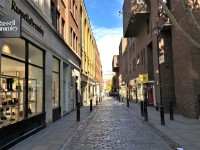
The paving is uneven in places, particularly around inspection covers, trees and tree roots (photograph 18).
Glass block flooring in front of some buildings may be slippery when wet (photograph 17). - There is a crossing point across Long Acre at St Martin's Circus crossroads (west of Covent Garden) with dropped kerbs and tactile paving.
There was a temporary Pelican crossing at the time of survey (November 2022) (photographs 11 to 13).
At Slingsby Place, the road is narrowed and there is a raised crossing without signals with level kerbs and blockwork crossing (photograph 6).
There are similar crossings at Mercer Street (photograph 5) and Langley Street across Long Acre (photograph 7), and across the side road at Arne Street.
The crossing at the Drury Lane end has level kerbs without tactile paving, a tarmac crossing, and one-way traffic from Drury Lane west into Long Acre.
There is a cycle lane on the north side of Long Acre which runs in the opposite direction to motorised traffic (photographs 2 and 3).
At the time of survey (November 2022) the north side pavement past the Endell Street / Bow Street junction was width restricted due to scaffolding (photograph 33).
Crossroads and zebra crossings along Long Acre are described in separate sections in this guide.
- Long Acre is located to the north of Covent Garden.
-
Street Furniture and Features
View
- Lampposts, signposts, and bins reduce the width of pavements (photographs 2, 5, 19 and 20).
There are bollards marking crossings in places which although mostly unmarked, do contrast with paving.
There are trees on the corner of Neal Street, and on both the north and south pavements between Endell Street / Bow Street and Drury Lane (photographs 3 and 21).
There is a black wheelchair accessible telephone kiosk on the south pavement opposite Slingsby Place (photograph 22).
The kiosk contains a coin free telephone for freephone calls only.
There is a black standard telephone kiosk on the north pavement (photograph 23).
Advertising boards are may be placed outside some shops in Long Acre (photographs 25 and 26).
There are bicycle racks reducing access width near Odhams Walk (photograph 27), and at the corner of Long Acre / Bow Street (photograph 28).
Bicycles may be locked against signposts and railings throughout the area, potentially reducing access width. - Street café seating without barriers along Long Acre may reduce access width in places.
There is pavement seating outside cafés and bars on the corner of Hanover Place, on the corner of Arne Street, between Drury Lane and Bow Street, and on the corner of Bow Street.
Example café seating is shown in photograph 30.
- Lampposts, signposts, and bins reduce the width of pavements (photographs 2, 5, 19 and 20).
-
Maps and Signage
View
- There are Legible London wayfinding maps on the corner with Upper St Martin's Lane (photograph 31), on the corner of Slingsby Place, on the south pavement near Banbury Court, on the south pavement near Langley Court (photograph 32), and at the corner of Neal Street and on the south pavement near Hanover Place.
-
Public Transport
View
- The nearest bus stops are in Charing Cross Road.
- There is a taxi rank in Russell Street.
- The nearest tube station is Covent Garden; however, this station has stepped access to platforms.
The nearest step-free tube station is Tottenham Court Road approximately 600m - 1km (0.4 - 0.6 miles) or 10 - 15 minutes walk away.
Main Pedestrian Crossing(s) (St Martin's Circus - Garrick Street / Long Acre / Upper St Martin's Lane)
- St Martin's Circus is a busy crossroads with Long Acre, Garrick Street, St Martin's Lane, Cranbourn Street and Great Newport Street all meeting at this point.
All pavements have dropped kerbs and tactile paving.
Photographs 2 to 6 show the crossing across Garrick Street.
Photographs 7 to 9 show the crossing across Long Acre.
Photographs 10 to 12 show the crossing across Upper St Martin's Lane. - The road surface on all crossings is tarmac with crossings marked by white dashed lines to either side.
- There are 6 roads at this busy junction: Long Acre, Garrick Street, Upper St Martin's Lane, St Martin's Lane, Cranbourn Street and Great Newport Street.
This guide focuses on the first three which can be used to access different parts of Covent Garden.
Garrick Street is two lanes wide and two-way, without a central island.
Long Acre is one lane wide and one-way eastbound away from the crossroads.
Upper St Martin's Lane is two lanes wide and one-way southbound toward the crossroads.
The other three streets at the crossroads are all one lane wide and one-way: Great Newport Street eastbound toward the junction, Cranbourne Street westbound away from the crossroads and St Martin's Lane southbound away from the crossroads. - There were temporary Pelican crossings at the time of survey (November 2022).
All crossings featured visual signals with push button.
The button heights are all between 100 and 105cm high.
There were no rotating cones or audio signals.
Main Pedestrian Crossing(s) (Long Acre - James Street - Neal Street Crossroads)
- There are four crossings at this staggered crossroads:
1. Long Acre zebra crossing (photographs 1 to 3).
2. James Street (Covent Garden side) (photographs 4 to 6).
3. Long Acre block paving crossing (east towards Drury Lane) (photographs 7 and 8).
4. Neal Street (north, away from Covent Garden towards Shelton Street) (photographs 9 and 10).
All kerbs are level and the crossings raised at the crossroads. There is tactile paving to both pavements for the Long Acre zebra crossing only. - The Long Acre roadway is narrowed to a single lane through the crossroads.
The road surface to the Long Acre zebra crossing is multi-coloured block paving with white faded zebra crossing markings (photographs 1 to 3).
The crossing to the east of the crossroads (towards Drury Lane) is similar (photographs 7 and 8).
There is dark grey block paving to the James Street crossing (photographs 4 to 6).
The crossing to Neal Street is cobbled and uneven in places (photographs 9 and 10). - Traffic is one-way in Long Acre west to east (towards Drury Lane), approaching from the left facing away from Covent Garden.
James Street is pedestrianised.
Traffic is one-way in Neal Street south to north (away from Covent Garden) from Long Acre to Shelton Street.
Neal Street is pedestrianised except for loading 07:00 to 11:00. - There are no visual or audio signals at this crossroads.
Main Pedestrian Crossing(s) (Long Acre - Bow Street - Endell Street Crossroads)
- There are five crossings at this staggered crossroads:
1. Long Acre crossing (west, towards St. Martin's Circus) (photographs 1 to 3).
2. Endell Street (north, towards Shelton Street) (photographs 4 to 6).
3. Long Acre zebra crossing (diagonal across the junction from the south west corner to the north east corner) (photographs 7 and 8.
4. Bow Street (south, towards Wellington Street) (photographs 9 and 10).
5. Long Acre crossing (east, towards Drury Lane) (photographs 11 and 12).
All kerbs are level and the crossings raised at the crossroads.
There is tactile paving to both pavements for the Long Acre zebra crossing only. The Endell Street crossing (photographs 4 to 6) was out of use at the time of survey (November 2022) due to extensive building works on the eastern side (on the right facing down Endell Street towards Shelton Street). - The roadway is ramped and raised to the crossroads with tarmac to all crossings and faded white markings to the zebra crossing.
- The main traffic at this crossroads is one-way in a northerly direction at Endell Street / Bow Street.
The traffic is one-way across the zebra crossing.
The traffic in Long Acre is one-way from the west (St. Martin's Circus) and one-way from the east (Drury Lane) approaching the crossroads.
There is a cycle lane along Endell Street towards Shelton Street (north, away from Covent Garden).
There is a cycle lane eastbound against the traffic flow in Long Acre to the east (Drury Lane end) of the junction (photograph 11).
General Accessibility (Upper St Martin's Lane)
-
Paths and Pavements
View
- Upper St Martin's Lane runs one-way south from Monmouth Street, at the junction with West Street and Shelton Street, to the St Martin's Circus crossroads at the west end of Long Acre.
Upper St Martin's Lane is approximately 85m in length and is level for its full length.
Parking is residents with permits only.
This section details the east pavement (nearest Covent Garden) between Shelton Street (away from Covent Garden) and Long Acre (nearer to Covent Garden).
There is a pedestrian passageway to the east (towards Covent Garden), Slingsby Place, which includes St Martin's Courtyard. - The crossing at the end of Shelton Street is unmarked and has level kerbs without tactile paving (photograph 3) although there is a small lip at the edge of the kerb (photograph 5).
The crossing over Upper St Martin's Lane towards Tower and West Street has level kerbs with tactile pavement and is unmarked (photograph 4).
The crossing at the Long Acre end across Upper St. Martin's Lane, and similarly across Long Acre, has level kerbs, is marked, and has tactile paving (photograph 7).
There was a temporary Pelican crossing at the time of survey (November 2022) (photographs 8 to 10).
This junction is described in separate sections in this guide. - The pavement is flagstone paved for most of its length.
There is a section of block paving at Slingsby Place entrance to "The Yards" (photograph 14).
This entrance has bollards (photograph 15) with spacing greater than 100cm, however street signage may narrow the route in places.
The paving here is slightly uneven in parts.
- Upper St Martin's Lane runs one-way south from Monmouth Street, at the junction with West Street and Shelton Street, to the St Martin's Circus crossroads at the west end of Long Acre.
-
Street Furniture and Features
View
- Lampposts, signposts and bins line the kerb but are generally not a problem in that the pavement is wide for much of its length.
There are bicycle stands to both ends of the street.
Bicycle stands and a telephone box between Shelton Street and Slingsby Place reduce the pavement width (photographs 16 to 18). - At the corner of Shelton Street restaurant seating, marked by post and banner barriers, reduce the width of the paving (photograph 19).
There is similar seating with post and rope barriers between Slingsby Place and Long Acre as the pavement widens (photograph 20).
- Lampposts, signposts and bins line the kerb but are generally not a problem in that the pavement is wide for much of its length.
-
Maps and Signage
View
- There is a Legible London wayfinding map at the corner of Long Acre and Upper St Martin's Lane (photograph 21).
-
Public Transport
View
- The nearest bus stops are in Charing Cross Road.
- There is a single taxi bay outside Stringfellows towards the Long Acre end of Upper St. Martin's Lane.
- The nearest underground station is Leicester Square with stepped access to platforms.
The nearest step-free underground station is Tottenham Court Road approximately 550m - 650m (0.4 miles) or 10 minutes walk away.
General Accessibility (Mercer Street)
-
Paths and Pavements
View
- Mercer Street is located to the north of Covent Garden and runs south to north (away from Covent Garden), one-way, from Long Acre to Shelton Street.
Mercer Street then continues north towards Seven Dials junction.
Mercer Street gives access to Slingsby Place and Mercer Walk passageways around half-way along the southern section (photographs 8 and 9).
Mercer Street is approximately 102m long and has a slope with a slight incline downwards from Long Acre to Shelton Street.
There is resident-only parking in Mercer Street. - The road is block paved and has level kerbs without tactile paving to pavements on the south side of the road where it meets Long Acre (towards Covent Garden).
There are level kerbs with tactile paving and painted road markings indicating that pedestrians need to look both ways due to a cycle lane crossing on the left (downward) side of the road (photograph 4).
The pavements are mainly block paved, but with painted concrete and glass block flooring to both pavements at the Long Acre end (nearer Covent Garden) that may be slippery when wet (photograph 7).
- Mercer Street is located to the north of Covent Garden and runs south to north (away from Covent Garden), one-way, from Long Acre to Shelton Street.
-
Street Furniture and Features
View
- Bollards at the edge of the west pavement (left as you travel towards Shelton Street, away from Covent Garden) reduce the width of the pavement to 85cm.
-
Maps and Signage
View
- There are no directional signs or maps in Mercer Street.
-
Public Transport
View
- The nearest bus stops are in Charing Cross Road by Leicester Square.
- There nearest taxi rank is in Russell Street.
- The nearest tube station is Covent Garden; however, this station has stepped access to platforms.
The nearest step-free tube station is Tottenham Court Road approximately 650m - 750m (0.4 miles) or 10 minutes walk away.
General Accessibility (Langley Street)
-
Paths and Pavements
View
- Langley Street is located to the north of Covent Garden and runs north to south, one-way from Shelton Street to Long Acre (towards Covent Garden).
Langley Street is approximately 95m long and has a slope with a slight incline upwards from Shelton Street to Long Acre.
Langley Street widens at Mercer Walk and gives access to Mercer Walk passageway (photographs 7 and 8).
There is no parking permitted in Langley Street. - The road is block paved and has level kerbs without tactile paving to pavements.
The crossing at Long Acre and also at Shelton Street has level kerbs without tactile paving (photograph 5).
The pavements are concrete tile paved to both pavements.
- Langley Street is located to the north of Covent Garden and runs north to south, one-way from Shelton Street to Long Acre (towards Covent Garden).
-
Street Furniture and Features
View
- At the entrance to Mercer Walk, there is a concrete slabbed terrace area with café tables, chairs and display stand. There are no barriers to this seating area (photographs 7 and 8).
Bicycles may be locked to posts, pipes or railings, which may reduce pavement widths.
- At the entrance to Mercer Walk, there is a concrete slabbed terrace area with café tables, chairs and display stand. There are no barriers to this seating area (photographs 7 and 8).
-
Maps and Signage
View
- There are no directional signs or maps in Langley Street.
-
Public Transport
View
- The nearest bus stops are in Charing Cross Road by Leicester Square.
- There nearest taxi rank is in Russell Street.
- The nearest tube station is Covent Garden; however, this station has stepped access to platforms.
The nearest step-free tube station is Tottenham Court Road approximately 650m - 750m (0.4 miles) or 10 minutes walk away.
General Accessibility (Slingsby Place / Mercer Walk / Odhams Walk)
-
Paths and Pavements
View
- Slingsby Place is a T-shaped passageway incorporating St Martin's Courtyard "The Yards" (photographs 1 to 12).
Slingsby Place runs between Upper St Martin's Lane and Mercer Street through St Martin's Courtyard (towards Covent Garden).
There is also a branch running from the Courtyard to Long Acre.
There is a slope with a slight incline upwards from the Upper St Martin's Lane entrance to the Courtyard.
There is a slope with a slight incline upwards from the Courtyard to Mercer Street (towards Covent Garden.
There is level access from Long Acre to the Courtyard (away from Covent Garden).
The courtyard area is tiled with multi-coloured tiles with grey at the edges and is generally even. - Mercer Walk "The Yards" is a dog-legged tiled passageway and courtyard (photographs 13 to 20).
Mercer Walk runs from Mercer Street, opposite Slingsby Place, to Langley Street (towards Covent Garden).
There is a slope with a slight incline upwards from Mercer Street with restaurant seating available.
There is a ramp up from Langley Street.
To the side there are 3 tapered medium well-marked steps to the H&M store, with tactile paving and a handrail to the right as you go up (photograph 18).
The level tiled paving is patterned and may appear visually stepped or uneven (photographs 19 and 20). - Odhams Walk is a passageway leading to a residential courtyard, a dental practice and tanning shop (photographs 21 to 33).
Odhams Walk is paved with concrete slabs that are uneven in places.
There is a steep ramp up from Long Acre with a handrail on the left hand side going up (photographs 21 and 22).
There is a gated and stepped residents entrance located in Shelton Street (photographs 30 to 33).
There is a push-pad automated door (photographs 32 and 33).
- Slingsby Place is a T-shaped passageway incorporating St Martin's Courtyard "The Yards" (photographs 1 to 12).
-
Street Furniture and Features
View
- There are planters in all three passageways used decoratively and to mark restaurant seating area boundaries.
There are also fixed dark stone stools and benches that are not clearly marked (photographs 27 and 28).
There are advertising boards which may not be clearly marked and may cause an obstacle depending on placement. - Steel barrier posts are located at the entrances to Odhams Walk and Slingsby Place (photograph 29).
The posts are unmarked and do not contrast visually with the paving. - There are no wayfinding maps in Slingsby Place, Mercer Walk or Odhams Walk.
- There are planters in all three passageways used decoratively and to mark restaurant seating area boundaries.
-
Public Transport
View
- The nearest bus stops are in Charing Cross Road.
- There is a taxi rank in Russell Street.
- The nearest tube station is Covent Garden; however, this station has stepped access to platforms.
The nearest step-free tube station is Tottenham Court Road approximately 500m - 900m (0.3 - 0.5 miles) or 10 - 15 minutes walk away.
General Accessibility (Neal Street)
-
Paths and Pavements
View
- Neal Street is located to the north of Covent Garden and runs south to north (away from Covent Garden), one-way, from Long Acre / James Street to Shelton Street.
Neal Street then continues north to Shaftsbury Avenue at its junction with Monmouth Street.
This section covers the section from Long Acre to Shelton Street only.
Neal Street is approximately 90m long on a slope with a slight incline downwards from Long Acre to Shelton Street.
Neal Street is pedestrianised except for loading 07:00 to 11:00.
There is no parking available on Neal Street. - The roadway is cobbled, with flagstone on the pavements.
There are level kerbs without tactile paving, with the edge of the pavements being marked by bollards.
The road cobbles are uneven (photograph 6).
The pavement flagstones are uneven in places (photographs 7 to 9).
At the Shelton Street end (away from Covent Garden) there are level kerbs without tactile paving and cobbles on the zebra crossing that are uneven (photograph 12).
The zebra crossing has no other road markings.
Neal Street continues past Shelton Street, however there is no road access from that direction.
At the Long Acre end (towards Covent Garden) there are level kerbs without tactile paving and block paving to the crossing.
- Neal Street is located to the north of Covent Garden and runs south to north (away from Covent Garden), one-way, from Long Acre / James Street to Shelton Street.
-
Street Furniture and Features
View
- Bollards line both pavements. These reduce the pavement width to 125cm in places (photograph 7).
At the Shelton Street end (away from Covent Garden) on the east pavement (on the right facing down the slight incline), guard railings reduce the width to 120cm (photograph 9).
At this point, there is also a low overhang on the building.
At both ends of the east pavement (right hand side going down) there is a bollard in the centre of the pavement reducing the width to 85cm (photographs 8 and 10).
- Bollards line both pavements. These reduce the pavement width to 125cm in places (photograph 7).
-
Maps and Signage
View
- There is a Legible London wayfinding map at the corner of Long Acre and Neal Street (nearer Covent Garden).
-
Public Transport
View
- The nearest bus stops are in Charing Cross Road by Leicester Square.
- There is a taxi rank in Russell Street.
- The nearest tube station is Covent Garden, opposite the end of Neal Street on Long Acre. However, this station has stepped access to platforms.
The nearest step-free tube station is Tottenham Court Road approximately 700m - 900m (half a mile) or 12 minutes walk away.
General Accessibility (Endell Street)
-
Paths and Pavements
View
- Endell Street is located to the north of Covent Garden and runs one-way from the Bow Street crossroads with Long Acre north (away from Covent Garden) to High Holborn (A40).
Endell Street is crossed by Shelton Street.
This guide covers the section from the Long Acre / Bow Street crossroads to Shelton Street, approximately 95m.
Endell Street is tarmacked and has a slight slope down from Long Acre to Shelton Street.
There is resident only parking in Endell Street.
The eastern pavement (right hand side going down) was out of bounds at the time of survey (November 2022) due to extensive building work (photographs 1 and 2). - The crossings at Long Acre (towards Covent Garden) have level kerbs without tactile paving.
The zebra crossing at Long Acre has tactile paving at the kerbs (photographs 3 and 4).
Crossroads and crossings at Long Acre are described in separate sections in this guide.
The crossing at Shelton Street is unmarked, and there is a slight camber to the roadway.
The pavements are widened at this crossing point with level kerbs and tactile paving (photographs 5 and 6). - The flagstone pavement is uneven in places.
- Endell Street is located to the north of Covent Garden and runs one-way from the Bow Street crossroads with Long Acre north (away from Covent Garden) to High Holborn (A40).
-
Street Furniture and Features
View
- The west pavement (left as you go down the slope towards Shelton Street) is narrowed by planters and advertising boards by a grocery store, and lampposts and signposts at the kerb edge.
There are bollards at the Long Acre crossroads.
The pavement narrows at Shelton Street by a building with a kicker rail at low level.
Bicycles may be locked to the railing causing a width restriction (photograph 11).
At the time of survey (November 2022) there was a construction safety barrier concealing a bollard on the corner of Endell Street and Shelton Street (photograph 13). - The pavement narrows at the Long Acre crossroads and there are bollards at the kerb edge.
- The west pavement (left as you go down the slope towards Shelton Street) is narrowed by planters and advertising boards by a grocery store, and lampposts and signposts at the kerb edge.
-
Maps and Signage
View
- There is a Legible London wayfinding map on the south corner with Long Acre by the crossroads.
-
Public Transport
View
- The nearest bus stops are on The Strand. There are additional bus stops in Charing Cross Road by Leicester Square.
- There nearest taxi rank is in Russell Street.
- The nearest tube station is Covent Garden with step-free access to platforms via lift.
The next step-free tube station is Tottenham Court Road approximately 1km (0.6 miles) or 12 minutes walk away.
Access To (West Piazza Public Toilets (St Paul's Church))
- This section details the stepped access to the West Piazza Public Toilets by St Paul's Church.
- There are steps beyond an open gate leading to the female and male toilet facilities.
- There are 15+ steps .
- The height of the step(s) is/are between the recommended 15cm and 18cm.
- The height of the step(s) is/are 16cm.
- The depth of the step(s) is/are not between the recommended 30cm and 45cm.
- The steps are not clearly marked.
- There is a/are handrail(s) at the step(s).
- The steps have a handrail on both sides.
- Handrails are not at the recommended height (90cm-100cm).
- Handrails do cover the flight of stairs throughout its length.
- Handrails are not easy to grip.
- Handrails do not extend horizontally beyond the first and last steps.
- There is a landing.
-
Comments
View
- The gateway to the female standard toilets is to the right of the facility (photograph 1).
- The gateway to the male standard toilets is to the left of the facility (photograph 2).
Standard Toilet(s) (West Piazza Public Toilets (St Paul's Church))
- Standard toilet facilities are available.
-
Toilet Facilities
View
- The female and male toilets are located in the West Piazza by St Paul's Church.
- There is stepped access into the toilet(s).
- There is written text signage on or near the toilet door.
- An ambulant toilet cubicle is not available.
- The height of the wash basin(s) is 87cm.
- The wash basin(s) tap type is push.
- Lighting levels are moderate to good.
- The toilet turnstile has a coin slot 103cm high and a push button to exit which is 85cm high. The turnstile has a 53cm width.
-
Baby Changing Facilities
View
- Baby change facilities are available in the female toilets.
-
Comments
View
- The baby change facilities are only available if the attendant is on site.
- The baby change facilities were locked at the time of survey with no attendant present (November 2022).
- These public toilet facilities are located just west of the Covent Garden Market Building.
- Alternative public toilets may be found in the Market Building South Hall on the lower ground floor. There is also only stepped access to these toilets.
Opening Times (Standard Public Toilets)
- Monday 09:00 - 19:00.
- Tuesday 09:00 - 19:00.
- Wednesday 09:00 - 19:00.
- Thursday 09:00 - 19:00.
- Friday 09:00 - 19:00.
- Saturday 09:00 - 19:00.
- Sunday 09:00 - 19:00.
Access To (Tavistock Court Accessible Toilet)
- This section details the ramped access to the Accessible Toilet in Tavistock Court.
- The ramp is at the side of the Jubilee Hall Market in Tavistock Court.
- The gradient of the ramp/slope is slight.
- The width of the ramp/slope is 135cm (4ft 5in).
- There is a/are handrail(s) at the ramp.
Accessible Toilet(s) (Left Hand Transfer Tavistock Court)
- There is an/are accessible toilet(s) available.
-
Location and Access
View
- The accessible toilet was out of use at the time of the survey.
- This accessible toilet is located in Tavistock Court, to the side of the Jubilee Hall Market.
- There is ramped/sloped access into the accessible toilet.
- This is a shared toilet.
- A key is required for the accessible toilet.
- The key is a radar key.
- The key can be obtained from Security in Jubilee Market.
- There is pictorial signage on or near the toilet door.
- The contrast between the external door and wall is good.
- The door opens outwards.
- The door may be difficult to open.
- The door is locked by a locking handle.
- The width of the accessible toilet opening is 90cm (2ft 11in).
- The contrast between the internal door and wall is good.
- The door has a horizontal grab rail.
- The contrast between the horizontal grab rail and internal door is good.
-
Toilet Features
View
- The dimensions of the accessible toilet are 162cm x 179cm (5ft 4in x 5ft 10in).
- The accessible toilet does not have an unobstructed minimum turning space of 150cm x 150cm.
- The lighting levels are low to moderate.
- There is a lateral transfer space.
- As you face the toilet pan the transfer space is on the left.
- The lateral transfer space is 102cm (3ft 4in).
- The transfer space is obstructed by a waste disposal bin.
- There is a flush on the transfer side.
- There is not a spatula type lever flush.
- There is a lever flush.
- There is a dropdown rail on the transfer side.
- The contrast between the dropdown rail(s) and wall is poor.
- There is a/are wall-mounted grab rail(s) available.
- As you face the toilet the wall-mounted grab rail(s) is/are on the right.
- There is not a vertical wall-mounted grab rail on the transfer side.
- There is a horizontal wall-mounted grab rail on the opposite side of the seat to the transfer space.
- The contrast between the wall-mounted grab rail(s) and wall is good.
- The contrast between the walls and floor is good.
- There is not an emergency alarm.
- There is not a red flashing fire alarm beacon within the toilet.
- Disposal facilities are available in the toilet.
- There is a/are general waste (with lid) disposal units.
- There is a/are coat hook(s).
- The height of the coat hook is 177cm from the floor.
-
Additional Fixtures
View
- There is a mirror.
- The mirror is not placed at a lower level or at an angle for ease of use.
- There is not a shelf within the accessible toilet.
- The toilet has a wall which acts as a backrest.
- The height of the toilet seat above floor level is 48cm (1ft 7in).
- The toilet seat colour contrast is poor.
- There is a toilet roll holder.
- The toilet roll holder can be reached from seated on the toilet.
- The toilet roll holder is not placed higher than 100cm (3ft 3in).
- The height of the toilet roll holder is 92cm (3ft).
- The contrast between the toilet roll holder and the wall is fair.
- There is a wash basin.
- The wash basin and tap(s) can be reached from seated on the toilet.
- The wash basin is placed higher than 74cm (2ft 5in).
- The height of the wash basin is 82cm (2ft 8in).
- There is a vertical wall-mounted grab rail on the left hand side of the wash basin.
- The contrast between the wash basin wall-mounted grab rail(s) and wall is good.
- The wash basin tap type is push.
- There is not a wall fixed soap dispenser.
- There is no soap available.
- There is not a towel dispenser.
- There is a hand dryer.
- The hand dryer is placed higher than 100cm (3ft 3in).
- The height of the hand dryer is 122cm (4ft).
- The contrast between the hand dryer and the wall is poor.
-
Baby Changing Facilities
View
- Baby changing facilities are located within the accessible toilet.
- There is a flip down baby change table available.
- The height of the baby change table is 90cm.
-
Comments
View
- There is an outer door before the cubicle door.
- The outer door is heavy, 90cm wide and is without an internal handrail.
- Please note that there is a second accessible toilet at the same location to the left that is permanently locked and out of use.
Opening Times (Accessible Public Toilet)
- Monday 07:30 - 23:00.
- Tuesday 07:30 - 23:00.
- Wednesday 07:30 - 23:00.
- Thursday 07:30 - 23:00.
- Friday 07:30 - 23:00.
- Saturday 07:30 - 23:00.
- Sunday 07:30 - 23:00.
General Accessibility (Arne Street - Dryden Street)
-
Paths and Pavements
View
- Arne Street is located to the north east of Covent Garden and runs north to south, one-way from Shelton Street (away from Covent Garden) to Long Acre (towards Covent Garden).
Arne Street is approximately 80m long and has a slope with a slight incline upwards from Shelton Street to Long Acre (photographs 1 to 7).
Dryden Street branches east (left facing uphill) midway along Arne Street and continues to Drury Lane (photographs 8 to 12).
Dryden Street is approximately 55m long and level.
There is no parking permitted in Arne Street.
Dryden Street was closed to road traffic at the time of survey (November 2022) due to extensive building works.
The Dryden Street northern pavement (right hand side moving away from Arne Street) was open to pedestrians at the time of survey (November 2022) but width restricted to 107cm due to extensive building works (photograph 10). - Arne Street and Dryden Street are tarmacked which is broken up and patch repaired in places.
The road is raised and block paved at its crossing point at the junction of Arne Street with Long Acre (photographs 4 and 5).
The west pavement (right hand side facing uphill) in Arne Street is concrete tile paved, with flagstones at the Long Acre end (towards Covent Garden) (photograph 1).
Arne Street has block paving at the corner to Shelton Street (away from Covent Garden) (photograph 2).
The east (left side going uphill) pavement from Shelton Street (away from Covent Garden) to Dryden Street (towards Covent Garden) was out of bounds at the time of survey (November 2022) due to extensive building works.
The east (left side going uphill) pavement from Dryden Street to Long Acre (towards from Covent Garden) is tarmacked.
The northern pavement (right hand side moving away from Arne Street) on Dryden Street is tarmacked, patched, and uneven in places.
There are dropped kerbs without tactile paving to the crossing point at Shelton Street (photograph 7).
There are medium kerbs without dropped kerbs at the junction of Arne Street with Dryden Street (photograph 9), and at the junction of Dryden Street with Drury Lane (photograph 12).
There are level kerbs without tactile paving and block paving to the road at the crossing point at the Long Acre end of Arne Street (photograph 7).
- Arne Street is located to the north east of Covent Garden and runs north to south, one-way from Shelton Street (away from Covent Garden) to Long Acre (towards Covent Garden).
-
Street Furniture and Features
View
- Arne Street has lamp posts which severely restrict the width of the west pavement (right hand side facing uphill) (photographs 3 and 4).
-
Maps and Signage
View
- There are no directional signs or maps in Arne Street or Dryden Street.
-
Public Transport
View
- The nearest bus stops are on The Strand.
- There nearest taxi rank is in Russell Street.
- The nearest underground station is Covent Garden; however, this station has stepped access to platforms.
The nearest step-free tube station is Tottenham Court Road approximately 1km (0.6 miles) or 12 minutes walk away.
General Accessibility (Shelton Street)
-
Paths and Pavements
View
- Shelton Street is located to the north of Covent Garden.
It runs between Drury Lane and can be divided into 3 sections:
1. Shelton Street passageway between Drury Lane and Arne Street (undergoing work at time of survey November 2022) (photographs 3 and 4).
2. One-way eastbound from Endell Street to Arne Street (photograph 5).
3. One-way westbound from Endell Street to Upper St Martin's Lane (photographs 6 to 9).
Shelton Street (including the passageway) is approximately 400m long and is level for its full length.
Shelton Street is crossed by Endell Street, with junctions at Arne Street (east of Endell Street), and Neal Street, Langley Street and Mercer Street (west of Endell Street).
Parking is limited but there are some Pay by Phone parking bays on Shelton Street.
There is Pay by Phone car parking between Neal Street and Langley Street (photograph 9).
There is Pay by Phone motorbike parking and resident-only parking and trading bays between Langley Street and Mercer Street (photograph 10).
There is underground attendant parking on Shelton Street between Endell Street and Neal Street. - Shelton Street is tarmacked its full length, with raised blockwork junctions at Neal Street, Mercer Street and Langley Street.
The passageway from Drury Lane to Shelton Street was undergoing work at the time of survey November 2022 (photographs 1 to 4).
The passageway is 111cm wide, however lampposts narrow it to 50cm or 90cm in two different places (photographs 1 and 2).
The pedestrian crossing point at the Arne Street junction has dropped kerbs without tactile paving (photograph 14).
The southern pavement (on the right hand side looking towards Drury Lane) between Arne Street and Endell Street was severely width restricted at the time of survey (November 2022) due to building works (photograph 5).
At the Endell Street crossroads, there are no marked or signalled crossings.
All crossing points at Endell Street have dropped kerbs and tactile paving (photographs 15 to 17).
The entry on the south pavement (towards Covent Garden) to the underground car park has dropped kerbs and tactile paving (photograph 12).
The northern pavement (on the right hand side looking towards Upper St. Martin's Lane) opposite the parking garage was severely width restricted at the time of survey (November 2022) due to scaffolding (photograph 9).
At Neal Street, there is a clearly marked zebra crossing across Shelton Street at the raised blockwork junction, with level kerbs without tactile paving (photographs 18 and 19).
Neal Street is closed with bollards on the north side and pedestrianised on the south side (photographs 22 to 24).
The kerbs at Neal Street are level but the crossings are cobbled to both pavements (photograph 24).
The crossing point at the Langley Street junction, and all crossings at the Mercer Street crossroads have raised blockwork crossings with level kerbs without tactile paving.
At the Upper St Martin's Lane end the crossing point is unmarked but has dropped kerbs without tactile paving and tarmac to the roadway (photograph 25). - Pavements to the Shelton Street passageway and then to both pavements from Arne Street to Endell Street are concrete tile slabs and uneven in places (photographs 26 and 27).
Pavements between Endell Street through to Upper St Martin's Lane have a surface of concrete tile slabs to the south (left) pavement and flagstones or tarmac to the north (right) pavement.
Both pavements are quite narrow and the paving is uneven from Endell Street to Upper St Martin's Lane.
There are garage and service door entrances where there are tarmac ramps with tapered kerbs, or level or dropped kerbs, on the south pavement (photographs 31 and 32).
- Shelton Street is located to the north of Covent Garden.
-
Street Furniture and Features
View
- Lampposts placed in the centre of the Shelton Street passageway at the Drury Lane end of Shelton Street are not clearly marked.
There is short bollard surround by a building works safety barrier at the time of survey (November 2022) at the corner of Endell Street and Shelton Street (photograph 33).
There are unmarked black bollards to each pavement between Endell Street and Mercer Street (photographs 33 and 34).
The north pavement is lined with lampposts at the kerb, reducing the width to 105cm in places.
Bollards on the south pavement are placed at road corners or to mark entries (photographs 27 and 28).
Just west of Neal Street the south pavement is width restricted to 112cm by a bollard marking the opening to the "Old Brewer's Yard" (photograph 39).
At the corner of Langley Street a bollard reduces the width to 85cm (photograph 40). - Bicycles to be locked up against signposts and railings throughout the area, with some signposts designed for this (photographs 41 and 42).
- Lampposts placed in the centre of the Shelton Street passageway at the Drury Lane end of Shelton Street are not clearly marked.
-
Maps and Signage
View
- There is a Legible London wayfinding map on Neal Street just north of Shelton Street (photograph 43).
-
Public Transport
View
- The nearest bus stops are on The Strand.
- There is a taxi rank in Russell Street.
- The nearest underground station is Covent Garden; however, the station has stepped access to platforms.
The nearest step-free tube station is Tottenham Court Road approximately 550m - 950m (0.3 - 0.6 miles) or 10 - 15 minutes walk away.