
Access Guide
Introduction
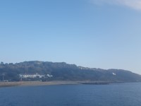
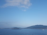
- Herm Island is located off the coast of Guernsey, opposite St Peters Port.
- There is public car parking available in St Peters Port at St Julians Pier.
Trident Ferry
- Access to Herm Island from Guernsey is via Ferry, the crossing is approximately 20 minutes.
- To view the Trident Ferry Access Guide please click here
- Depending on the tide, the ferry will either land at the Harbour Landing or Rosaire Landing.
Harbour Landing
- After disembarking the Ferry, there are between 1-7 medium height steps with handrails on both sides, leading from the Ferry to the Harbour.
- The number of steps will vary depending on the tide.
- The steps can be wet due to sea and weather conditions.
- There is an easy slope leading from the harbour landing to the harbour and harbour village.
- The surface is uneven stone paving to begin with then becomes loose chippings and tarmac further along.
Rosaire Landing
- After disembarking the Ferry, there are 15+ steps. The height of the steps vary between shallow, medium or deep leading from the landing point up to the cliff top.
- There are handrails located in the centre or on your left for some of the steps.
- The steps can be wet due to sea and weather conditions.
Rosaire Landing - Harbour Village
- There is a path which leads from the top of the Rosaire Landing to the Harbour Village.
- At the Cliff Top after climbing the steps from Rosaire Landing, follow the path as it bears left.
- Follow the path for approximately 400m to Harbour Village.
- The path has easy, moderate and steep slopes along the route.
- There is clear signage along the route.
- The path is unsurfaced and is uneven in places.
Herm Island - Shops, Food/Drink and Accommodation
- On Herm Island there is the Herm Island Gift Shops, White House Hotel, Mermaid Tavern, Shell Beach Kiosk, Belvoir Bay Beach Kiosk, Seagull Campsite and Manor Village & Pine Log Cabins Self Catering.
- Herm Island Gift Shops, White House Hotel and Mermaid Tavern are located in the Harbour Village.
- To view the Herm Island Gift Shops access guide please click here (opens in a new tab)
- To view the Mermaid Tavern access guide please click here(opens in a new tab)
- To view the White House Hotel access guide please click here (opens in a new tab)
- Shell Beach Kiosk and Belvoir Bay Beach Kiosk are located on the east coast of Herm.
- To view the Belvoir Bay Beach access guide please click here (opens in a new tab)
- To view the Shell Beach access guide please click here (opens in a new tab)
- Seagull Campsite and Manor Village & Pine Log Cabins Self Catering are located at the centre of Herm.
- To view the Herm Camping web page please click here (opens in a new tab)
- To view the Herm Self Catering web page please click here (opens in a new tab).
Harbour Village, Herm Common and Shell Beach Paths
- The paths lead from Harbour Village to Shell Beach via Herm Common.
- The paths are surfaced in Harbour village but they are unsurfaced the rest of the way and varying between dirt, grass and light sand.
- There is easy and moderate slopes located along the paths.
- The paths can be uneven in places.
- On the paths that pass through Herm Common, there are rabbit holes located along the paths. These may present a trip hazard.
- There is clear signage along the route.
- In Herm Common there is the Robert's Cross Burial Tomb.
- There are grass paths leading to the North Coast of the Island and the Obelisk.
- There are stone resting points located along the route.
East and South Coastal Paths
- The Coastal Paths run along the East and South of Herm Island.
- The East Coastal Path begins just after Shell Beach and leads towards Belvoir Bay. The path merges with the South Coastal Path.
- The South Coastal Path passes Rosaire Landing before leading to Harbour Village.
- The Paths are unsurfaced and uneven in places.
- There easy, moderate and steep slopes along the paths.
- There are some stone resting points located along the paths.
Central Paths
- There is a steep slope leading from Harbour Village up to the Spine Road and Manor Village.
- The surface of the path is tarmac.
- There is a steep slope leading from Herm Common up to the Spine Road and Manor Village. The slope is located next to Roberts Cross burial tomb and the path is unsurfaced.
- There is a steep slope leading from the East Coastal Path to Manor Village. The slope is located next to Belvoir Bay Beach and the path has a tarmac surface.
- There is a path leading from the South Coastal Path to Manor Village. The path itself has easy and moderate slopes and is unsurfaced.
- The main path running along the centre of the Island is Spine Road.
- There are easy, moderate and steep slopes along the path.
- The surface of the paths vary between unsurfaced, sand, grass and tarmac.
- The paths are uneven in places.
- Seagull Campsite and Manor Village & Pine Log Cabins Self Catering are accessed via Spine Road.
Public Toilets
- Toilets are located in Harbour Village and on the coastal path between Shell Beach and Belvoir Bay Beach.
- To view the Harbour Public Toilets access guide please click here (opens in a new tab)
- To view the Shell Beach to Belvoir Bay Beach Path Public Toilets please click here (opens in new tab)
- Accessible toilets are located at the Harbour Village and at the Campsite.