
Access Guide
Opening Times
- The venue is open from dawn til dusk.
Location
- There is not a bus stop within 150m (164yds) of the venue.
- The nearest National Rail station is Hayes and Harlington.
- The nearest underground station is Hatton Cross.
Parking
- The venue does have its own car park.
-
Venue Car Park
View
- Parking is free for all users.
- The car park is located in Crane Lodge Lane.
- The car park type is open air/surface.
- There is/are 2 Blue Badge parking bay(s) within the car park.
- The dimensions of the Blue Badge parking bay(s) are 340cm x 460cm (11ft 2in x 15ft 1in).
- The nearest Blue Badge bay is 12m (13yd 4in) from the main entrance.
- The furthest Blue Badge bay is 18m (19yd 2ft) from the main entrance.
- The route from the car park to the entrance is accessible to a wheelchair user unaided.
- The car park surface is tarmac.
- There is not a road to cross between the car park and the entrance.
- The car park does not have a height restriction barrier.
-
Drop-off Point
View
- There is not a designated drop off point.
Access Point (Main Entrance)
-
Access Point
View
- This information is for the access point located in the car park.
- There is an information board/map at this access point.
- There is step-free access at this access point.
- There is no gate at this access point.
- The width of the gap is 90cm.
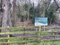
Access Point (Cranford Lane)
-
Access Point
View
- This information is for the access point located on Cranford Lane.
- There is an information board/map at this access point.
- There is step-free access at this access point.
- There is a gate which opens away from you (push).
- The gate is difficult to open.
- The width of the gap is 76cm.
Access Point (St Dunstan's Subway)
-
Access Point
View
- This information is for the access point located leading from Roseville Road.
- There is an information board/map at this access point.
- There is ramped/sloped access at this access point.
- There is a kissing gate at this access point.
- The gate is easy to open.
- The width of the gap is 65cm.
- There is a kissing gate at each end of the subway.
-
Ramp/Slope
View
- The ramp/slope is located leading from Roseville Road to the subway.
- The gradient of the ramp/slope is slight.
Parks and Gardens
- The park or garden does have footpaths.
- The path(s) has a / have compact earth, gravel and muddy surface(s).
- The majority of the path(s) is / are wide enough for wheelchair users.
- There are slight slopes on the paths.
- There are some bench seats situated along the paths for people to rest.
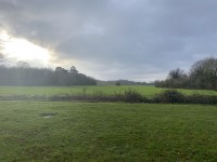
Grounds
- The park is a large open space with grassy paths across it.
- The park is mostly flat.
- There is a children's play area and ruins situated within the grounds.
- The children's play area has a surface of rubberised material.
Standard Toilet(s)
-
Availability and Location of Standard Toilets
View
- Standard toilet facilities are not available.
Accessible Toilet
- There are not accessible toilet facilities within this venue.