
Access Guide
Introduction
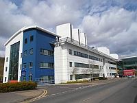
- Related link Queen's Medical Research Institute.
- Https://www.disabledgo.com/access-guide/the-university-of-edinburgh/queens-medical-research-institute
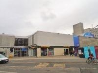
- Related link Potterrow.
- Https://www.disabledgo.com/access-guide/the-university-of-edinburgh/potterrow-2
-
Comments
View
- The route plan is between the Queen's Building Medical Research Centre and Potterrow via bus.
- The distance from the Queen's Building Medical Research Centre and the Craigmillar Castle Bus Stop is approximately 0.2 miles. .
- It should take approximately 4 minutes to complete this part of the journey.
- The distance from the Surgeon's Hall Bus Stop to Potterrow is approximately 0.2 miles.
- This part of the journey should take 3 minutes to complete.
- The journey between the two stops should take approximately 19 minutes making for a total journey time of 24 minutes.
Little France Crescent to Old Dalkeith Road
- Head from the Queen's Building to Old Dalkeith Road. This distance is approximately 190m.
- The surface of the pavement upon exiting the building is brick block paving.
- There is a slight downhill gradient towards the pavement.
- After a while the surface of the pavement is tarmac.
- Upon reaching the tarmac pavement turn right.
- You will encounter tactile paving for a Zebra crossing across Little France Crescent. This can be seen in photograph 2.
- There are then two service roads for the separate building parking for the Queen's Building. These have tactile drop kerbs on either side and the roads are tarmac.
- The space between the two roads is approximately 15m the pavement of which is tarmac.
- This area can be seen in photographs 3, 4 and 5.
- The pavement continues for approximately 19m until you reach the first of two surface roads into a car park. These have drop kerbs on either side, tarmac roads and a distance of 25m between them. The second service road has an island level with the road and formed of tactile block paving in the middle.
- After the service roads continue for approximately 70m until you reach the pedestrian crossing across Old Dalkeith Road.
Old Dalkeith Road
- Cross Old Dalkeith Road at the pedestrian crossing.
- There are tactile drop kerbs on either side.
- The traffic lights have controls at a height of 100cm.
- There are rotating cones located here.
- The surface of the road is tarmac.
- After crossing the road there is a tarmac island with a similar crossing over the road to the other side.
Old Dalkeith Road to Craigmillar Castle Road (Stop IG)
- Turn right for approximately 130m to reach the bus stop.
- The surface of the pavement is tarmac.
- There is an uphill gradient heading towards the bus stop.
- Along the route, the pavements width is reduced to only 82cm. This can be seen in photographs 2 and 3 and ends in photograph 4.
- Continue until you reach the bus stop.
Craigmillar Castle Road (Stop IG)
- The bus stop has no shelter or seating available.
- The bus stop serves routes 24, 33, 38, 49, 51 and 52.
- The routes between this stop and Surgeons Hall (Stop ID) are 33, 49, 51 and 52.
- Depending on route the bus journey should take between 14 minutes and 20 minutes.
Surgeon's Hall Stop ID
- The bus stop has a shelter, seating and an electric timetable.
- The bus stop serves routes 3, 5, 7, 8, 14, 29, 30, 31, 33, 37, 49, 51, 52, N3, N7, N30, N31, N37, X29, X31, X33, X37, X62, X70 and X95.
- The routes between this stop and Craigmillar Castle (Stop IG) are 33, 49, 51 and 52.
- Depending on route the bus journey should take between 14 minutes and 20 minutes.
Surgeon's Hall Stop (ID) / South Bridge to South College Street
- Turn right along South Bridge for approximately 170m to reach South College Street.
- The surface of the pavement is tarmac.
- After 15m you will encounter the road across Nicolson Square. There are tactile drop kerbs on either side.
- The surface of the road is tarmac.
- You will encounter another such road after approximately 24m.
- After this, continue along South Bridge for approximately 110m until you reach South College Street.
South College Street to Potterrow Port
- Turn left down South College Street for 120m until you reach Potterrow Port.
- As you turn left there is a crossing across South College Street which has tactile paving.
- The surface of the pavement is block paving with the occasional manhole cover.
- There is an uphill gradient up South College Street.
- After 75m there is a service road with drop kerbs on either side. The road itself is cobbled. This can be seen in photograph 5.
- After this continue into Potterrow Port.
Potterrow Port to Bristo Place
- Turn right and head up the ramp to Bristo Place
- The surface of the ramp is block paving.
- There is a handrail in the centre of the ramp.
- The width of the ramp is 110cm.
- The ramp is steep.
- Photograph 2 shows the view at the top of the slope.