
Access Guide
Opening Times
- The venue is open 24hrs.
Location
- There is a bus stop within 150m (164yds) of the venue.
- The nearest National Rail station is Sunderland.
- The nearest Metro Station is South Hylton.
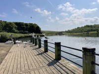
Parking (Model Boating Lake)
- The venue does have its own car park.
-
Venue Car Park
View
- Parking is free for all users.
- The car park is located to the north side of the park, opposite the model boating lake.
- The car park type is open air/surface.
- There is/are 5 Blue Badge parking bay(s) within the car park.
- The dimensions of the Blue Badge parking bay(s) are 368cm x 488cm (12ft 1in x 16ft).
- The nearest Blue Badge bay is 3m (3yd 10in) from the model boating lake car park entrance.
- The furthest Blue Badge bay is 16m (17yd 1ft) from the model boating lake car park entrance.
- The route from the car park to the entrance is accessible to a wheelchair user with assistance.
- Assistance may be required because there is/are slopes/ramps.
- The car park surface is tarmac.
- There is not a road to cross between the car park and the entrance.
- The car park does not have a height restriction barrier.
-
Drop-off Point
View
- There is not a designated drop off point.
-
Comments
View
- Please see the Herrington Country Park Car Park and Toilet Block guide for the main car parking details.
Parking (Skate Park Car Park)
- The venue does have its own car park.
-
Venue Car Park
View
- Parking is free for all users.
- The car park is located to the west side of the park, opposite the skate park and BMX track.
- The car park type is open air/surface.
- There is/are 0 Blue Badge parking bay(s) within the car park.
- The route from the car park to the entrance is accessible to a wheelchair user with assistance.
- Assistance may be required because there is / are uneven surfaces.
- The car park surface is tarmac.
- There is not a road to cross between the car park and the entrance.
- The car park does not have a height restriction barrier.
-
Drop-off Point
View
- There is not a designated drop off point.
-
Comments
View
- Please see the Herrington Country Park Car Park and Toilet Block guide for the main car parking details.
Main Country Park Vehicle and Pedestrian Entrance and Exit
- The main entrance and exit to the Country Park for vehicles and pedestrians is located off Chester Road. (Photograph 1).
- There entrance road has two lanes.
- The road has gates which are closed at dusk.
- There is a footpath to both sides of the gates and road.
- There are no gates on the footpath and the clear width on the footpath to the right of the gates is 173cm. The path to the right has a very easy gradient. (Photograph 2).
- After approximately 80m there is a road crossing the pathway to the right. (Photograph 3) and there is a dropped kerb at either side of this road. (Photograph 4).
- After approximately 100m the path to the right turns to the right and there is an easy slope on the path, leading to the Country Park. (Photographs 5, 6 and 7).
- The clear width on the footpath to the left of the gates is 83cm and this path leads to the Duck Pond. (Photograph 8).
- There is a metal bench seat without arm rests at the beginning of the path to the left. (Photograph 9).
- After the bench seat the path has a steep slope, leading down to the Duck Pond. (Photographs 10 and 11).
- After the Duck Pond the path has a slight slope upwards to the road. (Photographs 12, 13 and 14).
- There is a wooden bench seat with armrests, towards the end of the path, overlooking the Duck Pond. (Photograph 15).
- The path then rejoins the main road and is approximately 60m in length. (Photograph 16).
- Both paths are constructed of tarmac.
- Both paths have some uneven surfaces.
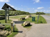
Access Point (Main Car Park Entrance)
-
Access Point
View
- This information is for the access point located leading to the park from the main car park.
- There is not an information board/map at this access point.
- There is ramped/sloped access at this access point.
- There is an open gap for access.
- The width at the bottom of the squeeze gap is 112cm. The width at the top of the squeeze gap is 32cm.
-
Ramp/Slope
View
- The ramp/slope is located on the road leading to the entrance.
- The gradient of the ramp/slope is slight.
-
Step(s)
View
- The step(s) is/are not clearly marked.
Access Point (Access Road Entrance)
-
Access Point
View
- This information is for the access point located leading from the main car park to the access road that leads into the park.
- There is not an information board/map at this access point.
- There is stepped access at this access point.
- There is an open gap for access.
- The width at the bottom of the squeeze gap is 112cm. The width at the top of the squeeze gap is 32cm.
-
Step(s)
View
- The step(s) is/are located on the pathway leading from the car park.
- There is/are 1 step(s).
- The step(s) is/are clearly marked.
- The height of the step(s) is/are 10cm.
- The going of the step(s) is/are not between 30cm and 45cm.
- There is not a/are not handrail(s) at the step(s).
Access Point (Chester Road Entrance)
-
Access Point
View
- This information is for the access point located on Chester Road.
- There is not an information board/map at this access point.
- There is step-free access at this access point.
- There is an open gap for access.
- The width at the lower part of the entrance is 112cm. The width at the upper part of the entrance is 32cm.
-
Comments
View
- There are similar entrances leading into the park from the model boating lake (shown in photographs 3 and 4), McClaren Way (shown in photographs 5 and 6), Lady Beatrice Terrace (shown in photographs 7 and 8), Railway Terrace North (shown in photographs 9 and 10), and leading from the fishing lake area to the access road that leads to the skate park car park (shown in photographs 11 and 12).
- Some of the entrances have a gate next to them which prevents vehicles from entering the park, but allows pedestrians and horses to enter.
- The barrier at the bottom of the anti-vehicle gate creates a deep step (30cm).
Access Point (Model Boating Lake Entrance)
-
Access Point
View
- This information is for the access point located in the model boating lake car park.
- There is not an information board/map at this access point.
- There is ramped/sloped access at this access point.
- There is no gate at this access point.
- There is a boulder in the entrance area which reduces the width to a minimum of 121cm.
-
Ramp/Slope
View
- The ramp/slope is located throughout the entrance area.
- The ramp/slope is permanent.
- There is a level landing at the top of the ramp/slope.
- There is a/are handrail(s) at the ramp.
- The handrail(s) is/are on both sides.
Parks and Gardens
- The park or garden does have footpaths.
- The path(s) has a / have compact earth, tarmac, gravel and muddy surface(s).
- The majority of the path(s) is / are wide enough for wheelchair users.
- There are moderate, slight and steep slopes on the paths.
- There are some bench seats situated along the paths for people to rest.
-
Comments
View
- There are picnic benches opposite the model boating lake.
- The height of the picnic tables is 67cm.
- There are gates throughout the park to access various areas.
- The minimum width at the gates is 123cm.
- There are maps located at various points throughout the park.
- The height to the top of the maps is 110cm.
- There are 3 walking routes marked on the maps.
- The lngth of the walking routes are 1km, 2km, and 3km.
- The routes are signposted throughout the park.
- There are signposts located at various points throughout the park.
- Some of the signposts are weathered and may be hard to read.
- Some of the paths may become uneven during winter months and rain as the gravel may be washed down the gradients.
Skate Park and BMX Track
- The skate park and BMX track are located to the west side of the park, opposite the skate park car park.
- The surface of the skate park is tarmac and concrete.
- The skate park has some steep ramps / slopes.
- There are steps to access some areas of the skate park.
- There are 2 medium height steps without handrails to access the top of one skate ramp.
- There are 7 medium height steps with a handrail to the centre to access the skate ramp nearest to the car park.
- The BMX track is a grass and dirt track area next to the skate park.
- The BMX track has slopes with a variety of gradients throughout from easy to steep.
Amphitheatre
- The amphitheatre is located at the fork in the access road leading to the two car parks.
- The amphitheatre is used for various outdoor events.
- The nearest car park is the skate park car park.
- The entrance to the amphitheatre is a single gate, which opens away from you.
- The width of the gate is 114cm.
- The gate gives access to the top of the amphitheatre.
- There is no designated seating for wheelchair users.
- The seats are grassed.
- There is stepped access to the seating.
- The steps have handrails on the stage side.
- The stage is located at the front of the amphitheatre.
- The stage is accessed by an easy ramp.
- The ramp is 120cm wide.
- There are handrails on both sides.
- There are 4 medium height steps to access the stage.
- The steps do not have tactile paving.
- The steps are not clearly marked.
- The steps have handrails on both sides.
- The ramp overcomes the steps.
- The lower area of the amphitheatre can be accessed by using one of the sloped paths leading down from the skate park car park.
Sight Lines Scuplture
- The Sight Lines Sculpture is located on a hill in the centre of the country park.
- The sculpture is signposted throughout the park.
- Access to the sculpture is via compacted earth and gravel paths.
- The paths are on an easy gradient and are over 150cm wide.
- The sculpture features 7 viewing points with windows creating sight lines to local landmarks.
- Each viewing point has a plaque with the name of the local landmark.
- The height to the top of the viewing window is 170cm.
Miners Memorial Garden
- The Miners Memorial Garden is located to the south of the park, near the Railway Terrace North entrance.
- The minimum width at the entrance to the garden is 236cm wide.
- The surface of the garden is gravel and grass.
- The surface is uneven.
- Ther are bench seats in the garden.
Children's Play Area
- The children's play area is located at the north of the park, next to the car park, cafe, and toilet block.
- There is a gate to enter the play area.
- The gate opens away from you and is heavy.
- The width of the gate is 126cm.
- There is a variety of play equipment for different age groups.
- There are picnic benches near the entrance.
- The height of the picnic benches is 77cm.
- There are benches with armrests.
- The surface of the paths is tarmac.
- The surface around the play equipment is bark.
- Some of the play equipment is accessed by slopes or steps.
- The steps do not have handrails.
Accessible Toilet
- Please see the Herrington Country Park Car Park and Toilet Block guide for toilet details.
Standard Toilet(s)
- Please see the Herrington Country Park Car Park and Toilet Block guide for toilet details.
Related Access Guides
- To view other AccessAble Detailed Access Guides that are related to this one please use the links below.
- Herrington Country Park Car Park and Toilet Block link (new tab) - click here.
- Cafe on the Park link (new tab) - click here.