Access Guide
Introduction
- Aylesbury High Street is in the town centre.
The A41 is just metres from where the High Street starts at the south east end of the route.
This guide covers the main shopping area of High Street which runs between the junction of Market Square and the A41.
This guide has junctions with Market Square and Kingsbury at the south western side and the A41 to the south east.
The route is approximately 0.2 miles (322m) and takes approximately 3-4 minutes to walk.
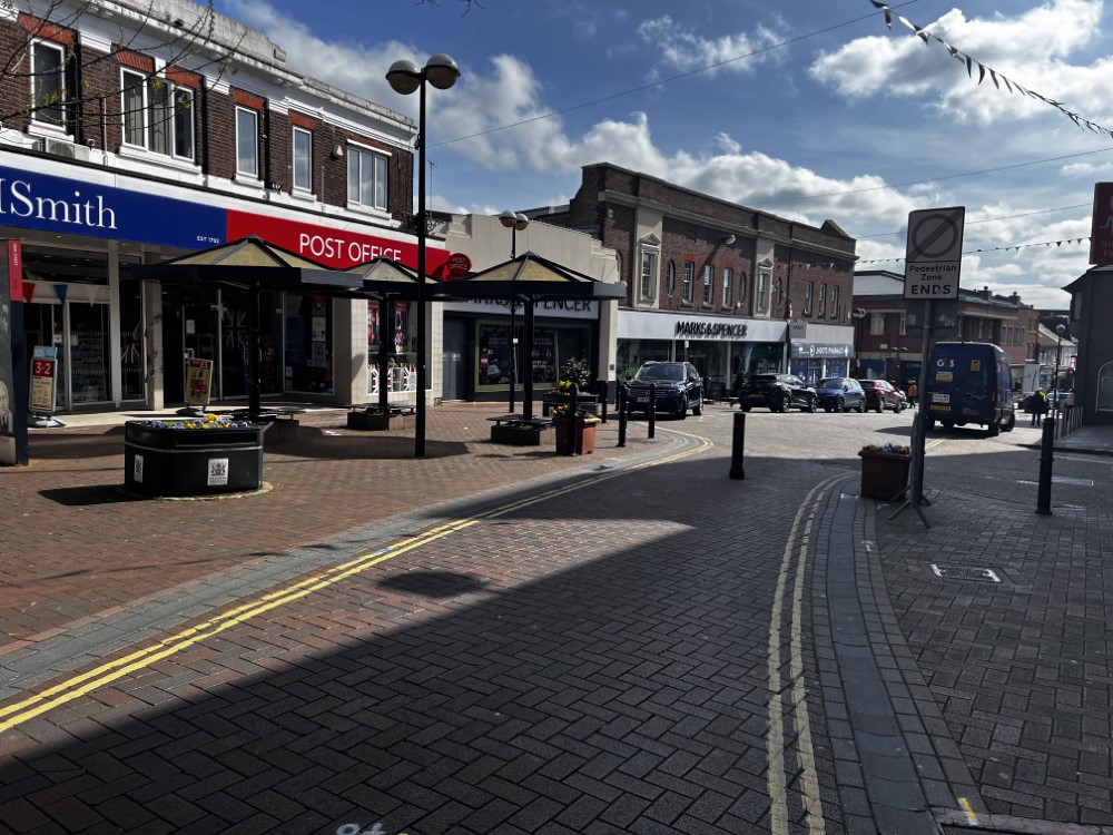
The shopping area is in a pedestrianised area between Market Square and Britannia Street and on both sides of a one way road between Britannia Street and the A41.
There are some easy to steep slopes throughout the route.
Pathway surfaces are a mixture concrete paving slabs and block paving.
The pathways have some uneven sections, which include some raised manhole covers.
The roadway is a mixture of tarmac and block paving.
There are opportunities to sit and rest. - Kingsbury Street Guide link (new tab) - click here.
- Market Square Street Guide link (new tab) - click here.
- The Exchange Street Guide link (new tab) - click here.
- Waterside South Street Guide link (new tab) - click here.
Getting Here
- By Car
- The A41 is at the south eastern end of High Street with direct links to the M25, London, Tring and Bicester.
- This street guide runs in a loop between Market Square and Kingsbury to the south west and the A41 to the south east.
- Parking
- There is limited on street Blue Badge and standard parking available in High Street and Market Street.
- There are some public car parks available close by such as Friars Square Shopping Centre Multi-Storey Car Park in Station Way East, Exchange Street Car Park in Exchange Street (A41) and Waterside North Car Park in Exchange Street (A41).
- By Bus
- There are bus stops available in nearby Friarage Road (A41), on the opposite side of Friars Square Shopping Centre and also in Exchange Street (A41) at the southern tip of Walton Street.
- There are direct bus services available to Watford, Pitstone, Oxford, Milton Keynes, Steeple Claydon, Leighton Buzzard, Tring and many more.
- For Winslow Bus information please click here
- For information on Arriva buses in Aylesbury please click here
- For information on Redline Buses please click here
- By Train
- Aylesbury Station is located in Station Way West and is approximately 0.4 miles from High Street.
- There is step-free access to all platforms at this station via a steep barrow ramp.
- There are direct train services available to London Marylebone, Aylesbury Vale, High Wycombe, Amersham and Chorleywood.
- For information on Aylesbury Station please click here .
Parking
- There is limited on-street Blue Badge and Standard parking bays on High Street, Market Square and some surrounding side roads.
- The on-street standard parking is pay and display via various payment meters.
- Blue Badge holders can park for free in any bay for 2 hours with no return within 1 hour.
- The on-street Blue Badge bays in High Street and Market Square are 290cm in width.
- The length of these bays varies as it is strip parking, however they do merge into the on-street standard strip parking area.
- Photographs 1, 2 and 3 show examples of the on-street Blue Badge parking.
- Photographs 4 and 5 shows an example of the on-street standard pay and display parking bays in High Street.
- Public Car Parks
- There is a car park in Station Way East for the Friars Square Shopping Centre.
- This car park is chargeable for all.
- Please refer to the Friars Square Shopping Centre Multi-Storey Car Park guide for further information.
- Exchange Street Car Park is in Exchange Street (A41), is chargeable and has 20 Blue Badge parking bays available.
- Photographs 6 and 7 show the Blue Badge parking at this car park.
- Photographs 8 and 9 show the standard parking at this car park.
- Waterside North Car Park is in Exchange Street (A41), is chargeable and has 10 Blue Badge parking bays available.
- Photographs 10 and 11 show the Blue Badge parking at this car park.
- Photographs 12, 13 and 14 show the standard parking at this car park.
Junction – Great Western Street, Walton Street and Market Square
- There are two crossing points at this junction for pedestrians to cross Walton Street, Great Western Street and Market Square.
- All of the crossings have an easy downhill slope running into Walton Street and have dropped kerbs on both sides with some having tactile markings on both sides.
- The surface of the roads is tarmac.
- The surface of the pathways is block paving.
- Although the area is mainly for pedestrian use, there are often delivery and service vehicles using the roads.
- Photographs 1, 2 and 3 show the crossing in Walton Street.
- Photographs 4, 5 and show the crossing in Great Western Street.
- There are some bollards on the pathway at the junctions.
- These bollards are well marked, close to the roadway and have a width of 155cm between them.
Market Square to Britannia Street via High Street
- The pathways are on both sides of the road; however the area is mainly pedestrian in this section.
- The pathways are formed of block paving.
- The pathways on both sides of the road are wide.
- The pathways are level between Market Square and Hale Leys Shopping Centre.
- There is a dropped kerb on the right hand pathway outside the Hale Leys shopping centre goods entrance
- From the shopping centre the pathways become a steep downhill slope towards Britannia Street.
- There are some uneven areas on the pathways throughout this section.
- There are some obstructions along the pathways on both sides such as signs, cash points, railings, cycle racks, bus stops, bins and signboards.
- There are some side roads to cross along the route which have dropped kerbs on both sides but no tactile markings.
- There are some bollards on the pathway on both sides as you pass WHSmith which have a width of 155cm between them.
- The length of this section of the route is approximately 152metres (499feet) and takes 2-3 minutes to walk.
Junction – Britannia Street and High Street
- This is where Britannia Street meets High Street and there are three crossing points at this junction for pedestrians to cross High Street and Britannia Street.
- The crossings all have dropped kerbs and tactile markings on both sides.
- There is an easy downhill slope leading into High Street towards the A41 from Britannia Street and the roads have a tarmac surface, the pathways have a surface of block paving.
- Photographs 1 and 2 show the crossing in Britannia Street next to Coral Bookmakers.
- Photographs 3 and 4 show the crossing in the High Street next to McDonalds.
- Photographs 5 and 6 show the crossing in the High Street next to Poundland and there are some bollards on the pathway at this junction that are well-marked and close to the roadway.
- These bollards are 100cm high and have a gap between of 155cm.
Britannia Street to A41 via High Street
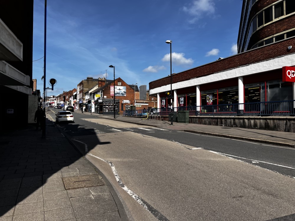
- The pathways are on both sides of the road in this section and are formed block paving.
- The pathways on both sides of the road are wide.
- The pathways are on an easy then steep downhill slope leading from Britannia Street towards the A41.
- The surface of the road is tarmac.
- The road is one way with traffic coming from the A41 towards Britannia Street.
- There are some uneven areas on the pathways throughout this section.
- There are some obstructions along the pavement on both sides such as signs, cash points, railings, cycle racks, bus stops, bins and signboards.
- There are some side roads and crossing points to cross along the route.
- Most of these have dropped kerbs with tactile markings on both sides.
- There are bus stops available opposite Iceland.
- The bus stops are sheltered with bench seating.
- There are some on street pay and display standard parking bays available outside Oxfam.
- The length of this section of the route is approximately 0.1 miles (162m) and takes 2-3 minutes to walk.
Junction – A41 Roundabout and High Street
- There is a zebra crossing at this junction for pedestrians to cross High Street as you approach/exit the A41.
- The crossing is on an easy slope downhill between Britannia Street and the A41.
- There are dropped kerbs and tactile markings on both sides.
- The surface of the road is tarmac.
- The surface of the pathways is block paving.
- The roadway in this area is often very busy with traffic coming from both directions.
- There are some bollards on the pathway at this junction.
- These bollards are well marked out and close to the roadway.
- Photographs 1, 2 and 3 show the zebra crossing over High Street.
Accessible Toilet
- Accessible toilet facilities are not available.
-
Comments
View
- The nearest public accessible toilets are located on Levels 1 and 3 in the Friars Square Shopping Centre.
Standard Toilet(s)
- The nearest public standard toilets are located on Level 3 in the Friars Square Shopping Centre.


