Access Guide
Introduction
- This route plan gives access information for the Armagh City Walking Tour.
- The total distance of the route is approximately 3.5 kilometres.
- The starting point is the Mall and the finishing point is No. 5 Vicar's Hill.
- The tour goes via Armagh Observatory, The Archbishop's Palace and Armagh Public Library.
- There are sections of this route that may not be accessible for a wheelchair user due to the gradient, surface or narrowness of the paths.
The Mall to The Observatory - Section 1
- Start at the Mall East.
- Click here for detailed information
- Use the ramped exit from The Mall Grounds into The Mall East.
- The ramp has a moderate gradient and is 130cm wide.
- The ramp does not have handrails.
- The ramp overcomes 5 medium steps.
- The steps are not marked and do not have handrails.
- There is a Blue Badge parking bay close to this access point.
- The dimensions of the bay are 230cm x 790cm.
- After exiting the grounds turn left and follow the pavement along the Mall East.
- The pavement is level and has a tarmac surface.
- At the end of the road turn right and cross The Mall East.
- The crossing has dropped kerbs at both sides but no tactile paving.
- At the far side of the crossing turn left and then immediately right into College Hill.
The Mall to The Observatory - Section 2
- Proceed along College Hill.
- The pavement is uneven in place due to drain covers and drainage gulleys.
- The path slopes moderately uphill.
- When you reach an archway on the right hand side turn left to cross College Hill.
- Take care when crossing this road as it is busy with traffic in both directions.
- This crossing point has a dropped kerb on the near side but not on the far side.
- There is not tactile paving.
- At the far side of the road turn left and come back on yourself along College Hill until you reach the Observatory access road.
- Turn right into the Observatory access road.
- There is no dropped kerb at this point.
- Proceed along the Observatory access road.
- Take care of traffic in both directions as there is no pavement.
- The road has a tarmac surface and slopes steeply uphill.
- There are several speed bumps along the route.
- Continue along the access road for 300 metres until you reach the Observatory.
- Click here for detailed information.
The Observatory to the Archbishop's Palace - Section 1
- Go back down the Observatory access road.
- At College Hill turn left and cross the road in the same position opposite the arch.
- Turn right at the arch and follow the pavement back down towards The Mall East.
- Cross the Mall East in the same position at the end of the road.
- The crossing has dropped kerbs at both sides but no tactile paving.
- Proceed straight ahead for approximately 500 metres, following the pavement to the end of The Mall East.
- At the junction with Gaol Square follow the pavement round to the right.
- The pavement widens and bench seating is available.
- Proceed along Gaol Square until you reach The Mall West.
- Turn right into the Mall West and stop at the traffic lights.
- Cross the Mall West at the traffic lights.
- There are 3 roads to cross here with the traffic coming from the right then the left and the left again on the third.
- All crossings have dropped kerbs and tactile paving at both sides.
- Controls are at a convenient height for wheelchair users at all crossings in this route.
- At the far side of Mall West turn left and then right along Barrack Street.
- The pavement has a very easy cross slope from right to left.
- The pavement surface is block paving.
The Observatory to the Archbishop's Palace - Section 2
- When the pavement splits, bear left and cross Scotch Street at the traffic lights.
- There are 2 roads to cross with traffic from the right and then the left.
- Both crossings have dropped kerbs and tactile paving at either side.
- Turn right down Scotch Street, the pavement is level with a block paving surface.
- Cross Dobbin Street next to the stainless steel sculpture called "For the Love of Emer".
- There are dropped kerbs and tactile paving on both sides of the crossing.
- Turn left and proceed along Dobbin Street for 170 metres.
- The pavement continues to have a block paving surface.
- There are some undulating sections.
- You will pass the Dobbin Street Community Centre on the right (click here for detailed information) and then reach Linenhall Street as the pavement bends round to the right.
- Cross Linenhall Street. There are dropped kerbs and tactile paving on both sides of the crossing.
- Continue along Dobbin Street until just before the junction with Dobbin Street Lane on the opposite side of the road.
The Observatory to the Archbishop's Palace - Section 3
- Cross Dobbin Street diagonally to the right towards Dobbin Street Lane using the dropped kerbs.
- The dropped kerbs have short moderate slopes with no tactile paving.
- Be cautious of oncoming traffic approaching from the left.
- Turn left down Dobbin Street Lane and continue straight ahead for 100 metres.
- Turn to the right and cross Dobbin Street Lane diagonally to the left towards the shops service yard.
- There are dropped kerbs on both sides but tactile paving on the far side only.
- Turn left and continue along Dobbin Street Lane.
- Cross the car park access road.
- There are dropped kerbs and tactile paving on both sides of the road.
- Follow the pavement as it slopes easily uphill to the end of Dobbin Street Lane.
- At the end of Dobbin Street Lane to the right is some more public art in the form of the "Saints and Scholars Railings".
- Turn right past the railings into Friary Road.
- Proceed straight ahead past an advertising board until you reach the traffic lights.
- There is some loose gravel on this tarmac section of pavement and a slight cross slope from right to left.
- Cross Friary Road at the traffic lights.
- There are dropped kerbs and tactile paving on both sides.
- The dropped kerb on the far side is 5cm high.
- Turn left at the far side then immediately right into the Palace Demesne Public Park. (click here for detailed information)
- At the park information sign, cross the access road.
- There are dropped kerbs and tactile paving on both sides of the access road.
- Turn right and proceed straight ahead, past the Priory.
- Follow the pavement up the hill, there is a very long moderate slope.
- The path is tarmac but there are some slightly uneven sections where the surface is worn.
- There are some bench seats along the route.
- Continue until the road forks and then bear left towards the Palace.
- There is tactile paving on the right hand side of the pavement at this point.
- Follow the tarmac path as it slopes moderately downhill towards the Palace.
- There is a dropped kerb and tactile paving when you reach the Palace car park driveway.
- It is over 500 metres in total from Friary Road to the Palace.
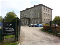
- You have reached the Palace.
- The Palace was being refurbished at the time of the survey.
The Archbishop's Palace to Armagh Robinson Library - Section 1
- Return to Friary Road the same way you came, crossing the access road in the same position near the entrance.
- Turn left into Friary Road and cross the road in the same position at the traffic lights.
- At the far side of crossing turn left and proceed along Friary Road.
- There is a long easy slope leading uphill.
- The pavement has a tarmac surface with some loose gravel.
- Follow the path as it bends round to the right and take the first right.
- The path slopes easily downhill to the junction with Irish Street opposite St Malachy's Chapel.
- Click here for detailed information.
The Archbishop's Palace to Armagh Robinson Library - Section 2
- Just before the junction with Irish Street turn left and cross the road.
- There are dropped kerbs on both sides of the road but no tactile paving.
- Take care when crossing this road as it is busy.
- Turn right then immediately left into Irish Street.
- Proceed towards the traffic lights.
- The pavement has a tarmac surface and slopes easily uphill.
- At the crossroads with traffic lights bear left and cross Navan Street.
- There are dropped kerbs with tactile paving at both sides of the crossing.
- Turn right then immediately left and continue along Irish Street.
- The pavement has a tarmac surface and slopes steeply uphill.
- Cross Culdee Street.
- There are dropped kerbs on both sides of the crossing but no tactile paving.
- Continue uphill along Upper Irish Street.
- Follow the path as it bends round to the left away from the road and then turns right to lead back up to Upper Irish Street.
- Cross Upper Irish Street.
- There is a dropped kerb at the far side only and no tactile paving.
- The nearside kerb is 10cm high.
- Take care for traffic in both directions as vehicles can be travelling very quickly.
- Turn left at the far side of the crossing.
- The pavement is very narrow (width 85cm) with a wall to the right.
- There are easy to moderate slopes uphill on this section.
- The surface of the pavement is tarmac.
- There are some breaks in the pavement with no dropped kerbs.
- The kerbs are 7cm high.
- The pavement then narrows to 62cm as you approach the junction with Castle Street on the right hand side.
- Turn right into Castle Street.
- There is then another kerb across the pavement which has to be navigated.
- The kerb is 12cm high.
- There is a moderate cross slope from right to left on the final section of pavement (width 85cm) as you approach the Irish Public Library on the right hand side.
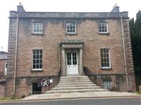
- You have reached the Public Library.
- Click here for detailed information.
Armagh Robinson Library To No. 5 Vicar's Hill
- Exit the library and turn right towards the St Patrick's Cathedral (COI).
- Click here for detailed information
- Vicar's Hill is the road to the right of the cathedral as you face it from the library.
- There is a pavement on the right hand side of Vicar's Hill only.
- Wheelchair users may have to use the road as the pavement is very uneven and can be obstructed by parked cars.
- The road slopes uphill steeply from the library into Vicar's Hill.
- No. 5 Vicar's Hill is located on the right hand side.
- Click here for detailed information.


