Access Guide
Introduction
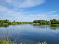
- Sandhill Lake is a small lake and park, west of the centre of Worksop.
- The Chesterfield Canal runs alongside part of the park.
- The path around the park has a circumference of 1.21 miles (1.95 km).
Location
- There is a bus stop within 150m (164yds) of the venue.
- The nearest National Rail station is Worksop.
Opening Times
- This service is open 24 hours.
Parking
- The venue does have its own car park.
-
Venue Car Park
View
- Parking is free for all users.
- The car park is located at the front of the venue.
- The car park type is open air/surface.
- Parking spaces for Blue Badge holders cannot booked in advance.
- There is/are 2 Blue Badge parking bay(s) within the car park.
- The dimensions of the Blue Badge parking bay(s) are 230cm x 450cm (7ft 7in x 14ft 9in).
- The nearest Blue Badge bay is 10m (10yd 2ft) from the Sandhill Street access point.
- The route from the car park to the entrance is accessible to a wheelchair user unaided.
- The car park surface is tarmac.
- There is not a road to cross between the car park and the entrance.
- The car park does not have a height restriction barrier.
-
Drop-off Point
View
- There is not a designated drop off point.
-
Comments
View
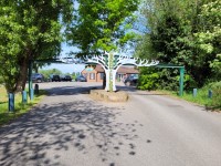
- Photographs 1 to 4 show the car park at the Sandhill Street access point.
- Photographs 5 to 7 show the car park at the John Street access point.
- There is not a Blue Badge bay at the John Street access point.
Access Point (Sandhill Street)
-
Access Point
View
- This information is for the access point located off Sandhill Street.
- There is an information board/map at this access point.
- There is step-free access at this access point.
- There is no gate at this access point.
Access Point (John Street)
-
Access Point
View
- This information is for the access point located off John Street.
- There is not an information board/map at this access point.
- There is ramped/sloped access at this access point.
- There is a kissing gate at this access point.
- The gate is easy to open.
- The gate has a latch lock.
- The width of the gap is 130cm.
-
Ramp/Slope
View
- The ramp/slope is located beyond the access point.
- The gradient of the ramp/slope is slight.
- The ramp/slope is permanent.
-
Comments
View
- The ground leading to and away from the access point is uneven.
Access Point (Sandy Lane)
-
Access Point
View
- This information is for the access point located off Sandy Lane.
- There is not an information board/map at this access point.
- There is step-free access at this access point.
- There is a kissing gate at this access point.
- The gate is easy to open.
- The gate has a latch lock.
- The width of the gap is 130cm.
-
Comments
View
- The ground leading to and beyond the access point is uneven.
Parks and Gardens
- The park or garden does have footpaths.
- The path(s) has a / have compact earth, tarmac, concrete, gravel and muddy surface(s).
- The majority of the path(s) is not / are not wide enough for wheelchair users.
- There are steep, moderate and slight slopes on the paths.
- There are bench seats situated along the paths for people to rest.
-
Comments
View
- Photographs 1 and 2 show the fixed bench picnic tables at the Sandhill Street access point.
- The path to the left leading from this access point is wide enough to access some of the park for wheelchair users, although, the ground is uneven in places.
- Photographs 3 and 4 show the gates similar to the access point gates and bollards which reduce the path size to 90cm.
- Photographs 14 to 17 show the bridge with a steep curve leading from the pathway to the canal towpath at Morse Lock No. 49.
Fishing Platforms
- There are fishing platforms along the lake.
- The fishing platforms are 190cm by 200cm.
- Photographs 3 to 5 show the ramp along the path to the left of the Sandhill Street access point.
- This ramp has a very easy slope and has handrails on both sides.
- It facilitates easier access for wheelchair users to two fishing platforms.
- Access from the ramp to the platforms is over grass with some uneven ground.
Level Change (Steps)
- There is a/are step(s) to access this area/service.
- The step(s) is/are located along the pathways.
- There is/are 15+ step(s) to the area/service.
- There is not tactile paving at the top and bottom of the steps.
- The step(s) is/are not clearly marked.
- The step(s) is/are medium height (11cm - 17cm).
- There is a/are handrail(s) at the step(s).
- The handrail(s) is/are on the left going up the step(s).
-
Comments
View
- Photograph 2 shows 9 steps with the handrail on the right.
- All of the steps can be avoided by taking a different route.
Accessible Toilet
- Accessible toilet facilities are not available.
Standard Toilet(s)
-
Availability and Location of Standard Toilets
View
- Standard toilet facilities are not available.


