Access Guide
Opening Times
- The venue is open 24hrs.
Location
- The venue is in a pedestrian area.
- There is a bus stop within 150m (164yds) of the venue.
- The nearest National Rail station is Cambridge North Train Station.
Parking
- The venue does not have its own car park.
-
Public Car Parks
View
- There is not a car park for public use within 200m (approx).
-
On Street Blue Badge Parking
View
- On street marked Blue Badge bays are not available.
-
On Street Standard Parking
View
- Clearly signed and / or standard marked parking bays are not available.
-
Drop-off Point
View
- There is not a designated drop off point.
-
Comments
View
- Standard on street parking is available on Ribston Way and Laxton Way.
Access Point (Laxton Way)
-
Access Point
View
- This information is for the access point located at the end of Laxton Way.
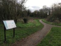
- There is an information board/map at this access point.
- There is ramped/sloped access at this access point.
- There is no gate at this access point.
- The width of the gap is 108cm.
-
Ramp/Slope
View
- The ramp/slope is located in front of the entrance.
- The gradient of the ramp/slope is slight.
Access Point (Discovery Way)
-
Access Point
View
- This information is for the access point located at the end of Discovery Way.
- There is not an information board/map at this access point.
- There is ramped/sloped access at this access point.
- There is no gate at this access point.
- The width of the gap is 192cm.
- There are bollards at this access point.
-
Ramp/Slope
View
- The ramp/slope is located in front of the bollards.
- The gradient of the ramp/slope is slight.
Access Point (Long Reach Road)
-
Access Point
View
- This information is for the access point located along Long Reach Road.
- There is an information board/map at this access point.
- There is step-free access at this access point.
- There is no gate at this access point.
- The width of the gap is 104cm.
- There are bollards at this access point.
Access Point (Pippin Drive)
-
Access Point
View
- This information is for the access point located at the end of Pippin Drive.
- There is not an information board/map at this access point.
- There is step-free access at this access point.
- There is no gate at this access point.
- The width of the gap is 112cm.
- The second part of the entrance is 104cm wide.
Access Point (Ribston Way)
-
Access Point
View
- This information is for the access point located at the end of Ribston Way.
- There is not an information board/map at this access point.
- There is ramped/sloped and stepped access at this access point.
- There is no gate at this access point.
- The width of the gap is 108cm.
-
Ramp/Slope
View
- The ramp/slope is located in front of and after the entrance.
- The gradient of the ramp/slope is slight.
- The ramp/slope does not bypass the step(s).
-
Step(s)
View
- The step(s) is/are located in front of the entrance.
- There is/are 1 step(s).
- The step(s) is/are not clearly marked.
- The height of the step(s) is/are not between 15cm and 18cm.
- The height of the step(s) is/are 3cm.
- The going of the step(s) is/are between 30cm and 45cm.
- There is not a/are not handrail(s) at the step(s).
Parks and Gardens
- The park or garden does have footpaths.
- The path(s) has a / have tarmac and muddy surface(s).
- The majority of the path(s) is / are wide enough for wheelchair users.
- There are slight and moderate slopes on the paths.
- There are some bench seats situated along the paths for people to rest.
Play Area
- The closest Access Point to the play area is Access Point Laxton Way.
- The play area is not fenced off.
- The surface of the play area is mud and grass.
Accessible Toilet
- Accessible toilet facilities are not available.
Standard Toilet(s)
-
Availability and Location of Standard Toilets
View
- Standard toilet facilities are not available.


