
Access Guide
Introduction
- The following information describes the route from Coventry University Staff Car Park to the Cu Mile Building on Mile Lane via Gosford Street and Puma Way Junction.
The approximate distance of this route is 0.7 miles or 1126 metres.
The route takes approximately 14-16 minutes.
The route starts at Coventry University Staff Car Park exit along Gosford Street, passing the ECB and along Gulson Road to Paradise Street Subway and then along Paradise Street and into Puma Way. The route then continues along Puma Way until you reach Mile Lane passing the Technology Park along the way.
The pathways have a mixture of block paving and concrete throughout with most major crossings tarmac.
The potential hazards on this route include; narrow pathways in some sections, uneven paving, manhole covers, street signs, bollards, tree and steep/downhill and uphill slopes.
There are several crossings along the route with tactile paving and dropped kerbs.
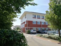
The following University buildings are on this route directly:- Cu Mile Lane Building (opens 2019), ECB, Students Centres and the Technology Park.
The following University buildings are on Puma Way opposite the end of the route:-
Serious Games Institute Building, Innovation Village, Futures Institute Building, Design Hub Building, Enterprise Building, Innovation Centre Building, The Bistro and the Coventry Conferences Building.
Multi-Storey Car Park to Gosford Street)
Gosford Street to ECB Main Access Way
- There is a long slight gradient upwards along this section.
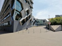
- After approximately 45m you will come to an opening on your left which is for the William Morris Building, Frederick Lanchester Building, the Engineering and Computer Building and the Student Centre (as shown in photograph 6).
- On your right at this point is the Jaguar Building (as shown in photograph 8).
ECB Main Access Way to ECB Building
- Once you have turned left onto the Main Access Way you will see the William Morris Building main entrance on your left.
- There is bench seating in the area.
- Proceed ahead. After approximately 15m you will see an entrance to the Frederick Lanchester Building on your left (as shown in photograph 4).
- The path here forks slightly.
- Continue along the right hand fork.
- Proceed ahead and you will come to more bench seating.
- The path bears to the left.
- Continue ahead and you will see the Engineering and Computer Building ahead (as shown in photograph 11).
- You will see the Student Centre ahead and to your right (as shown in photograph 12).
ECB Main Access Way to ECB Gulson Road Entrance
- Continue ahead with the ECB to the left with the Student Centre on the right a short distance away. As shown in photographs 2 and 3.
- The pathway is block paving and for use for both pedestrians and vehicles. The pathway is on an easy slope downhill.
- Continuing ahead and after about 47 metres you will see the entrance and steps to the Students Centre on your right. The steps are medium and have a hand rail at both sides and centre and automatic double sliding doors to enter the building. As shown in photograph 4.
- The pathway is still block paving and on an easy slope downhill.
- Continuing ahead for a few metres you will arrive at some bollards with a width of 113 cm between them. The bollards do not have a good colour contrast to their surroundings. As shown in photograph 5.
- Continuing ahead for a further 37metres you will arrive at ECB Gulson Road Entrance. As shown in photograph 7. There are dropped kerbs and tactile paving to join Gulson Road at the entrance. As shown in photographs 8 and 9.
- The length covered in this section is about 87 metres.
ECB Gulson Road Entrance to Paradise Street Subway Via Gulson Road
- Turn right out of the entrance onto Gulson Road and continue ahead on a pathway that is concrete and on a steep slope uphill.
- There are some raised manhole covers along the section and some uneven surfaces. As shown in photographs 1, 3 and 5.
- Continuing along Gulson Road for about 6 metres you will pass the entrance walkway to the Students Centre on the right. As shown in photograph 2.
- Continuing along Gulson Road the pathway is still concrete and a steep slope uphill.
- After about 12 metres the pathway narrows to 140 to pass a post and then shortly afterwards a sign. As shown in photographs 4 and 5.
- Continuing along Gulson Road for about 60 metres on a pathway still concrete and on a steep slope uphill you will approach a pedestrian crossing ahead. As shown in photograph 7.
- The pathway changes to block paving and becomes a slight uphill slope as you pass the beginning of the railings. As shown in photographs 7 and 8.
- As you reach the pedestrian crossing turn left and cross over the crossing. This crossing has tactile paving and dropped kerbs and has a island in the middle that also has tactile paving and dropped kerbs. As shown in photographs 9, 10, 12, 13 and 14.
- There is a low level push button to activate the crossing which is 98cm in height. As shown in photograph 11.
- The length covered in this section of the route is 126 metres.
Paradise Street Subway to Paradise Street
- Continue ahead on a pathway that is block paving and on a slight slope downhill which progresses to a steep downhill slope.
- The pathway turns to the right and left as you work your way towards a tunnel that will pass under the Ring Road. As shown in photographs 1, 2, 3, 4, 5 and 6.
- You will continue ahead as you reach the tunnel under the Ring Road on a pathway that is block paving and now level. As shown in photographs 6 and 7.
- As you exit the tunnel on the other side the pathway is still block paving but becomes a steep slope uphill again. As shown in photograph 8.
- The pathway snakes to the left after a short distance and then continues ahead. As shown in photograph 9, 10 and 11.
- The pathway is block paving still and a steep slope uphill as you reach Paradise Street and the end of the Subway. As shown in photograph 12.
- The length covered in this section is about 145 metres.
Paradise Street to Coventry University Technology Park Roundabout
- As you exit the subway turn right into Paradise Street and go straight ahead. As shown in photographs 1 and 2.
- The pathway is block paving and on a slight uphill slope and becomes a steep uphill slope as you get around the corner. The pathway is also very uneven in many places due to ongoing building work alongside the pathway. As shown in photographs 1, 2, 3, 5 and 8.
- Continuing along the pathway after about 12 metres the pathway narrows to 130cm as you pass a sign close to the road. As shown in photograph 3.
- Shortly after passing the sign you will have to cross a side entrance road to your right. This side entrance has dropped kerbs and no tactile paving and is uneven as you cross. As shown in photograph 4.
- The pathway is now concrete and still on a steep slope uphill as you pass another side entrance blocked off for building work. This entrance has dropped kerbs but no tactile paving. As shown in photograph 5.
- Continuing ahead along the pathway for about 25 metres you will approach a crossing to your left to cross Paradise Street if you so wish. This crossing has tactile paving and dropped kerbs and has traffic that flows in both directions. As shown in photographs 8 and 9.
- As you continue ahead for a further 8 metres the pathway turns towards the right as you approach Technology Park roundabout. As shown in photographs 10 and 11.
- The pathway is concrete still and now a slight uphill slope.
- You will now arrive at a crossing on your left to cross Parkside. As shown in photograph 11.
- The pathway is concrete and on an slight slope uphill.
- Turn left and cross over the crossing which has an island in the middle. There is tactile paving and dropped kerbs on both sections. As shown in photographs 11, 12, 13 and 14.
- As you exit the crossing, turn left and follow the pathway as it bends right. The pathway is now block paving and on an easy slope uphill. As shown in photographs 15 and 16.
- After about 17 metres you will see a crossing to your left with the Technology Park straight ahead. As shown in photographs 17 and 18.
- The length covered in this section is about 137 metres.
Technology Park Roundabout to Swift Road via Puma Way
- Turn left onto the crossing that crosses the Technology Park entrance road. This crossing has tactile paving and dropped kerbs with traffic coming from both directions. As shown in photographs 1, 2 and 3.
- The pathway is tarmac as you cross the crossing with an easy slope leading towards the roundabout.
- Turn left as you exit the crossing on the other side on a pathway that is blocked paving and on an easy downhill slope that then becomes a slight uphill slope. As shown in photograph 4.
- Continue ahead for about 13 metres and you will approach a crossing to the left to cross Puma Way if required. This crossing has tactile paving and dropped kerbs. As shown in photographs 5 and 6.
- Continue ahead on Puma Way as the pathway turns to the right slightly and then straightens out again. The pathway is block paving and on an easy uphill slope. As shown in photographs 7 and 8.
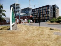
- Continuing along Puma Way for about 68 metres you will see the road entrance to Innovation Village on your left. As shown in photographs 9 and 10.
- The pathway is block paving and on an easy slope uphill as you continue ahead for a further few metres before reaching a crossing to the left to cross Puma Way should you require the Innovation Village. This crossing has tactile paving and dropped kerbs. As shown in photographs 11 and 12.
- Continuing ahead for a further 64 metres you will reach Swift Road that is on your right.
- The length covered in this section is about 161 metres.
Swift Road to Cu Mile Lane via Puma Way
- Follow the pathway as it turns right towards Swift Road and you will approach a crossing to the left to cross the road.
- The pathway is block paving and is on a slight slope uphill and levels out as you reach the crossing.
- Cross at this crossing which has tactile paving and dropped kerbs with traffic coming from both directions. As shown in photographs 1, 2 and 3.
- On exiting the crossing turn left and follow the pathway which is block paving and on a slight downhill slope until you turn the corner where the pathway becomes a slight uphill slope. As shown in photographs 4 and 5.
- Continuing ahead for a further 70 metres on a slight uphill slope and block paving path you approach the pedestrian crossing at the junction with Mile Lane. At this point the path narrows to 130cm as you pass the railings the crossing. As shown in photographs 6 and 7.
- The pathway is block paving and on an easy slope uphill.
- Continuing past the railing you will reach a crossing to the left with tactile paving and dropped kerbs to cross Puma Way. As shown in photograph 8.
- Continuing ahead the pathway levels out and is still block paving as you approach a pedestrian crossing to the left to cross Mile Lane. This crossing has tactile paving and dropped kerbs. As shown in photographs 10, 11, and 12.
- Turn left as you exit the crossing on a path that is now concrete and on an easy uphill slope. As shown in photographs 13 and 14.
- Continuing ahead for around 7 metres, you will approach a crossing over Merlin Close. This crossing has tactile paving and dropped kerbs. As shown in photograph 15.
- Turn left as you exit the crossing on a pathway that is concrete and on an easy slope uphill.
- After about 7 metres you will arrive at a path on your right to the Cu Mile Lane. This pathway is block paving and on an easy slope uphill. As shown in photographs 17 and 18.
- The length covered in this section is about 104 metres.