
Access Guide
Location
- There is a bus stop within 150m (164yds) of the venue.
- The nearest National Rail station is Lenzie.
Parking
- The venue does have its own car park.
-
Venue Car Park
View
- Parking is free for all users.
- The car park is located off Main Street.
- The car park type is open air/surface.
- Parking spaces for Blue Badge holders cannot booked in advance.
- The route from the car park to the entrance is accessible to a wheelchair user with assistance.
- Assistance may be required because there is/are slopes/ramps.
- The car park surface is tarmac.
- There is not a road to cross between the car park and the entrance.
- The car park does have a height restriction barrier.
- The maximum height is 300cm (9ft 10in).
-
Drop-off Point
View
- There is not a designated drop off point.
-
Comments
View
- Cars can park near the old church and at graves to the rear which have roads, although vehicles are not permitted in the lower area.
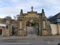
Access Point (Main Street)
-
Access Point
View
- This information is for the access point located on Main Street.
- There is not an information board/map at this access point.
- There is ramped/sloped access at this access point.
- There is a gate which opens away from you (push).
- The gate is permanently held open.
- The width of the gap is 120cm.
-
Ramp/Slope
View
- The ramp/slope is located leading up beyond the gate.
- The gradient of the ramp/slope is slight.
- The ramp/slope is permanent.
- There is not a level landing at the top of the ramp/slope.
-
Comments
View
- This is a long slope around 175m from the cemetery.
Access Point (Cemetery Entrance)
-
Access Point
View
- This information is for the access point located to the left of the church.
- There is not an information board/map at this access point.
- There is ramped/sloped access at this access point.
- There is no gate at this access point.
-
Ramp/Slope
View
- The ramp/slope is located leading down to the lower cemetery.
- The gradient of the ramp/slope is steep.
- The ramp/slope is permanent.
- There is not a level landing at the top of the ramp/slope.
-
Step(s)
View
- The step(s) is/are located to the left of the entrance.
- There is/are 8 step(s).
- The step(s) is/are not clearly marked.
- The height of the step(s) is/are between 15cm and 18cm.
- The height of the step(s) is/are 17cm.
- The going of the step(s) is/are not between 30cm and 45cm.
- There is a/are handrail(s) at the step(s).
- The handrail(s) is/are on both sides.
- Handrails are at the recommended height (90cm-100cm).
- Handrails do not cover the flight of stairs throughout its length.
- Handrails are easy to grip.
- Handrails do not extend horizontally beyond the first and last steps.
-
Comments
View
- There are steep slopes throughout the lower cemetery, although the areas to the rear of the church are mostly level.
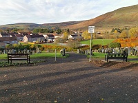
Parks and Gardens (Cemetery)
- The park or garden does have footpaths.
- The path(s) has a / have tarmac surface(s).
- The majority of the path(s) is / are wide enough for wheelchair users.
- There are slight and steep slopes on the paths.
- There are some bench seats situated along the paths for people to rest.
Accessible Toilet
- Accessible toilet facilities are not available.
Standard Toilet(s)
-
Availability and Location of Standard Toilets
View
- Standard toilet facilities are not available.
Additional Info
- A bowl of water cannot be provided for an assistance dog.
- A member of staff trained in BSL skills is not normally on duty.