Access Guide
Introduction
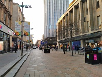
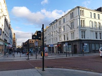
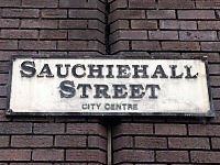
- Sauchiehall Street, Glasgow, runs from Buchanan Street at its east end in the city centre to the junction with Claremont Street at its west end.
The pedestrianised section covered by this guide runs from Buchanan Street to the junction with Blythswood Street (south) and Rose Street (north).
Its total length is approximately 0.58km (0.36 miles).
The average width of the pedestrianised section is approximately 18m.
Sauchiehall Street is divided up into 5 sections in this guide, from the east end to the west end.
1. Buchanan Street to West Nile Street.
2. West Nile Street to Renfield Street.
3. Renfield Street to Hope Street.
4. Hope Street to Cambridge Street / West Campbell Street.
5. Cambridge Street / West Campbell Street to Rose Street / Blythswood Street.
Sauchiehall Street is part of the main pedestrianised shopping area of the city centre.
Also pedestrianised, but not forming part of this guide, are Buchanan Street, Royal Exchange and St Enoch Square. - The lighting along Sauchiehall Street is mostly modern bright white lighting on lampposts.
Most pedestrian crossings are split with a signal controlled pelican crossing to each side of the street.
The crossings are push button controlled.
There is tactile paving at each pedestrian crossing, together with dropped kerbs. - People Make Glasgow - Sauchiehall Street link (new tab) - click here.
- Glasgow City Parking link (new tab) - click here.
Access Guides Available For (Sauchiehall Street)
Getting Here
- Sauchiehall Street is a pedestrianised street with other streets crossing it.
- There are bus stops in West Nile Street, Renfield Street, Hope Street, Blythswood Street and Rose Street.
- The nearest railway stations are Glasgow Queen Street, Charing Cross and Glasgow Central.
- The nearest subway stations are Buchanan Street and Cowcaddens.
- There is a taxi rank in Renfield Street, near the Pavilion Theatre.
Parking
- BLUE BADGE PARKING
- There are 9 Blue Badge bays in Cambridge Street on the north side of Sauchiehall Street (photograph 1).
- They are approximately 650cm wide and 260cm deep.
- ON STREET PARKING
- There are pay and display standard on-street parking bays in most streets around Sauchiehall Street (photographs 2 and 3).
- Parking is free in these bays for those displaying a valid Blue Badge.
- PUBLIC PARKING
- There are 4 paid public car parks with Blue Badge bays (photographs 4 to 8).
- Parking is not free for Blue Badge holders.
- 1. Cambridge Street Car Park lies in Cambridge Street, north of Sauchiehall Street (photograph 5).
- 2. Concert Square Car Park is to the north east of Sauchiehall Street and is accessed via Cowcaddens Road (photograph 6).
- 3. Q-Park Sauchiehall Street Car Park is located to the south in Bath Street and overlooks Sauchiehall Street at West Campbell Street (photograph 7).
- 4. Buchanan Galleries Car Park is located to the east of Buchanan Galleries Shopping Centre giving covered access to the end of Sauchiehall Street (photograph 8).
Toilet Facilities
- Public accessible and standard toilets at the east end may be found in the Buchanan Galleries Shopping Centre.
- There are also public toilets in the Savoy Centre on the ground floor between Hope Street and Cambridge Street.
- There are accessible and standard toilets within the Q-Park car park.
- Many cafés and shops also have toilet facilities; however, they may not be accessible toilets.
- Some cafés have toilets behind coded entry doors for customer use only.
- Boots, Primark and Waterstone's all have accessible toilet facilities.
- The public toilets at 281a West Campbell Street were closed down at the time of survey (February 2020).
Section 1. Buchanan Street to West Nile Street
- The length of this section is approximately 65m.
- Photographs 1 and 2 show each end of the section.
- Looking west from Buchanan Street towards West Nile Street, the north of the pavement is on the right and the south pavement is on the left.
- This section is pedestrianised from Buchanan Street to West Nile Street.
- The pavement has a slight slope up towards West Nile Street.
- There is a raised section of pavement on the south side, raised by 2 medium steps without handrails sloping down towards West Nile Street (photograph 3).
- There is a narrow lane that branches off on the left (East Bank Lane) that runs south from Sauchiehall Street.
- There are steep ramps with ribbed tactile paving on the raised pavement to each side and a slight ramp on to Sauchiehall Street (photograph 4 to 5).
- The paving to Sauchiehall Street is granite and stone blockwork and is uneven.
- Vehicle access to the streets is limited to emergency vehicles.
- The central area of the pedestrianised zone has trees, planters, benches, and black refuse and blue recycling bins (photographs 6 to 12).
- Black bins may be used for general rubbish and dog waste.
- There is a line of planters and bins across the street in front of the Buchanan Galleries entrance (photographs 6 to 7).
- There is an on street defibrillator outside Boots (photograph 9).
- Much of the street furniture is painted black, some with gold banding.
- At the West Nile Street end there are bicycle stands in the centre of the pavement (photograph 10).
- There is a city centre street map on the corner with West Nile Street (photograph 11).
Crossing - West Nile Street
- There are two signal controlled pelican crossings at the junction of Sauchiehall Street with West Nile Street, one to each side of the street.
- The crossings have push button controls and visual indicators.
- The buttons on the east side are 108cm to 115cm high.
- The buttons on the west side are 110cm to 116cm.
- There is no audio alert, however, there are rotating cones under each button unit indicating when it is safe to cross.
- At the time of survey some were not working.
- At the pelican crossings there is tactile paving between the control posts to locate the crossing.
- West Nile Street is 2 lanes wide and has traffic coming from both sides.
Section 2. West Nile Street to Renfield Street
- The length of this section is approximately 90m.
- Photographs 1 and 2 show each end of the section.
- Looking west from West Nile Street towards Renfield Street, the north of the pavement is on the right and the south pavement is on the left.
- This pedestrianised section is level from West Nile Street to Renfield Street.
- The paving is granite and stone blockwork and is uneven.
- At the West Nile Street end there is a line of planters.
- To both sides there are stone and concrete pillars at regular intervals, up to 90cm high and approximately 2-2.5m from the shop line to both the north and south sides.
- Cafés and restaurants in this section have outside seating out to this line as part of a street café culture.
- At the West Nile Street, a red painted police box marks the centre of the street with bicycle stands behind and 2 lampposts.
- There is a dual line of trees with seating at irregular intervals.
- There are low level stone and concrete benches which are not clearly marked.
- There are also metal benches painted black, black refuse, dog waste and blue recycling bins.
- There is a BT hotspot screen outside Bella Italia (47-49 Sauchiehall Street), with a low level touch screen for emergency service connection, free landline telephone, mobile phone charger, find your way interactive map and free wi-fi connection.
Crossing - Renfield Street
- There are two signal controlled pelican crossings at the junction of Sauchiehall Street with Renfield Street, one to each side of the street.
- The crossings have push button controls and visual indicators.
- The buttons on the east side are 110cm to 114cm high.
- The buttons on the west side are 109cm to 116cm.
- There is no audio alert, however, there are rotating cones under each button unit indicating when it is safe to cross.
- At the pelican crossings there is tactile paving between the control posts to locate the crossing.
- Renfield Street is 2 lanes wide and has one-way traffic travelling from north to south.
Section 3. Renfield Street to Hope Street
- The length of this section is approximately 100m.
- Photograph 1 shows the view from Renfield Street toward Hope Street.
- Photograph 2 shows the view from Hope Street back down towards Renfield Street.
- Looking west from Renfield Street toward Hope Street the north of the pavement is on the right and the south pavement is on the left.
- This pedestrianised section rises from Renfield Street to Hope Street with a slight slope.
- The paving is granite and stone blockwork and is uneven.
- There are planters and black refuse and dog waste bins (photograph 3).
- Near the Renfield Street end there is a raised tarmac section in the middle with 2 medium steps to 3 sides, used as a seating area by a local public house (photographs 4 to 5).
- To the right there is hoarding following the demolition of buildings following a major fire between numbers 82 and 96 Sauchiehall Street (photographs 6 and 7).
- There is a BT hotspot screen outside Gifts4U (83 Sauchiehall Street), with a low level touch screen for emergency service connection, free landline telephone, mobile phone charger, find your way interactive map and free wi-fi connection (photographs 8 and 9).
- Halfway up is another raised area with further seating with 2 medium steps (photograph 10).
- On this raised level there is seating for local restaurants.
- There are stone and concrete pillars at regular intervals, 60cm to 100cm high and approximately 2.5m from the shop line (photograph 11).
- There is a post and bollard at the Hope Street end in line with a street plan stand, lamppost and security camera post.
- At the Hope Street end there are bike stands centrally behind a street plan stand (photograph 12).
Crossing - Hope Street
- There are two signal controlled pelican crossings at the junction of Sauchiehall Street with Hope Street, one to each side of the street.
- There are 2 control posts to each kerb at each crossing with push button controls and visual indicators.
- The buttons on the east side are 112cm to 113cm high.
- The buttons on the west side are 110cm to 113cm.
- There is no audio alert, however, there are rotating cones under each button unit indicating when it is safe to cross.
- At the pelican crossings there is tactile paving between the control posts to locate the crossing.
- Hope Street is 2 lanes wide and has one-way traffic travelling from south to north.
- Just to the south of the junction there are bus stops.
Section 4. Hope Street to Cambridge Street / West Campbell Street
- The length of this section is approximately 195m.
- Photographs 1 and 2 show each end of the section.
- Looking west from Hope Street towards Cambridge Street, the north of the pavement is on the right and the south pavement is on the left.
- From Hope Street, Sauchiehall Street rises towards Cambridge Street with a slight slope.
- There is a line of stainless steel posts across Sauchiehall Street at the end of this section at Hope Street (photograph 3).
- The paving is granite and stone blockwork and is uneven (photograph 4).
- To both sides there are stone and concrete pillars at regular intervals up to 90cm high and approximately 2.5m from the shop line to both north and south sides (photograph 5).
- Cafés and restaurants in this section have outside seating out to this line.
- The Sauchiehall entrance to the Savoy Centre is located on the north side.
- The Savoy Centre is an accessible indoor shopping centre with a variety of small shopping units.
- It is marked by a wide ramped doorless entrance (photograph 6).
- Please click here for information on the Savoy Centre (opens in new tab)
- Halfway along the section on the south side, Wellington Street terminates at Sauchiehall Street then rises steeply south towards Bath Street.
- This is the closest route to the Q-Park Sauchiehall Street car park pedestrian entrance.
- There is a BT hotspot screen outside Flying Tiger (159-163 Sauchiehall Street), near the corner with Wellington Street with a low level touch screen for emergency service connection, free landline telephone, mobile phone charger, find your way interactive map and free wi-fi connection (photograph 7).
- There is a dual line of trees with seating at irregular intervals.
- There are metal benches painted black, further black refuse and dog waste bins and in the central area (photographs 8 to 9).
- There is an advertising box near the junction with Cambridge Street / West Campbell Street (photograph 10).
Junction - Cambridge Street and West Campbell Street
- At the junction with Campbell Street there is no pedestrian crossing as the pedestrianised area continues straight through.
- Cambridge Street terminates on the north side of the junction and gives access to the Blue Badge parking bays and the Cambridge Street car park.
- There is a slight slope up from Sauchiehall Street.
- On the corner of Cambridge Street there is a Nextbike bike sharing station.
- West Campbell Street terminates on the south side and is marked by a golden clad building with a Greggs store on the ground floor and Bijoux restaurant on the first floor.
- It rises steeply to Bath Street and gives access to the vehicle entrance for the Q-Park car park.
Section 5. Cambridge Street to Rose Street / Blythswood Street
- The length of this section is approximately 90m.
- Photographs 1 and 2 show each end of the section.
- Looking west from Cambridge Street towards Rose Street, the north of the pavement is on the right and the south pavement is on the left.
- From Cambridge Street, Sauchiehall Street rises towards Rose Street with a gentle slope.
- The paving is granite and stone blockwork and is uneven.
- To both sides there are stone and concrete pillars at regular intervals up to 100cm high and approximately 2.5m from the shop line to both the north and south sides.
- Cafés and restaurants in this section have outside seating out to this line.
- There is a dual line of trees with seating at irregular intervals.
- There are metal benches painted black and black refuse and dog waste bins in the central area (photograph 3 to 4).
- There is a police box in the centre toward the middle and an advertising pillar box towards the top of this section (photograph 5 to 6).
- There is a BT hotspot screen outside Caffè Nero (207 Sauchiehall Street), with a low level touch screen for emergency service connection, free landline telephone, mobile phone charger, find your way interactive map and free wi-fi connection (photograph 7).
- At the Rose Street end there is a street guide (photograph 8).
- There is a row of low stainless steel posts across the street (photograph 9).
- The pedestrianised section of Sauchiehall Street begins at the junction of Sauchiehall Street, Rose Street and Blythswood Street.
Crossing - Rose Street / Blythswood Street
- There are traffic lights and two pelican crossings at the junction of Sauchiehall Street with Rose Street and Blythswood Street.
- There are 3 control posts to the pedestrianised side with push button controls and visual indicators.
- The buttons on the east side are 108cm to 113cm high.
- The buttons on the west side are 110cm and 111cm.
- There is no audio alert, however, there are rotating cones under each button unit indicating when it is safe to cross.
- At the edge of pavements is a dropped kerb with tactile paving to locate each crossing.
- Sauchiehall continues west of this junction as a 2-lane carriageway which runs one way; west to east.
- At the junction Rose Street rises north as a one-way street going north and Blythswood Street rises south as a one-way street going south.
- This junction represents the start / end of this guide.


