Access Guide
Getting Here
- Main Road is located approximately 12 miles north east of Birmingham. Exit the A5 at the Holly Lane roundabout and take Merevale Lane/B4116. At the T junction turn left onto The Common and then immediately right onto Main Road. At the T junction turn right onto Main Road and after approximately 0.2 miles the play park will be on the right hand side.
- There is unmarked, unrestricted on street parking available on Main Road.
- There is a bus stop within 150 metres of the venue.
- The nearest bus stop is The Rose Inn located on Main Road. This stop is serviced by the number 761 bus with links to Baddesley Ensor.
- For more information on Stage Coach bus services please click here (opens new tab).
- The nearest Railway Station is Atherstone Railway Station.
- The nearest railway station is Atherstone which is approximately 2 miles away. The station is operated by West Midlands Railway and has regular links to Tamworth and Nuneaton. From the railway station take the number 761 bus from Atherstone bus stop on Station Road to The Rose Inn.
- For more information on Atherstone Railway Station please click here (opens new tab).
Parking
- The venue does not have its own car park.
-
Public Car Parks
View
- There is not a car park for public use within 200m (approx).
-
On Street Blue Badge Parking
View
- On street marked Blue Badge bays are not available.
-
On Street Standard Parking
View
- Clearly signed and / or standard marked parking bays are not available.
-
Drop-off Point
View
- There is not a designated drop off point.
-
Comments
View
- Standard non-marked on street parking is located on Main Road.
Access Point (Right Hand Access Point - Main Road)
-
Access Point
View
- This information is for the access point located on Main Road.
- There is not an information board/map at this access point.
- There is ramped/sloped access at this access point.
- There is a kissing gate at this access point.
- The gate is easy to open.
- The width of the gap is 134cm.
-
Ramp/Slope
View
- The ramp/slope is located between the access point and the play area.
- The gradient of the ramp/slope is slight.
- There is not a/are not handrail(s) at the ramp.
-
Comments
View
- There is a small step where the ground changes from compacted gravel to turf.
Access Point (Middle Access Point - Main Road)
-
Access Point
View
- This information is for the access point located in the middle of the park along Main Road.
- There is not an information board/map at this access point.
- There is ramped/sloped and stepped access at this access point.
- There is a kissing gate at this access point.
- The gate is easy to open.
- The width of the gap is 102cm.
-
Ramp/Slope
View
- The ramp/slope is located between the step and the gate.
- The gradient of the ramp/slope is steep.
-
Step(s)
View
- The step(s) is/are located between Main Road and the kissing gate.
- There is/are 1 step(s).
- The step(s) is/are not clearly marked.
- The height of the step(s) is/are not between 15cm and 18cm.
- The height of the step(s) is/are 22cm.
- The going of the step(s) is/are not between 30cm and 45cm.
- There is not a/are not handrail(s) at the step(s).
-
Comments
View
- The path leading up from the road is very narrow and uneven.
- The path leading to the grass area is 145cm wide as shown in photograph 7.
- The path leading up from the road is very narrow and uneven.
Access Point (Left Hand Access Point - Main Road)
-
Access Point
View
- This information is for the access point located to the left hand side of the park on Main Road.
- There is not an information board/map at this access point.
- There is ramped/sloped and stepped access at this access point.
- There is a kissing gate at this access point.
- The gate is easy to open.
- The width of the gap is 109cm.
-
Ramp/Slope
View
- The ramp/slope is located between Main Road and the kissing gate.
- The gradient of the ramp/slope is steep.
- The width of the ramp/slope is 145cm (4ft 9in).
-
Step(s)
View
- The step(s) is/are located in front of the kissing gate.
- There is/are 1 step(s).
- The step(s) is/are not clearly marked.
- The height of the step(s) is/are not between 15cm and 18cm.
- The height of the step(s) is/are 4cm.
- The going of the step(s) is/are not between 30cm and 45cm.
- There is not a/are not handrail(s) at the step(s).
-
Comments
View
- Photograph 6 shows the uneven path leading from the kissing gate to the park area.
- Photograph 7 shows the dropped kerb located on Main Road to the left of the access point.
- Photograph 6 shows the uneven path leading from the kissing gate to the park area.
Outdoor Spaces
-
Outdoor Spaces
View
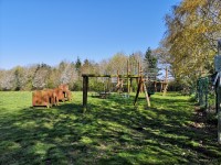
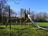
- The following outdoor facilities are available: a grassed play area and a playground with play equipment.
- Footpaths are not available in all of the outdoor space.
- There are bench seats situated along the paths for people to rest.
- There is a route around the play equipment which is not firm and even, but is over 150cm wide.
- The play equipment is not in easy reach for a range of users.
- The following play experiences are available: swinging, sliding, rotating, climbing and balancing.
Accessible Toilet(s)
- There is not an/are not accessible toilet facilities in this area.
Standard Toilet(s)
-
Availability and Location of Standard Toilets
View
- Standard toilet facilities are not available.


