Access Guide
Related Access Guides
- To view other AccessAble Detailed Access Guides that are related to this one please use the links below.
- Canbury Gardens is located in Kingston Upon Thames and run alongside the River Thames.
There is a large park area available along with a children's playground area and Canbury Secret Café. - Canbury Gardens Tennis Centre link (new tab) - click here.
- The Boaters Inn link (new tab) - click here.
Getting Here and Parking
- By Car
- The venue is located on Lower Ham Road in Kingston Upon Thames and is 0.2 miles from the A307 Richmond Road via Lower Ham Road and St Albans Road.
- By Bus
- There is a bus stop available on the A307 Richmond Road, which is 0.2 miles away from the venue.
- By Train
- Kingston Upon Thames Station is 0.7 miles from the venue. There is step-free access to the platforms at this station.
- Parking
- There is on-street Blue Badge and standard parking available on Lower Ham Road.
Parking (Lower Ham Road)
- The venue does not have its own car park.
-
Public Car Parks
View
- There is not a car park for public use within 200m (approx).
-
On Street Blue Badge Parking
View
- On street marked Blue Badge bays are available.
- The dimensions of the marked Blue Badge bays are 345cm x 600cm (11ft 4in x 19ft 8in).
- On street Blue Badge parking is located on Lower Ham Road, next to the Lower Ham Road/Bankside Access Point and also next to the Lower Ham Road/Woodside Road access point.
-
On Street Standard Parking
View
- Clearly signed and / or standard marked parking bays are available.
- The dimensions of the standard marked parking bays are 345cm x 600cm (11ft 4in x 19ft 8in).
- Standard marked parking bays are located throughout Lower Ham Road, close to Lower Ham Road/Woodside Road access point and other access points on Lower Ham Road.
-
Drop-off Point
View
- There is not a designated drop off point.
-
Comments
View
- On-street parking is pay and display.
Parking (Down Hall Road and Thameside Car Park)
- The venue does not have its own car park.
-
Public Car Parks
View
- There is a car park for public use within 200m (approx).
- The name of the car park is Thameside Car Park.
- The car park is located on Thameside.
-
On Street Blue Badge Parking
View
- On street marked Blue Badge bays are not available.
-
On Street Standard Parking
View
- Clearly signed and / or standard marked parking bays are available.
- The dimensions of the standard marked parking bays are 345cm x 600cm (11ft 4in x 19ft 8in).
- Standard marked parking bays are located on Down Hall Road.
-
Drop-off Point
View
- There is not a designated drop off point.
-
Comments
View
- Photographs 1-4 show Thameside Car Park.
- Photographs 5-7 show the standard on-street parking.
Access Point (Lower Ham Road)
-
Access Point
View
- This information is for the access point located on Lower Ham Road.
- There is an information board/map at this access point.
- There is ramped/sloped access at this access point.
- There is no gate at this access point.
- The width of the gap is 130cm.
- There are bollards at this access point.
-
Ramp/Slope
View
- The ramp/slope is located immediately after the access point.
- The gradient of the ramp/slope is slight.
Access Point (Lower Ham Road / Bank Lane)
-
Access Point
View
- This information is for the access point located on Lower Ham Road at the junction with Bank Lane.
- There is an information board/map at this access point.
- There is ramped/sloped access at this access point.
- There is no gate at this access point.
- The width of the gap is 115cm.
- There are bollards at this access point.
-
Ramp/Slope
View
- The ramp/slope is located on the approach and immediately beyond the access point.
- The gradient of the ramp/slope is slight.
Access Point (Lower Ham Road / Chestnut Road)
-
Access Point
View
- This information is for the access point located on the junction of Lower Ham Road and Chestnut Road.
- There is not an information board/map at this access point.
- There is ramped/sloped access at this access point.
- There is no gate at this access point.
- The width of the gap is 210cm.
- There are bollards at this access point.
-
Ramp/Slope
View
- The ramp/slope is located on the approach to the access point.
- The gradient of the ramp/slope is slight.
Access Point (Lower Ham Road / Woodside Road)
-
Access Point
View
- This information is for the access point located on Lower Ham Road opposite the junction with Woodside Road.
- There is not an information board/map at this access point.
- There is step-free access at this access point.
- There is no gate at this access point.
- The width of the gap is 130cm.
- There are bollards at this access point.
Access Point (Lower Ham Road / Lower Kings Road)
-
Access Point
View
- This information is for the access point located on the junction of Lower Ham Road and Lower Kings Road.
- There is not an information board/map at this access point.
- There is ramped/sloped access at this access point.
- There is no gate at this access point.
- The width of the gap is 130cm.
- There are bollards at this access point.
-
Ramp/Slope
View
- The ramp/slope is located on the approach to the access point.
- The gradient of the ramp/slope is slight.
Access Point (Henry Macaulay Avenue)
-
Access Point
View
- This information is for the access point located on Henry Macaulay Avenue.
- There is not an information board/map at this access point.
- There is ramped/sloped access at this access point.
- There is a gate which opens away from you (push).
- The gate is permanently held open.
- The width of the gap is 122cm.
-
Ramp/Slope
View
- The ramp/slope is located on the approach to the access point.
- The gradient of the ramp/slope is steep.
Access Point (Down Hall Road)
-
Access Point
View
- This information is for the access point located on Down Hall Road.
- There is an information board/map at this access point.
- There is step-free access at this access point.
- There is no gate at this access point.
- The width of the gap is 145cm.
- There are bollards at this access point.
Parks and Gardens (Canbury Gardens)
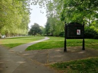
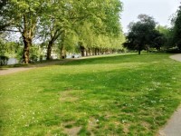
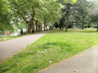
- The park or garden does have footpaths.
- The path(s) has a / have compact earth, tarmac and muddy surface(s).
- The majority of the path(s) is / are wide enough for wheelchair users.
- There are slight and moderate slopes on the paths.
- There are bench seats situated along the paths for people to rest.
-
Comments
View
- There are two main pathways that run from north to south.
- One pathway is next to the River Thames and the other pathway is on a slightly raised bank next to it.
- Both pathways lead out to the Lower Ham Road Access Point to the north of the park and merge just before the Down Hall Road Access Point to the south.
- There are several areas where you can cross between the two main pathways using some steps.
- These steps vary in number depending on where on the route you want to change pathway with. All steps are medium height, not clearly marked out well and have a handrail on both sides (photographs 8 and 9 show examples of these steps).
- There is a pathway called Lower Ham Road linking the Lower Ham Road / Lower Kings Road access point to the main pathways.
- There are other pathways leading towards the other access points, children’s play area and other facilities in the park from the main pathways.
Playground Area
- The children’s play area is located close to the Lower Ham Road / Chestnut Road access point.
- The play area is access via a single gate that opens away from you (push), is heavy and has an opening width of 115cm.
- The surface of the play area is a mixture of grass, mud and soft rubber matting.
- The flooring is uneven with slight to steep slopes in areas.
- Bench and picnic bench seating is available in the play area.
Eating and Drinking (Canbury Secret Café Kiosk and Seating)
- The following information is for the café.
- The café is located close to the Canbury Garden Tennis Centre and the Lower Ham Road pathway.
- Full table service is not available.
- Food or drinks are ordered from the service counter.
- Food or drinks can be brought to the table.
- There is not a lowered section at the counter.
- All tables are permanently fixed.
- All chairs are permanently fixed.
- Some chairs have armrests.
- The standard height for tables is 85cm.
- There is ample room for a wheelchair user to manoeuvre.
- Plastic / takeaway cups are available.
- Plastic / takeaway cutlery is available.
- Drinking straws are available.
- Menus are wall only.
- Menus are not available in Braille.
- Menus are available in large print.
- Picture menus are available.
- Menus are clearly written.
- Menus are presented in contrasting colours.
- The type of food served here is hot and cold meals and snacks.
Accessible Toilet
- Accessible toilet facilities are not available.
-
Comments
View
- There is an accessible toilet at The Boaters Inn. For more information please refer to the access guide.
Standard Toilet(s)
-
Availability and Location of Standard Toilets
View
- Standard toilet facilities are not available.
-
Comments
View
- There are standard toilets at The Boaters Inn. For more information please refer to the access guide.


