Access Guide
Introduction
- Eton is north of the River Thames adjacent to Windsor.
- The M4 is approximately 2.6 miles away travelling from the west and 3.6 miles travelling from the east. The M25 is 10 miles away.
- This guide covers the main shopping street in Eton.
- The guide runs from the main entrance to Eton College on Slough Road and the junction with Common Lane in the north to Eton Bridge in the south.
- The route is approximately 0.4 miles and takes approximately 8 minutes.
- The High Street has both a slight upward and downward incline along its path.
- Pathway surfaces vary including tarmac, smooth paving, older riven paving and areas of cobble. The pathway has uneven sections of paving including manhole covers.
- The road surface is tarmac, with dropped kerbs and tactile paving at most crossing points.
- There are opportunities to stop and rest.
Getting Here
- Getting here by train
- The closest railway stations to Eton are Windsor & Eton Riverside (0.5 miles or approximately 10 minutes from the Museum of Eton Life) and Windsor & Eton Central (0.7 miles or approximately 15 minutes).
- Windsor & Eton Riverside station is served by South West Trains. Trains run between London Waterloo and Windsor every 20 to 30 minutes during the week and every hour on Sundays.
- Great Western Railway (GWR)?runs a frequent service between London Paddington and Slough. A branch line then connects Slough and Windsor & Eton Central.
- Getting here by car
- Eton is located to the south of the M4. Junction 6 (Tuns Lane Interchange) is approximately 4 miles from the Museum of Eton Life. From the south, the River Thames may be crossed via the Queen Elizabeth Bridge (A332) which is 2.5 miles from the Museum of Eton Life.
- There is no direct access for vehicles over the Thames from Windsor to Eton. Pedestrians can walk across Windsor Bridge to Eton High Street.
- Getting here by bus
- There are numerous bus stops on the High Street. Bus numbers 15 (Thames Valley Buses), and 63/68 (Red Eagle Buses) serve the High Street.
- https://redeagle.org.uk/bus-services/
- https://www.thamesvalleybuses.com/.
Parking
- Parking
- On Street Parking: There are Blue Badge and standard parking bays on High Street. There is no charge for Blue Badge holders.
- Standard bays are limited to 2 hours on a pay and display basis.
- Public Car Parks: There are two council-run public car parks close to High Street. They are Eton Court Car Park and Meadow Lane Car Park.
- Eton Court Car Park: This car park is split into two parts. One element is on-street parking approximately 40 metres into Eton Court from High Street. The other element is off-street and is approximately 40 metres further along Eton Court.
- This is an open-air pay and display car park. The off-street element has a height restriction of 1.9m. The off-street element has accessible and standard toilets.
- Meadow Lane Car Park: This car park is located at the junction of Meadow Lane and Eton Court. This is an open-air pay and display car park.
- The car park has a height restriction of 2m.
.
Junction of High Street and Baldwin's Shore to Tangier Lane
- This section is approximately 300 metres and will take approximately 4 minutes.
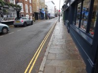
- The pathways on both sides of the road in this section are formed of concrete tiles/block paving. The pathways vary in width (from 180cm to 130cm) as you progress along towards Tangier Lane.
- There is a slight incline to the brow of the bridge. There is an information plaque on Baldwin’s Bridge.
- There is a Blue Badge parking bay, limited to 2 hours, just over the brow of Baldwin’s Bridge. Photograph 4 shows the Blue Badge bay at Baldwin’s Bridge.
- There is a slight decline in the paving once over the brow of the bridge.
- There is standard roadside pay and display parking on the west side of the street. Photographs 5 & 6 show the standard parking after Baldwin’s Bridge.
- There are some uneven areas and slightly raised manhole covers on the pathways throughout the section.
- There are some obstructions along the pavement on both sides such as signs, cash point machines, railings, cycle racks, bus stops, bins and signboards.
- There are bus stops available on both sides of the road near to Budgens store.
- There are side roads and entrances to cross along the route, most of which have dropped kerbs and tactile paving on both sides. Photographs 14, 15, 16, 17, 19, 21, 22, 25 and 26 show examples of side entrances/roads.
Junction of High Street and Tangier Lane to Eton Walkway Bridge
- This section is approximately 250 metres and takes approximately 3-4 minutes.
- The pathways on both sides of the road in this section are formed of concrete tiles/block paving and short sections of cobble. The pathways vary in width (from 200cm to 130cm) as you progress along towards Eton Bridge. Some parts of the east side paving are closed due to building works.
- Approximately 30 metres from Tangier Lane is the turning for Eton Court. This leads to Eton Court car park and Meadow Lane car park.
- The junction of Eton Court with High street has bollards on the north side. They are 93cm high and 172cm between them.
- There are side roads and entrances to cross along the route, most of which have dropped kerbs and tactile paving on both sides.
- There are two Blue Badge parking bays, limited to 2 hours, on either side of the road near to Eton Mess and Warren estate agents.
- There is standard roadside 2 hour pay and display parking at different points on both sides of the street. Photographs 5 & 6 show the standard parking.
- There are some uneven areas and slightly raised manhole covers on the pathways throughout the section. In particular, there is a raised cellar cover outside The Gorge public house.
- There are some obstructions along the pavement on both sides such as lamp posts, cycle racks, table, chairs, bins and signboards.
- There are side roads and entrances to cross along the route, most of which have dropped kerbs and tactile paving on both sides.
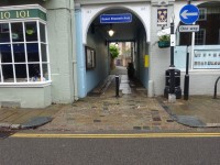
- There is a footpath located next to the council offices on High Street which leads to Eton Court car park and an accessible toilet. The entrance to the footpath is shown in photograph 10.
- There is a slight incline to the brow of the bridge.
- As you approach Eton Bridge, the tourist information centre is on the left.
- There is a slight incline to the brow of the bridge which has bollards across it. They are 84cm high and there is minimum gap of 107cm between them.
- Photographs 2, 3, 8, 9, 13, 18, 19, 23, 24 show examples of side entrances/roads.
Accessible Toilets
- There are no accessible toilets on the High Street. The nearest accessible toilet is in Eton Court car park.
Standard Toilets
- There are no standard toilets on the High Street. The nearest standard toilet is in Eton Court car park.
Access Guides Available For
- Shopping View
-
Eating and Drinking
View
- Tudors - To view the access guide please click here (new tab).
- Eton Mess - To view the access guide please click here (new tab).
- Nimia - To view the access guide please click here (new tab).
- Flaming Cow - To view the access guide please click here (new tab).
- The Christopher - To view the access guide please click here (new tab).
- Gilbey's - To view the access guide please click here (new tab).
- The George - To view the access guide please click here (new tab).
- Leisure and Entertainment View
- Car Parks View
- Other Services View


