Access Guide
Introduction
- The following information describes the route from Stoke City Train Station to the bet365 Stadium (bus pick-up/drop-off for home supporters)
- This route is via Station Road and Glebe Street.
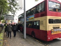
- A bus is used for transporting fans to the stadium.
- The approximate distance of the route is 680m
- The route takes approximately 7-9 minutes.
- The majority of paths along the route consist of block paving, concrete paving and tarmac.
- The potential hazards on this route include; congested pathways, slopes and uneven surfaces.
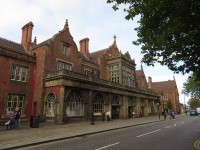
Stoke City Train Station
- There is step-free access via lift leading from the station platforms to the station exit.
- Car parking and toilet facilities are available at this station.
- There is step-free access when exiting the station.
- For more information about the facilities at the station please click here (opens in new tab).
Stoke City Train Station to Glebe Street
- Upon exiting the station, turn right and continue ahead along Station Road for approximately 200m towards Glebe Street.
- The path along this section of the route consists of tarmac and concrete paving slabs.
- There is step-free access throughout this section of the route.
- The path is mostly level with slight gradients in places.
- The path is uneven in places due to raised/lowered drain hole covers.
- The path narrows in places to 149cm due to lampposts.
- On matchdays there are police officers stationed along this section of the route.
Glebe Street to Glebe/Copeland Street Crossing
- Upon reaching the end of Station Road, turn right onto Glebe Street and continue ahead for approximately 220m towards the Glebe Street/Copeland Street crossing.
- The path along this section of the route consists of tarmac and block paving.
- There is tactile paving across the path at the Station Road to Glebe Street turning.
- There is a long, slight, downhill gradient along the path following the turn, this is due to an underpass beneath a railway bridge.
- Having passed under the bridge, the path then slopes upwards towards an access road crossing.
- This crossing has no tactile paving available on either side.
- The road surface consists of block paving.
- The road surface is level and mostly even.
- There are no visual/audible signals available at this crossing.
- After approximately 20m there is a second access road crossing.
- The second access road crossing is similar to the first, with the exception of a tarmac road surface and tactile paving available on both sides.
- Having completed the second access road crossing, continue ahead for approximately 75m.
- Continue over the bridge and towards the Glebe Street/Copeland Street crossing.
- The path immediately prior to the crossing has a slight slope towards the road.
Glebe Street/Copeland Street Crossing
- The Glebe Street/Copeland Street crossing consists of two crossing points with a central island between them.
- The crossing points have dropped kerbs and tactile paving available on both sides.
- Visual indicators activated by push buttons are available at this crossing. The controls are between the heights of 95cm and 105cm.
- There are rotating cones located at the base of the push button boxes to indicate when it is safe to cross.
- Upon reaching the central island, bare left and cross over the second crossing. The central island consists of block paving.
- The second crossing is identical to the first.
- The road surface consists of tarmac.
- The road is cambered and mostly even.
Glebe/Copeland Street Crossing to Brook Street Crossing
- Having crossed the Glebe Street/Copeland Street crossing, turn right and continue ahead along Glebe Street for approximately 110m, towards the Brook Street crossing.
- The path along this section of the route consists of block paving, tarmac and concrete paving slabs.
- The path has a long, slight, downhill gradient.
- After approximately 40m the path begins to curve from left to right.
- The curve continues for approximately 30m until the access road crossing point.
- The crossing point has dropped kerbs with no tactile paving on both sides.
- There are no visual signals available at this crossing.
- The road surface consists of tarmac.
- The road surface is cambered and uneven in places.
- Having crossed the access road, bare right and continue ahead for the remaining 30m towards the Brook Street crossing.
- The path narrows to 110cm due to a bollard located immediately beyond the crossing.
Brook Street Crossing
- The Brook Street crossing point has dropped kerbs on both sides.
- Tactile paving is only available on the near side.
- There are no visual signals available at this crossing.
- The road surface consists of tarmac.
- The road surface is uneven in places.
Brook Street Crossing to the Stadium Pick-up/Drop-off Point
- Having crossed Brook Street, continue ahead along Glebe Street for approximately 100m towards the pick-up/drop-off point.
- There is step-free access throughout this part of the route.
- The path along this section of the route consists of concrete paving slabs.
- The path is level and mostly even.
- The path narrows in places to 89cm due to road signs and posts.
- The pick-up/drop-off point is located between the bus stop and the end of Glebe Street.
- The bus stop is sheltered with fixed seating available.
- A bus is used for transporting fans to the stadium.
Stadium Pick-up/Drop-off Point to the Outer Concourse
- As you exit the bus, turn left and continue along Stanley Matthews Way.
- After approximately 30m, turn right and continue ahead along the path for 120m towards the stadium.
- At the end of the path you will reach the East Stand outer concourse.
- There is step-free access onto the outer concourse.
Outer Concourse
- There is step-free access around the concourse, however there are some very slight slopes in places.
The surface of the concourse varies between block paving and concrete.
There are some steps located outside the Boothen End (North Stand). These steps can be bypassed by using the dropped kerbs and the designated pathway in the North Car Park.
There are also steps located on the concourse between the ticket office and the Q-railing Stand (West Stand). These can be bypassed via the ramp on the opposite side of the access road, within West Car Park 1. There are pedestrian road crossings with bollards on either side of the ramp. - On matchdays there are food and drink stands located around the concourse; at the Boothen End (North Stand), on the corner between The Caldwell Construction Stand (South Stand) and The Franklyn Stand (West Stand), on the Tile Mountain Stand (East Stand), on the corner between the Tile Mountain (East Stand) and The Caldwell Construction Stand (South Stand) and on the away section of The Caldwell Construction Stand (South Stand).
There are programme stalls located around the concourse. - There is step-free access from the concourse to all of the stands.
- On matchdays the away section of The Caldwell Construction Stand (South Stand) is sectioned off.
There are gates manned with stewards on either side of the concourse outside of the away section of The Caldwell Construction Stand (South Stand).
Access between The Caldwell Construction Stand (South Stand) and The Franklyn Stand (West Stand) is possible via the public footpath along Stanley Matthews Way. - Clear directional signage is provided on the concourse.
- There is a stadium plan/map on the concourse.
- There is a steward/member of staff available for assistance on matchdays.
-
Stand(s)
View
- For more information on the Boothen End (North Stand) please click here - (new tab).
- For more information on the Tile Mountain Stand (East Stand) please click here - (new tab).
- For more information on the The Franklyn Stand (West Stand) Lower Tier please click here - (new tab).
- For more information on the The Franklyn Stand (West Stand) Upper Tier please click here - (new tab).
- For more information on the The Caldwell Construction Stand (South Stand) please click here - (new tab).
- For more information on the The Caldwell Construction Stand (South Stand) Visiting Supporters please click here - (new tab).
- Ticket Office(s) View
- Shop(s) View
- Bar(s) / Restaurant(s) View
- Main Reception / Hospitality View
- Additional Services View


