
Access Guide
Stowmarket Streetscape - Stowmarket Railway Station to Temple Road via Town Centre
- This guide is based in Stowmarket Town Centre and covers the main town centre area from the train station to Temple Road.
- This guide covers the main shopping area of Stowmarket along with some local landmarks.
- This guide runs from the train station on Prentice Road, via Station Road East (B1115), Station Road West (B1115) towards the town centre, then through the grounds of St Mary's and St Peter's Church (Church Walk and Butermarket), then onto Market Place and Ipswich Street before finishing outside the Regal Cinema on Temple Road.
- The route is around 1.5 miles long and would take roughly 30-45 mins to walk on average.
- There are some some slight and steep slopes along the route.
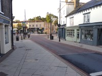
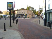
- Pathway surfaces are concrete paving slabs, block paving and tarmac.
- The pathways have some uneven sections, which include some raised manhole covers.
- The road surfaces are tarmac and block paving, with dropped kerbs and tactile paving at most crossing points.
- There are opportunities to sit and rest.
Getting Here
- By Car
- The A14 is approximately 1.9 miles away from Stowmarket Railway Station via A1308 Gipping Way, Stowupland Street and Station Road East.
- Parking
- There is limited on street Blue Badge parking and standard parking available on roads on and around the route. Several public car parks are also available in and around the shopping area.
- By Bus
- There are several bus stops along most of the route with direct services available to Ipswich, Colchester, Long Melford and Bury St Edmunds.
- For more information on First Buses please see the following link:-https://www.firstbus.co.uk/norfolk-suffolk
- For more information on Hadleigh Transport please see the following link:-https://hadleigh.org/
- By Train
- Stowmarket Station is located on Prentice Road, approximately 0.5 miles from Stowmarket town centre.
- There is step-free access to all platforms at this station via ramps.
- There are direct train services available to Norwich, Colchester, Chelmsford, Ipswich, London and many other destinations.
- For more information on Greater Anglia Trains please see the following link:-https://www.greateranglia.co.uk/.
On-Street Parking
- There are limited Blue Badge and standard on street parking bays on surrounding side roads and the main route.
- There is no charge for these parking bays.
- Parking is limited to 60 minutes for non-Blue Badge holders in some areas.
- Blue Badge holders may park in any of the bays for a maximum of 2 hours.
Junction – Stowmarket Station and Prentice Road
- There is a crossing at this junction.
- The crossing is to reach the station. There are dropped kerbs on both sides but no tactile paving.
- The pathways are concrete, tarmac and block paving.
- The surface of the road at all crossings is tarmac.
- The pathways are fairly narrow and are uneven in places.
- There are some obstructions along the pavement on both sides such as railings, cycle racks, bus stops, bins and signboards.
Stowmarket Station to Station Road East via Prentice Road
- The road is a two-way road.
- The surface of the road at all crossings is tarmac.
- The pathways in this section are formed of tarmac.
- The pathways on both sides are narrow in places.
- There are some uneven areas on the pathways throughout this section.
- There are some obstructions along the pavement on both sides, such as railings, cycle racks, bus stops, bins and signboards.
Junction – Station Road East and Prentice Road
- There are several crossings at this junction to cross Station Road East and Prentice Road.
- The crossings have dropped kerbs on both sides but not all have tactile paving on both sides.
- The pathways are block paving, concrete tiles and tarmac.
- The pathways are narrow at this junction.
- The surface of the road at all crossings is tarmac.
- The pathways are uneven in places.
- There are some obstructions along the pavement on both sides such as, railings, bollards, cycle racks, bus stops, bins and signboards.
Prentice Road to Gipping Way Via Station Road East
- The road is a two-way road.
- The surface of the road at all crossings is tarmac.
- The pathways in this section are formed of concrete tiles, tarmac and block paving.
- The pathways on both sides are narrow in places.
- There are some uneven areas on the pathways throughout this section.
- There are some obstructions along the pavement on both sides, such as railings, cycle racks, bus stops, bins and signboards.
- There are some side entrances to cross along the section, most have dropped kerbs, but most don’t have tactile paving.
Junction – Station Road East and Gipping Way
- There are several crossings at this junction to cross Station Road East and Gipping Way.
- The crossings are pedestrian crossing with lowered push button and flashing cones with audible beeps to cross.
- These crossings have dropped kerbs on both sides with tactile paving on both sides.
- The pathways are block paving and concrete.
- The pathways are narrow at this junction.
- The surface of the road at all crossings is tarmac.
- The pathways are narrow and are uneven in places.
- There are some obstructions along the pavement on both sides such as, railings, bollards, cycle racks, bus stops, bins and signboards.
Gipping Way to Church Walk (St Mary's and St Peter's Church) via Station Road West
- The road is a two-way road.
- The surface of the road at all crossings is tarmac.
- The pathways in this section are formed of concrete tiles/block paving and tarmac.
- The pathways on both sides are narrow in places.
- There is a steep uphill slope running from Gipping Way towards Church Walk along Station Road West.
- There are some uneven areas on the pathways throughout this section.
- There are some obstructions along the pavement on both sides such as railings, cycle racks, bus stops, bins and signboards.
- There are some side entrances to cross along the section - most have dropped kerbs, but most don’t have tactile paving.
Junction – Church Walk (St Mary's and St Peter's Church) and Station Road West
- There are limited crossing points over Station Road West.
- The crossings have dropped kerbs on both sides, but not all have tactile paving on both sides.
- The pathways are block paving and concrete.
- The pathways are narrow at this junction.
- The surface of the road at all crossings is tarmac.
- The pathways are narrow and are uneven in places.
- There are some obstructions along the pavement on both sides such as, railings, bollards, cycle racks, bus stops, bins and signboards.
Station Road West to Market Place and Ipswich Street via Church Walk (St Mary's and St Peter's Church) and Buttermarket
- The pathways in this section are formed of concrete tiles/block paving.
- The pathways on both sides are wide
- There is a slight downhill slope through this section on Buttermarket.
- There are some obstructions along the pavement on both sides such as railings, cycle racks, bus stops, bins and signboards.
- There are some side entrances to cross along the section, most have dropped kerbs, but most don’t have tactile paving.
Junction – Buttermarket, Market Place and Ipswich Street
- There are several crossings at this junction to cross Buttermarket, Market Place and Ipswich Street.
- The crossings have dropped kerbs on both sides but not all have tactile paving on both sides.
- The pathways are block paving and concrete.
- The pathways are narrow at this junction.
- The surface of the road at all crossings is block paving.
- The pathways are narrow and are uneven in places.
- There are some obstructions along the pavement on both sides such as, railings, bollards, cycle racks, bus stops, bins and signboards.
Market Place to Milton Road South via Ipswich Street
- The road is a one way road with traffic travelling in the direction from Milton Road South, along Ipswich Street towards Market Place and Station Road West.
- The surface of the road at crossings is tarmac and/or block paving.
- The pathways on both sides of the road in this section are formed of concrete tiles/block paving.
- The pathways on both sides are narrow.
- There are some uneven areas on the pathways throughout this section.
- There are some obstructions along the pavement on both sides such as railings, cycle racks, bus stops, bins and signboards.
- There are some side entrances to cross along the section, most have dropped kerbs, but most don’t have tactile paving.
- There is some limited on street Blue Badge parking available on Ipswich Street and surrounding side roads.
Junction – Milton Road South and Ipswich Street
- There are several crossings at this junction to cross Milton Road South and Ipswich Street.
- The crossings are pedestrian crossing with lowered push button and flashing cones with audible beeps to cross.
- These crossings have dropped kerbs on both sides with tactile paving on both sides.
- The pathways are block paving and concrete.
- The pathways are narrow at this junction.
- The surface of the road at crossings is tarmac and/or block paving.
- The pathways are narrow and are uneven in places.
- There are some obstructions along the pavement on both sides such as railings, bollards, cycle racks, bus stops, bins and signboards.
Milton Road South to Temple Road (Regal Cinema and Theatre) via Ipswich Street
- The road is a two-way road.
- The surface of the road at all crossings is tarmac.
- The pathways on both sides of the road in this section are formed of concrete tiles/block paving and tarmac.
- The pathways on both sides are narrow.
- There are some uneven areas on the pathways throughout this section.
- There are some obstructions along the pavement on both sides such as railings, cycle racks, bus stops, bins and signboards.
- There are some side entrances to cross along the section, most have dropped kerbs, but most don’t have tactile paving.
Junction – Temple Road and Ipswich Street
- There is a zebra crossing to cross Ipswich Street and a standard crossing over Temple Road
- The crossings have dropped kerbs on both sides but not all have tactile paving on both sides.
- The pathways are block paving, concrete and tarmac.
- The pathways are narrow at this junction.
- The surface of the road at all crossings is tarmac.
- The pathways are uneven in places.
- There are some obstructions along the pavement on both sides, such as railings, bollards, cycle racks, bus stops, bins and signboards.
Accessible Toilet(s)
- There are no public toilets along this route.
- Some car parks, shops and restaurants may have facilities for customer use.
- Please see related access guides for details.
Standard Toilet(s)
- There are no public toilets along this route.
- Some car parks, shops and restaurants may have facilities for customer use.
- Please see related access guides for details.
Access Guides Available For
Stowmarket Station Car Park
- This is a pay and display car park.
Ipswich Street Pay and Display Car Park
- This is a pay and display car park.
Union Street West Long Stay Car Park
- This is a pay and display car park.
Union Street Car Park
- This is a pay and display car park.
Bury Street Car Park
- This is a pay and display car park.