Access Guide
Introduction
- Services / facilities within the grounds include a children's play area, sensory garden, train track, bandstand, basketball court, football pitches, boating lake and a bowling green.
-
Comments
View
- Please note that access to some areas may be locked at times for maintenance.
Location
- There is a bus stop within 150m (164yds) of the venue.
- The nearest National Rail station is Sunderland.
- The nearest Metro Station is Seaburn.
Parking
- The venue does not have its own car park.
-
Public Car Parks
View
- There is not a car park for public use within 200m (approx).
-
On Street Blue Badge Parking
View
- On street marked Blue Badge bays are available.
- The dimensions of the marked Blue Badge bays are 200cm x 600cm (6ft 7in x 19ft 8in).
- On street Blue Badge parking is located in Roker Park Road.
-
On Street Standard Parking
View
- Clearly signed and / or standard marked parking bays are available.
- Standard marked parking bays are located in Roker Park Road, Sea Cliff Road and Park Parade.
-
Drop-off Point
View
- There is not a designated drop off point.
Access Point (Whitburn Road)
-
Access Point
View
- This information is for the access point located on Whitburn Road.
- There is an information board/map at this access point.
- There is ramped/sloped access at this access point.
- There is a gate which opens away from you (push).
- The gate is permanently held open.
- There are further gates on the other side of the bridge.
-
Ramp/Slope
View
- The ramp/slope is located leading down beyond the access point.
- The gradient of the ramp/slope is slight.
-
Comments
View
- There are steeper slopes down to a bridge overlooking the Marine Walk access point bridge which links both gates here.
Access Point (Side Cliff Road)
-
Access Point
View
- This information is for the access point located on Side Cliff Road.
- There is an information board/map at this access point.
- There is ramped/sloped access at this access point.
- There is a gate which opens away from you (push).
- The gate is permanently held open.
-
Ramp/Slope
View
- The ramp/slope is located leading down beyond the access point.
- The gradient of the ramp/slope is slight.
Access Point (Roker Park Road)
-
Access Point
View
- This information is for the access point located on Roker Park Road.
- There is an information board/map at this access point.
- There is ramped/sloped access at this access point.
- There is a gate which opens away from you (push).
- The gate is permanently held open.
- There are further access points along Roker Park Road.
-
Ramp/Slope
View
- The ramp/slope is located leading down beyond the access point.
- The gradient of the ramp/slope is slight.
Access Point (Marine Walk)
-
Access Point
View
- This information is for the access point located off Marine Walk, below Whitburn Road.
- There is not an information board/map at this access point.
- There is ramped/sloped or stepped access at this access point.
- There is a gate which opens towards you (pull).
- The gate is permanently held open.
- The width of the gap is 110cm.
-
Ramp/Slope
View
- The ramp/slope is located beyond the access point.
- The gradient of the ramp/slope is slight.
-
Step(s)
View
- The step(s) is/are located to the right of the slope.
- There is/are 15+ step(s).
- The step(s) is/are not clearly marked.
- The height of the step(s) is/are between 15cm and 18cm.
- The height of the step(s) is/are 18cm.
- The going of the step(s) is/are between 30cm and 45cm.
- There is a/are handrail(s) at the step(s).
- The handrail(s) is/are on both sides.
- Handrails are at the recommended height (90cm-100cm).
- Handrails do cover the flight of stairs throughout its length.
- Handrails are easy to grip.
- Handrails do not extend horizontally beyond the first and last steps.
- There is a second lower handrail.
-
Comments
View
- The steps at the top are widely spaced with steep slopes between steps.
Access Point (Park Parade)
-
Access Point
View
- This information is for the access point located on Park Parade.
- There is an information board/map at this access point.
- There is ramped/sloped access at this access point.
- There is a gate which opens away from you (push).
- The gate is permanently held open.
- The width of the gap is 110cm.
- There is another gate near the junction with Roker Park Road here.
-
Ramp/Slope
View
- The ramp/slope is located beyond the access point.
- The gradient of the ramp/slope is slight.
Access Point (Ravine Terrace)
-
Access Point
View
- This information is for the access point located off Ravine Terrace.
- There is not an information board/map at this access point.
- There is ramped/sloped access at this access point.
- There is a gate which opens away from you (push).
- The gate is permanently held open.
- The width of the gap is 110cm.
-
Ramp/Slope
View
- The ramp/slope is located beyond the access point.
- The gradient of the ramp/slope is slight.
Parks and Gardens
- The park or garden does have footpaths.
- The path(s) has a / have tarmac surface(s).
- The majority of the path(s) is / are wide enough for wheelchair users.
- There are steep, slight and moderate slopes on the paths.
- There are bench seats situated along the paths for people to rest.
Children's Play Area
- There are 2 parks located near the Side Cliff Road access point.
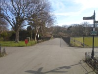
- One is for younger children and is accessed by a set of light gates with a width of 280cm that open away from you, as shown in photograph 1.
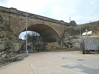
- The other park for older children and is accessed by a light gate with a width of 104cm and that opens towards you as shown in photograph 2.
Level Change (Bandstand)
- There is a ramp/slope to access this area/service.
- The ramp/slope is located leading to the bandstand.
- The width of the ramp/slope is 75cm (2ft 6in).
- There is a/are step(s) to access this area/service.
- The step(s) is/are located in front of the bandstand.
- There is/are 1 step(s) to the area/service.
- There is not tactile paving at the top and bottom of the steps.
- The step(s) is/are not clearly marked.
- The step(s) is/are deep (18cm+).
- There is not a/are not handrail(s) at the step(s).
- The ramp/slope does not bypass the step(s).
Level Change (Bowling Green)
- There is a/are step(s) to access this area/service.
- There is/are 10 step(s) to the area/service.
- The step(s) is/are not clearly marked.
- The step(s) is/are medium height (11cm - 17cm).
- There is a/are handrail(s) at the step(s).
- The handrail(s) is/are on both sides.
-
Comments
View
- There is an alternative bowling green located nearby with step free access.
- There is an additional stepped or ramped level change leading to the bowls green house.
Basketball Courts
- There are courts are located near Park Parade Road.
- They are accessed by heavy gates with widths of either 110cm or 200cm.
- There is either level access, access via two medium steps or access via steep ramps to the courts.
Accessible Toilet
- Accessible toilet facilities are available.
-
Location and Access
View
- There is pictorial signage on or near the toilet door.
- There is not level access to this accessible toilet.
-
Features and Dimensions
View
- In the standard female toilet.
-
Comments
View
- At the time of survey (March 2019) it was not possible to survey the accessible toilet.
Standard Toilet(s)
-
Availability and Location of Standard Toilets
View
- Standard toilet facilities are available.
-
Access to Standard Female Toilet(s)
View
- The female toilet facilities that were surveyed are located near the children's play area.
- The female toilet(s) is/are approximately 104m (113yd 2ft) from the Side Cliff Road access point.
- Inside the venue, there is not level access to the female toilet(s).
- Lighting levels are bright.
-
Access to Standard Male Toilet(s)
View
- The male toilet facilities that were surveyed are located next to the information centre.
- The male toilet(s) is/are approximately 70m (76yd 1ft) from the Roker Park Road access point.
- Inside the venue, there is not level access to the male toilet(s).
- Lighting levels are medium.
-
Access to Standard Female and Male Toilet(s)
View
- The female and male toilet facilities that were surveyed are located near the park parade access point.
- The female and male toilets are approximately 25m (27yd 1ft) from the park parade access point.
- Inside the venue, there is not level access to the female and male toilets.
- Lighting levels are bright.
Level Change (Accessible Toilet and Standard Female Toilets)
- There is a ramp/slope to access this area/service.
- The ramp/slope is located on the path leading to the toilets.
- The ramp/slope is permanent.
- There is a level landing at the top of the ramp/slope.
- The ramp does have handrails.
- The handrails are on the right going up.
- The width of the ramp/slope is 130cm (4ft 3in).
Level Change (Standard Male Toilets)
- There is a/are step(s) to access this area/service.
- The step(s) is/are located in the doorway to the toilet.
- There is/are 1 step(s) to the area/service.
- The step(s) is/are not clearly marked.
- The step(s) is/are shallow (2cm - 10cm).
- There is not a/are not handrail(s) at the step(s).
Additional Info
- Access to Wi-Fi is available via _FreeSunderlandWi-Fi.


