Access Guide
Introduction (Route Summary)
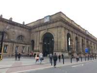
- Related link Newcastle Central Station.
- Https://www.disabledgo.com/access-guide/newcastle-city-council/newcastle-central-station
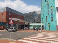
- Related link Royal Victoria Infirmary.
- Https://www.disabledgo.com/organisations/the-newcastle-upon-tyne-hospitals-nhs-foundation-trust/royal-victoria-infirmary
-
Comments
View
- This route plan takes you from Newcastle Central Station to Royal Victoria Infirmary Main Entrance.
- There are two transport options in this guide.
- Route 1 is by bus, Route 2 is by Metro.
- Both routes merge at Haymarket Metro Station.
Route 1 By Bus - Newcastle Central Station to Neville Street
- This section of the route is approximately 15m long.
- Exit the station at the front right hand side from the concourse.
- Proceed to the pedestrian controlled crossing on Neville Street.
Route 1 By Bus - Neville Street Crossing
- The crossing at Neville Street is a pedestrian crossing.
- There is a level kerb and tactile paving at each side of the crossing.
- The control box is 110cm high.
- There is a rotating cone beneath the control box which indicate when it is safe to cross.
- There is also visual and audible warning.
- Traffic comes from the left and right.
Route 1 By Bus - Neville Street to Grainger Street Crossing
- Continue straight ahead and proceed along Grainger Street.
- Grainger Street is pedestrianised and the surface is block paved.
- Proceed along Grainger Street to the pedestrian crossing at the junction with Westgate Road.
- At the end of Grainger Street before the pedestrian crossing there are bollards.
- The bollards are 100cm high and the width between them is 200cm.
- The bollards do not contrast with the paving and do not have and identification strip.
Route 1 By Bus - Grainger Street Crossing
- The crossing at Grainger Street is a pedestrian crossing.
- The crossing has tactile paving and level kerbs.
- The height of the crossing button is 109cm.
- There is a rotating cone beneath the crossing button to indicate when it is safe to cross.
- There is also a visual and audible warning.
- Traffic comes from the left and right.
Route 1 By Bus - Grainger Street Crossing to Central Station Westgate Road Stand M
- Immediately after crossing Grainger Street turn left and proceed along Westgate Road.
- After 17m proceed across the access road to The Mile Castle.
- The crossing has tactile paving and dropped kerbs.
- Central Station Westgate Road Stand M is ahead.
- Take the number 38 bus to Freeman Hospital.
Route 1 By Bus - Haymarket St Mary's Place to Great North Road
- This section of the route is approximately 98m.
- After exiting the bus at Haymarket St Mary's Place turn right.
- Proceed along St Mary's Place.
- There are railings along the right hand side of the pavement.
- The surface of the pavement is concrete tiles.
- Continue onto the pedestrianised area of Northumberland Street and proceed past Haymarket Metro Station on the left.
- Turn right and proceed along the side of Haymarket Metro Station, along the B1307.
- Just before the end of the station building turn right and proceed to the pedestrian controlled crossing.
Route 2 By Metro - Newcastle Central Station to Haymarket Metro Station
- Newcastle Central Station is located above Central Metro Station.
- Proceed to Platform 2 of the Metro Station and take the Yellow Line train towards The Coast, or the Green Line train towards Airport.
- Exit the Metro at Haymarket Station, taking the exit towards Newcastle University and Royal Victoria Infirmary (RVI).
- Proceed towards the pedestrian controlled crossing on the B1307.
Great North Road Crossing
- The crossing point is pedestrian controlled.
- There are dropped kerbs with tactile paving at the crossing.
- The road is busy with traffic from the left and right.
- The surface of the crossing is tarmac.
- The height of the button for the controls is 95cm.
- There is a rotating cone beneath the controls which indicates when it is safe to cross.
- There are also audible and visual indicators.
Great North Road Crossing to Queen Victoria Road
- This section of the route is approximately 320 metres.
- After crossing the Great North Road turn left and proceed along the pavement with Newcastle University on the right.
- The surface of the pavement is concrete tiles.
- Continue along the path for approximately 85m.
- Take the first road on the right onto St Thomas' Street.
- There is an easy uphill gradient along St Thomas' Street.
- After approximately 110m proceed across the access road to the Newcastle University buildings on the right.
- The access road is quiet.
- There are dropped kerbs without tactile paving at the crossing point.
- Vehicles pass from both directions.
- After approximately 40m cross King's Road.
- There are dropped kerbs with tactile paving at the crossing point.
- The road is quiet.
- Vehicles cross in both directions.
- Continue to the end of St Thomas' Street and turn right onto Queen Victoria Road.
- Proceed along Queen Victoria Road to the pedestrian crossing.
Queen Victoria Road Crossing
- The crossing point is pedestrian controlled.
- There are dropped kerbs with tactile paving at the crossing.
- The road is busy with traffic coming from the left and right.
- The surface of the crossing is tarmac.
- The height of the button for the controls is 110cm.
- There is a rotating cone underneath the control box to indicate when it is safe to cross.
- There are also audible and visual indicators.
Queen Victoria Road Crossing to Royal Victoria Infirmary Main Entrance
- After crossing Queen Victoria Road take a slight left and proceed ahead into the hospital grounds.
- The pathway becomes block paved.
- There is bench seating on the right.
- At the roundabout bear right and proceed to the car park access road.
- There is a zebra crossing at the car park access road.
- There are level kerbs with tactile paving at the crossing.
- The access road is busy during peak times.
- The surface of the crossing is block paving.
- The crossing has a camber to the left.
- Continue along the pathway towards the main hospital building.
- There are bench seats along the pathway on the right.
- The car park pay station is on the right.
- At the end of the pathway there is a zebra crossing at the ambulance and taxi drop off area.
- The surface of the crossing is block paving.
- The crossing has a rainbow along each side.
- After crossing the drop off area proceed towards the main building.
Outside Access (Main Entrance)
-
Entrance Details
View
- This information is for the entrance located at the front of the hospital.
- The entrance area/door is not clearly signed.
- There is step free access at this entrance.
- There is a canopy or recess which provides weather protection at this entrance.
- The entrance door(s) does not/do not contrast visually with its immediate surroundings.
- The main door(s) open(s) by revolving.
- The width of the door opening is 220cm.
-
Comments
View
- There is a touch button available that is used to slow the door.
- The touch button is at a suitable height for a wheelchair user.
Related Access Guides
- To view other Detailed Access Guides that are related to this one please use the links below.
- Newcastle Central Station link (new tab) - click here.
- Royal Victoria Hospital Main Entrance link (new tab) - click here.


