Access Guide
Introduction
- Related link National Hospital for Neurology and Neurosurgery.
- Http://www.disabledgo.com/access-guide/university-college-london-hospitals-nhs-foundation-trust/national-hospital-for-neurology-and-neurosurgery-main-entrance-20
-
Comments
View
- This route is from Euston Station to the National Hospital for Neurology and Neurosurgery.
- The distance of the journey is approximately 0.7 miles.
- This should take approximately 14 minutes.
- The roads along this route are generally busy.
- The pavements may well be congested.
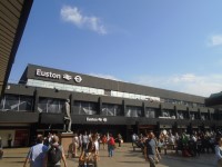
Euston Station
- There is step free access from the platforms to the entrance of the station.
- There are car park facilities at the station.
- There are toilets within the station.
- Exit the station onto Euston Square via a set of double doors with a width of over 150cm.
- As you exit the station there is a section of tactile flooring which can be seen in photograph 2.
- Which is immediately followed by a section of brick block paving which can be seen in photograph 3.
Euston Square / Euston Gardens - Euston Road
- Cross Euston Square and head towards Euston Gardens.
- Before heading through Euston Gardens to Euston Road.
- The distance from the station to Euston Road is approximately 110m.
- The surface of the square is block paving.
- There are small drains along the way to the gardens which can be seen in photograph 2.
- There are bollards with a width of 114cm which can be seen in photograph 3.
- After approximately 60m there is an easy slope leading towards the gardens with a handrail to the right going down.
- It is not possible to use this handrail all the way down the slope as there is a tree in the way.
- The slope can be seen in photographs 5 and 6.
- At the bottom of the slope take the path in front of you to Euston Road, shown in photographs 7 and 8.
- There is a patch of tactile paving that you will need to overcome to the left as you start down this path, shown in photograph 7.
Cross Euston Road
- Use the pedestrian crossing to cross the entrance road to the Euston Station bus stop, then immediately take the crossing to the right across Euston Road.
- The crossing for the bus entrance road to Euston Station has tactile dropped kerbs on either side.
- There is also a central island which has tactile dropped kerbs on either side.
- The surface of the central island is block paving.
- When heading to the island, traffic approaches from the right.
- When heading from the island to the road, traffic approaches from the left.
- This crossing can be seen in photographs 1, 2, 3 and 4.
- After using this crossing, immediately turn right and use the crossing for Euston Road.
- The bus entrance road crossing to Euston Station has tactile dropped kerbs on either side.
- There is also a central island which has tactile dropped kerbs on either side.
- The surface of the island is made of tactile block paving.
- This crossing has traffic lights with controls at a height of 104cm and rotating cones present.
- This crossing can be seen in photographs 6, 7, 8, 9 and 10.
Euston Road - Upper Woburn Place
- After crossing Euston Road turn left and head along Euston Road for approximately 90m until you reach Upper Woburn Place.
- Cross at the pedestrian crossing.
- The surface of the road is block paved with the occasional manhole cover.
- There is a slight gradient heading towards the road.
- There are small concrete areas to the right of the pavement.
- This area of the route can be seen in photographs 1, 2 and 3.
- There is a section of tactile paving for a crossing across Euston Place after approximately 85m, shown in photograph 4.
- Continue on and cross Upper Woburn Place at the next pedestrian crossing you encounter.
- The crossing across the Bus entrance road to Euston station has tactile drop kerbs on either side.There is also a central island which likewise has drop kerb and the surface of which is entirely tactile paving.
- At the island there are two seperate crossings leading to either side of Euston Road take the crossing to your right.
- This crossing has traffic lights with controls at a height of 104cm and rotating cones present.
- This crossing can be seen in photographs 5, 6, 7, and 8.
Upper Woburn Place / Tavistock Square - Woburn Place
- Turn right upon reaching Upper Woburn Place and head along this road for approximately 330m before crossing Tavistock Place at the pedestrian crossing.
- The surface of the pavement is block paving.
- There is a downhill gradient towards the road.
- After approximately 95m you will come to tactile paving for a zebra crossing across Upper Woburn Place.
- 5m beyond this is Woburn Walk, a pedestrian only road which is block paved and level with the rest of the pavement.
- 5m after Woburn Walk you will encounter 2 concrete service roads to reach the County Hotel.
- These are accessed by block paved drop kerbs, shown in photographs 4, 5 and 6.
- Approximately 170m after crossing Upper Woburn Place there is another section of tactile paving for a zebra crossing (photograph 9).
- After another 12m there is a cobbled road that is level with the pavement to enter the British Medical Association (photograph 11).
- After this continue on until you reach the Tavistock Place pedestrian crossing.
- You will arrive at Tavistock Place after approximately 330m after crossing Upper Woburn Place.
- There is tactile paving on either side of the road.
- The surface of the road is tarmac.
- Before reaching the main road there is a cycle path with an island level with the road.
- The island is tarmac.
- At the cycle path cyclists will be potentially coming from the right.
- There are traffic lights with controls at a height of 104cm and rotating cones present.
- The crossing can be seen in photographs 15 and 16.
Woburn Place - Russell Square
- After crossing Tavistock Place, head along Woburn Place for approximately 250m until you reach Russell Square.
- Along the way you will need to cross both Coram Street and Bernard Street.
- The surface of the road is block paving.
- Immediately after you cross Tavistock Place there is tactile paving for crossing across Woburn Place.
- Continue past this (photograph 1).
- Head along the road for 105m until you reach Coram Street (photographs 2 and 3).
- The crossing at Coram Street has tactile dropped kerbs on either side and a central tactile paved island.
- As you approach the island, traffic will be coming from the right and as you leave it traffic will be coming from the left (photographs 4, 5 and 6).
- Immediately after crossing Coram Street, as you continue along Woburn Place, there is a section of tactile paving for a pedestrian crossing across Woburn Place that must be overcome (photograph 7).
- After a few metres you will see 2 separate tarmac service roads with dropped kerbs on either side and a brick block paved island with dropped kerbs in the middle.
- After crossing the next service road there is a portion of Woburn Place which has a brick block paved surface.
- The pavement will be a mixture of block paved and brick blocked paving from here until Bernard Street a distance 110m.
- As you approach Bernard Street there is a small section of tactile block paving for a pedestrian crossing that will need to be overcome (photograph 10).
- After this continue to Bernard Street and cross the tarmac road at the pedestrian crossing.
- There are tactile dropped kerbs on either side of the crossing.
- There are traffic lights with controls at a height of 104cm and rotating cones present (photograph 11).
Russell Square - Guilford Street
- Continue on until you reach Guilford Street, which you should then cross at the pedestrian crossing a distance of 85m.
- There is tactile paving for a pedestrian crossing after 10m that needs to be overcome (photograph 1).
- As you approach Guilford Street there is a second set of tactile paving for a pedestrian crossing (photograph 4).
- The pedestrian crossing across Guilford Street has tactile paving on either side.
- There are traffic lights at a height of 104cm and rotating cones.
- The surface of the road is tarmac.
- The crossing can be seen in photographs 5 and 6.
Guilford Street / Queen Anne's Walk - Queens Square
- After crossing Guilford street head left downhill for approximately 120m.
- Before turning right down Queen Anne's Walk for approximately 30m until you reach Queen Square.
- The surface of the pavement is block pavement.
- There is a slight downhill gradient.
- After 50m you will come across the entrance and exit to the President Hotel drop off point.
- These service roads are tarmac and have block paved dropped kerbs on either side (photographs 3 and 4).
- There is another similar service road to the President Hotel car park which can be seen in photograph 5.
- After overcoming this, turn right down Queen Anne's Walk and continue for 30m (photographs 6 and 7).
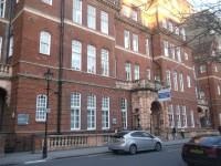
Queen Square - National Hospital for Neurology and Neurosurgery Main Entrance
- Turn left and continue for approximately 40m, then turn right and continue for 10m to reach the Hospital's Main Entrance.
- The surface of the pavement is block paving with the occasional manhole cover.
- There is a slight downhill gradient along the pavement.


