Access Guide
Introduction
- The Stoke Bishop Halls are all set on a significant hill. The pathway from the Transport Hub to Wills, Durdham and Churchill Halls is a slope varying between 8 and 20% making it unsuitable for most mobility aid users.
- There is no direct step free access to Wills Hall from the Transport Hub.
Transport Hub
- The Transport Hub is situated adjacent to Hiatt Baker Hall in Stoke Bishop.
- The Hub is served by service Wessex 16 which runs (term time only) every 6-7 minutes in the morning peak, every 20 minutes in the daytime, 7-8 minutes afternoon peak and every 30 minutes in the evenings. At weekends the service runs every 45 minutes.
- The service route is from Stoke Bishop to the City Centre (Colston Avenue) via Tyndalls Park and Woodlands Road, the main University Campus buildings.
- First year Undergraduate Students and Senior Residents living in Stoke Bishop Halls (Hiatt Baker, University, Badock, Churchill, The Holmes, Wills and Durdham) receive a free pass. All other students, staff and public pay on the service.
- There are four bus bays on the Hub, all of which are served by crossings with dropped kerbs.
- The Hub itself is accessible, with platforms for level access onto the buses and dropped kerbs at all crossings.
- Two of the Hiatt Baker residential units are accessible to people with mobility difficulties, but all other routes have steep slopes unsuitable for wheelchair or other mobility aid users.
- There are clear maps displayed at the Hub showing pathways to all the Stoke Bishop Halls.
Travel Information Point
- There is a clearly visible Travel Information Point overlooking the Transport Hub in the side of the building facing the Source Cafe.
- There is weather protection above the window. There are two shelf counter levels, 110cm and 83cm above the ground and there is also signage for an induction loop. There is no signage to show hours of operation.
- Throughout the Transport Hub there are signs recommending passengers download the Travelwest Bus Checker app which gives live information on timing of bus services throughout the West of England. Further information is available athttp://www.travelwest.info/buschecker.
Transport Hub to the Footpath
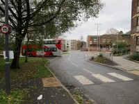
- On stepping from the bus at Bus Stop 1 turn right towards Churchill Hall (photograph 1).
- There are two ramp entrances side by side on your left. The first, curved ramp, leads to the area in front of the Source Cafe and steps to join the pathway to other Halls of Residence (photograph 2-6).
- The second ramp is the step-free access and leads past the Transport Hub Information Point to the pathway up the hill. This ramped section has a gradient of 7% and there is a guard rail / hand rail to the left. The path is tarmac and 150cm wide. (photograph 7-10).
Main Pathway
- The main pathway leads straight on from the ramp, passing the head of the steps from the Source. The main path is 400cm wide and has a tarmac surface with a handrail on the right.
- The path is also a cycleway with a demarcation line between the pedestrian and cycle sections. There is no physical or tactile barrier. The main pathway has a gradient of 14% with no level landing or resting areas.
- Follow the path for 120m to the branch for Wills Hall. At this point there is a bench seat at the side of the path; note that pedestrians are crossing the cycleway in order to reach the bench.
Turn Left towards Wills Hall
- At the branch take the left hand path towards Wills Hall. The pathway narrows to 150cm and has a handrail on the right.
- The gradient increases to 20% for 50m where there is a bench seat to the left.
- 15m past the seat the path levels out to reach the flight of steps to approach Wills Hall.
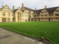
- There of 10 medium steps with no handrails or contrast edgings; there are tactile warnings at the top and bottom of the steps. The path slopes up at 6% for 60m to the archway into the Wills Hall quadrangle.
Alternative Step Free Access to Wills Hall
- There is an alternative step-free access route with some steep gradient sections; Follow the section of the route on the main path towards Durdham Hall, passing the Hall and continuing towards Churchill Hall through the car park.
- At the section describing the approach to Hollybush Lane turn left instead of right and cross the car park serving the outdoor gym and tennis courts.
- Cross the gym area and take the pathway on the right alongside the tennis court. The end of the path is adjacent to the top of the steps.
- This section of path has short ramped sections to overcome level changes between the car park, tennis court and path level.
Remain on Main Path to Durdham Hall
- Continue of the main path for 50m. The path has a 10% gradient. At the end of the path turn right to enter Durdham Hall (photograph 4).
- This section of path is also the approach road and vehicles may approach from either side. The surface is distinctive being two wide strips of block paving with a central tarmac section.
From Durdham Hall turn left toward The Holmes
- From the junction of the main path with the vehicle / footpath to Durdham Hall turn left along the shared use path (photograph 1).
- The path leads directly into the car park for Durdham Hall with appropriate warning signage. Continue straight ahead 70m (between the two rows of vehicles, there is no separate footway) (photograph 2).
- At the far side bear left up the slope, which has a gradient of approximately 16% (photograph 3 & 4). At the top of the slope either bear right to continue towards The Holmes or cross the roadway towards the outdoor gym area and the step-free access to Wills Hall.
- If heading towards The Holmes bear right up the short slope to the gateway in the perimeter wall. Pass through the gateway into Hollybush Lane (photograph 5 & 6).
- The lane is a cycleway in both directions and the perimeter wall is high so care must be taken before stepping out. Turn left and follow Hollybush Lane for 100m (photograph 7 & 8).
- At the end of the lane there is a bollard in the middle of the pathway restricting the width to 90cm each side (photograph 9).
- Immediately past the bollard turn right through the gateway which is the vehicle approach to The Holmes. At the top of Hollybush Lane there is a map giving clear directions (photograph 10).
Pass The Holmes and approach Stoke Park Road and Churchill Hall
- Proceed straight ahead across the front of The Holmes (photograph 1-5).
- On the far side of the building the pathway bears to the left past entrance to the Botanic Garden with a block paved path crossing the route.
- Continue on the pathway, which is also the vehicle route to the Botanic Garden Car Park, to the junction with Stoke Park Road (photograph 9).
- There are dropped kerbs each side of the road leading directly into the Churchill Hall Car Park and main entrance (photograph 6-8).
- Total distance to the Transport Hub is approximately 0.75km.

