Access Guide
Summary
-
Service
View
- The journey from the Visitors Car Park to David Ross Sports Village is 0.6 miles in length and takes approximately 12 minutes to travel. Along the journey are slight and steep slopes. The route crosses Lenton Hall Drive and Beeston Lane.
-
Building
View
- Visitors Car Park link (new tab) - click here.
- Cripps Hall link (new tab) - click here.
- Lincoln Hall link (new tab) - click here.
- Derby Hall link (new tab) - click here.
- Sherwood Hall link (new tab) - click here.
- Rutland Hall link (new tab) - click here.
- David Ross Sports Village link (new tab) - click here.
Starting Point - Visitors Car Park
- For more information on Visitors Car Park please follow the link below:
- www.accessable.co.uk/sir-clive-granger-building/nottingham-university-car-park.
Site/Campus Car Park (University of Nottingham Car Park)
-
Car Park
View
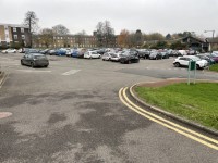
- The car park is located in the centre of the campus next to the Sir Clive Granger Building.
- The nearest building(s) to this car park is/are the Sir Clive Granger Building and the Sir Peter Mansfield Imaging Centre.
- The car park type is open air/surface.
- The car park does not have a height restriction barrier.
- The car park surface is tarmac.
- Designated Blue Badge parking bays are available.
- The Blue Badge bay(s) is/are clearly marked.
- There is/are 11 designated Blue Badge parking bay(s) within this car park.
- The dimensions of the designated parking bay(s) are 240cm x 470cm.
- The Blue Badge parking bays have a marked zone to one side and the rear.
- The marked zone is 125cm wide.
- The dimensions of the designated bays do not vary in size.
-
Charges and Restrictions
View
- This car park can be used by staff, students, visitors and Blue Badge holders.
- Parking charges apply for all except Blue Badge holders.
- Signs are provided to give information on parking charges/restrictions.
- Signs are clearly presented.
- Payment can be made by phone.
- To see more information on parking policies please click here (opens new tab).
-
Drop Off Point
View
- There is not a designated drop off point in this car park.
-
Car Park Access
View
- There is not step free access from this car park.
- Buildings are clearly signposted from this car park.
- There is not a campus map available within the car park.
- The nearest designated bay is 29m (31yd 2ft) from the Sir Peter Mansfield Imaging Centre.
Visitors Car Park to Ramp or Steps
- Exit the car park at the rear right hand corner.
- There is a ramp and steps here.
- The ramp is on the right of the steps.
- The ramp has handrails on the right to the turn and then on the left.
- The ramp is steep with resting spaces at regular intervals.
- Alternatively there are 7 clearly marked steps.
- The steps are 10cm high and 41cm deep.
- There is a handrail on both sides of the steps.
- The handrail is 96cm high.
- There is a corduroy hazard warning surface at the top and bottom of the ramp and steps.
Ramp or Steps to Lenton Hall Drive
- After the ramp or steps the surface of the path is tarmac edged with concrete paving.
- The gradient of the path is steep.
- After 5 meters take the path on the left and continue up the slope.
- Cripps Hall is on the right and Hugh Stewart Hall is on the left.
- The surface of the path is block paving.
- The path is uneven in places.
- There is grass on both sides with lampposts on the left.
- Continue for 90m meters to Lenton Hall Drive.
- There are bollards on the left at the crossing point.
- The bollards are 93cm high and 88cm between them.
- The bollards have a visual identification strip and contrast well with the tarmac.
Lenton Hall Drive Crossing
- At Lenton Hall Drive there is a dropped kerb and tactile paving.
- The road does not have a marked crossing.
- The road is 5 meters wide.
- There are parked cars on the right which may cause an obstruction to the view of traffic coming from the right.
- Traffic comes from the left and right.
Lenton Hall Drive Crossing to Beeston Lane
- After crossing Lenton Hall Drive take the path ahead and to the left, through the gap in the fence.
- The gap in the fence is 320cm wide.
- Take the path on the left.
- There is a steep downhill for 5 meters before the path.
- The path is 140cm wide and the surface is tarmac.
- The gradient of the path is steep downhill with a camber to the right.
- Lincoln Hall is on the left.
- There are small lights at regular intervals on the left.
- The path is uneven in place.
- There is grass on both sides edged with concrete bricks.
- Continue along the path for 144m until there is a crossroad in the path.
- At the crossroads take the path on the right.
- There is a grit bin on the left and a lamppost on the right.
- Continue on an easy downwards slope for 52 meters.
- Just before the fence on the right turn left.
- There is a signpost on the left.
- Continue along an easy downhill slope for 45 meters.
- Derby Hall is on the right.
- The path now becomes a steep uphill with a camber to the left.
- After a further 52 meters the path merges with the cycle/pedestrian path.
- Turn to the right and continue to the end of the path.
- There is an easy downhill slope for 16 meters until the path levels out.
- After 25 meters the path ends with a dropped kerb at the turning space between Rutland Hall on the left and Sherwood Hall on the right.
- There is no tactile paving at the dropped kerb.
- Continue on the road through the turning space.
- There is a circle of blocked paving in the middle of the turning space.
- Continue along the road to Beeston Lane.
- There are 2 Blue Badge bays on the right.
- The David Ross Sports Village is ahead.
Beeston Lane Crossing
- There is a zebra crossing to cross Beeston Lane.
- There is a steep uphill slope in front of the crossing.
- There is tactile paving at one side of the crossing.
- The crossing is 8 meters wide.
- Traffic comes from the left and right.
Beeston Lane Crossing to David Ross Sports Village
- After crossing Beeston Lane continue straight ahead.
- The surface of the path is tarmac and the gradient is a slight uphill.
- There are lampposts at regular intervals on the right.
- There are football pitches on the right and a marquee on the left.
- There is picnic bench seating outside the marquee.
- After 39 meters there is a cycle park on the right.
- After passing the cycle park head towards the right.
- There are steps on the right with corduroy hazard warning surface at the base.
- Continue past the steps.
- The surface changes to concrete paving.
- There are bollards on the left.
- The bollards are 101cm high with 208cm between them.
- There are picnic tables on the right before the entrance to the Sports Village.
Outside Access (Main Entrance)
-
Entrance
View
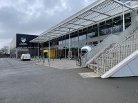
- This information is for the entrance located at the front of the building.
- This entrance gives access to Level A.
- The entrance area/door is clearly signed.
- This entrance is signed with 'Main Entrance'.
- There is step-free access at this entrance.
- There is a canopy or recess which provides weather protection at this entrance.
- There is a dark mat or floor marking at this entrance that might be perceived as a hole.
- The entrance door(s) does/do contrast visually with its immediate surroundings.
- There is not a bell/buzzer.
- There is not an intercom.
- The main door(s) open(s) automatically.
- The door(s) is/are double width.
- The width of the door opening is 194cm.
- There is a small lip on the threshold of the entrance, with a height of 2cm or below.
- There is a second set of doors.
- The door(s) open(s) automatically.
- The door(s) is/are double width.
- The width of the door opening is 196cm.
- There is a small lip on the threshold of the entrance, with a height of 2cm or below.
- There are bollards at this entrance.
- The minimum width between the bollards is 152cm.
- The bollards do contrast visually with the paving.
Finishing Point - David Ross Sports Village
- For more information on David Ross Sports Village follow the link below:
- www.accessable.co.uk/david-ross-sports-village.


