Access Guide
Summary
-
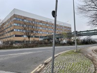
Building
View
- The journey from the Visitors Car Park to the QMC via the footpath is approximately 0.5 miles in length and takes approximately 12 minutes to travel.
- Sir Clive Granger University Car Park link (new tab) - click here.
- Keighton Auditorium link (new tab) - click here.
- Mathematical Sciences link (new tab) - click here.
- George Green Library link (new tab) - click here.
- Student Services Centre link (new tab) - click here.
- Engineering and Science Learning Centre link (new tab) - click here.
- Chemistry Building link (new tab) - click here.
- Tower Building link (new tab) - click here.
- Coates Building link (new tab) - click here.
- Medical School link (new tab) - click here.
Starting Point - Visitors Car Park
- For more information on the Visitors Car Park please follow the link below:
- www.accessable.co.uk/sir-clive-granger/university-of-nottingham-car-park.
Site/Campus Car Park (University of Nottingham Car Park)
-
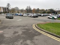
Car Park
View
- The car park is located in the centre of the campus next to the Sir Clive Granger Building.
- The nearest building(s) to this car park is/are the Sir Clive Granger Building and the Sir Peter Mansfield Imaging Centre.
- The car park type is open air/surface.
- The car park does not have a height restriction barrier.
- The car park surface is tarmac.
- Designated Blue Badge parking bays are available.
- The Blue Badge bay(s) is/are clearly marked.
- There is/are 11 designated Blue Badge parking bay(s) within this car park.
- The dimensions of the designated parking bay(s) are 240cm x 470cm.
- The Blue Badge parking bays have a marked zone to one side and the rear.
- The marked zone is 125cm wide.
- The dimensions of the designated bays do not vary in size.
-
Charges and Restrictions
View
- This car park can be used by staff, students, visitors and Blue Badge holders.
- Parking charges apply for all except Blue Badge holders.
- Signs are provided to give information on parking charges/restrictions.
- Signs are clearly presented.
- Payment can be made by phone.
- To see more information on parking policies please click here (opens new tab).
-
Drop Off Point
View
- There is not a designated drop off point in this car park.
-
Car Park Access
View
- There is not step free access from this car park.
- Buildings are clearly signposted from this car park.
- There is not a campus map available within the car park.
- The nearest designated bay is 29m (31yd 2ft) from the Sir Peter Mansfield Imaging Centre.
Visitors Car Park to Cut Through Lane
- Exit the car park at the front main entrance.
- Take the path on the right of the entrance.
- There is a dropped kerb to access the path.
- The dropped kerb does not have any tactile paving.
- The surface of the path is tarmac.
- There is a steep downwards slope which is 53 meters long.
- The kerb is on the left and there is grass on the right.
- The path is uneven in places and slopes to the left.
- At the bottom of the path follow it around to the right.
- The path narrows to 110cm.
- The path now slopes upwards in an easy slope.
- The kerb is on the left and there is a wall on the right which increases in height along the path.
- Follow the path for 13 meters to the zebra crossing on the left.
Cut Through Lane Crossing
- There is a zebra crossing to cross Cut Through Lane.
- The kerb is level with the crossing and has tactile paving.
- The zebra crossing is 6 meters wide.
- Traffic comes from the left and right.
Cut Through Lane Crossing to Internal Campus Road Zebra Crossing
- After crossing Cut Through Lane turn left.
- Continue along the path for 41 meters.
- The surface is tarmac.
- The path has a easy downwards slope which is uneven in places.
- There are railings on the right, along the front of the Keighton Auditorium which reduce the width of the path to 125cm for 3 meters.
- The path levels out at the entrance to the Keighton Auditorium on the right.
- There are cycle parks on the right at the entrance.
- Continue ahead to the end of the path.
- At the end of the path turn right and head down the slope.
- The slope is steep.
- The Mathematics Sciences Building is on the right.
- After 28 meters there is a zebra crossing on the left.
Internal Campus Road Zebra Crossing
- There is a zebra crossing on the left.
- The kerb is level with the crossing.
- There is no tactile paving at the crossing.
- The crossing is 5 meters wide and slopes to the right.
- Traffic comes from the left and right.
Internal Campus Road Zebra Crossing to Ramp and Steps
- Cross the internal Campus Road using the zebra crossing and continue ahead.
- The George Green Library is on the right.
- The Student Services Centre is on the left.
- The surface changes to block paving.
- There is an easy downwards slope which is 51 meters long.
- The paving changes to patterned block paving after 19 meters.
- There are lamp posts and grass on both sides of the slope.
- At the bottom of the slope turn right and continue ahead.
- There are picnic tables on the left and a cycle park on the right.
- The surface changes back to block paving.
- Continue ahead for 19 meters then turn left towards the steps and ramp.
- There is a signage post on the left just before the steps.
Ramp and Steps
- After turning left there are two flights of steps immediately ahead.
- There is a ramp on the right of the steps.
- The ramp is 34 meters long with resting places at regular intervals.
- The ramp is an easy slope until the last 6 meters when the ramp becomes steep.
- The ramp has handrails on both sides.
- The handrails are 96cm high.
- The surface of the ramp is block paving.
- The ramp bypasses the steps.
- There are two flights of steps.
- The first flight of steps has 11 steps which are 14cm high and 34cm deep.
- The steps are well marked and have handrails on both sides.
- The handrails are 104cm high.
- The second flight of steps has 5 steps which are 15cm high and 83cm deep.
- Between the two flights of steps there are cycle parks and bench seating on the left.
- The ramp is also used by scooters and cyclists.
Ramp and Steps to Bollards
- At the bottom of the ramp/slope or steps continue ahead for 70 meters.
- The path is level and the surface is concrete block paving.
- There is a cycle park on the right.
- Past the cycle park is the Engineering and Science Learning Centre on the right.
- The entrance to the Chemistry Building is on the left as can be seen in photograph 3.
- Continue along the path towards the bollards at the end.
- There are raised beds on the left with cycle parks in-between (photograph 5).
- There is a cycle park at the end of the path just before the bollards
- There are scooters parked on both sides of the path which may cause an obstructions a can be seen in photographs 6-8.
- There are four bollards at the end of the path.
- The bollards are 92cm high and the distance between them is 133.
- The bollards contrast with the path.
- There is a slight downwards slope towards the bollards.
- The Tower Building is immediately in front.
Bollards to Coates Road Crossing
- Turn right at the bollards.
- There is an easy upwards slope which levels out after 7 meters.
- The surface is block paving.
- There are bollards lining the right side of the path.
- The bollards are 101cm high and at intervals of 175cm.
- Continue along the path for a further 16 meters.
- The Coates Building is immediately ahead.
- Turn left and follow the path for 43 meters, then turn right.
- The surface of the path changes to tarmac and is uneven in places.
- Continue ahead for 16 meters to the Coates Road.
- The kerb is on the left and there are bushes on the right.
- The path is 150cm wide.
Coates Road Crossing
- At Coates Road there is a crossing.
- The crossing is not marked.
- There is a dropped kerb and tactile paving on both sides.
- The road is for deliveries only and is a pedestrian zone between the hours of 0830 and 1800.
- Traffic comes from the left.
Coates Road Crossing to Medical School
- After crossing Coates Road continue straight ahead.
- The Biodiscover Centre is on the right.
- The surface of the path is tarmac and is uneven in places.
- There is an steep downwards slope which evens out after 20 meters.
- There is seating on the right.
- Continue to the bollards.
- There are three bollards 98cm high with a distance of 96cm between them.
- The bollards do not have an identification strip but do contrast with the pavement.
- After passing the bollards continue for 3 meters then turn right.
- The entrance to the walkway for the Medical School is on the right.
- There are automatic doors at the entrance which open outwards.
- The doors are 173cm wide with a small lip in the doorway.
- Go through the doors and up the easy slope for 5 meters to the lift.
- The surface changes to carpet.
- There is tactile paving outside the lift.
- Take the lift to Level L or alternatively take the stairs which are opposite the lift.
- On exiting the lift turn left and go across the walkway.
- There is an easy slope to enter and exit the walkway.
- Follow the walkway to the entrance to the Medical School.
Finishing Point - Medical School
- For more information on the Medical School please follow the link below:
- www.accessable.co.uk/nottingham-medical-school.


