
Access Guide
Introduction
- Related link Cumnock Town Centre.
- Https://www.east-ayrshire.gov.uk/BusinessAndTrade/TownCentreManagement/CumnockTownCentre.aspx
- Related link Coalfield Community Transport.
- Http://www.yellowbuses.org.uk
- Related link Cumnock Heritage Trail.
- Http://www.cumnockhistorygroup.org
-
Comments
View
- Cumnock is the second largest town in East Ayrshire, located to the east of the A76 from Kilmarnock to Dumfries.
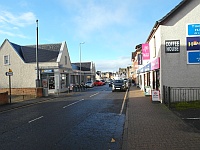
- This guide covers the main shopping area of Townhead Street.
. - Townhead Street runs from the corner and junction with Glaisnock Street near The Square in the west to the junction with Drumbrochan Road/Edgar Avenue in the east.
. - The shopping area is approximately 190 metres (0.1 miles) and takes approximately 5 minutes.
- The full street is approximately 700 metres (0.5 miles) with Cumnock Juniors FC grounds around 500 metres from the Glaisnock Street junction.
. - The shopping area has some slight slopes in places but it is mainly level.
- Footpaths on both sides are block paving and tarmac.
- The pavements are approximately 210cm wide.
. - There are no opportunities to sit and rest.
Getting Here
- By Car:
- Cumnock town centre is located approximately 1 mile from the A76 Kilmarnock-Dumfries road, using Ayr Road (A70) from the north west or Glaisnock Road (B7083) from the south east.
- The A70 (Ayr-Edinburgh) road goes through Cumnock approximately 150 metres from the centre with good links to Tanyard Car Park or the central Ayr Road Car Park.
- Glaisnock Street is in the town centre and runs from east to west.
- To the west it begins the corner and junction with Glaisnock Street near The Square.
- To the east it joins at the junction with Drumbrochan Road/Edgar Avenue.
- Parking:
- There are short and long stay car parks in the town centre with some on-street Blue Badge parking located in Townhead Street.
- By Bus:
- The bus station at Tanyard is approximately 130m from Townhead Street from The Square and is served by many routes to surrounding areas.
- Coalfield Community Transport also offer minibus links throughout the area, with membership costs approximately £5.
- By Train:
- Auchinleck Station is 1.7 miles from Cumnock town centre.
- There are ramps to both platforms, with a stepped bridge.
Parking
- On-Street Blue Badge Parking
- There are 2 designated bays near The Square on Lugar Street, which is one-way.
- On-Street Standard Parking
- There are 3 bays on Townhead Street.
- There is a dropped kerb with tactile paving from the bay.
- There are standard parking bays to the east of Townhead Street near Cumnock Juniors FC Social Club.
- Public Car Parks
- There are several free public car parks nearby.
- Townhead Street Car Park offers several designated bays around 100 metres away.
- There are also some standard parking bays behind the Townhead Street shops on The Strand around 20 metres away via the access lanes.
- Ayr Road Car Park to the west offers some designated bays around 75m from Townhead Street via the access lanes and Glaisnock Street.
- Tanyard Car Park to the west offers several designated bays and is around 140m away via Tower Street lane and Glaisnock Street.
- Glaisnock Street Car Park to the south east behind Cumnock Town Hall offers several designated bays around 230m from Townhead Street.
- ASDA supermarket to the east of Townhead Street has a customer car park around 210m away from the shopping area.
- Further along Cumnock Juniors FC also have their own car parks.
- Drop-off
- There are no designated drop-off points.
- Taxi rank
- There is not a taxi rank although Ayrshire Transport - Cumnock Taxis office is located near the junction with Glaisnock Street.
Glaisnock Street - Townhead Street
- The pavement from the junction with the one-way section of Glaisnock Street on the north side is 113cm wide.
- There is a block paving surface.
- There is a railing towards the traffic lights.
- There is a lollipop attendant during school times nearer the Glaisnock Street junction, although there are no dropped kerbs there.
- The south side is wider, narrowing near the bus shelter where it is raised for buses to stop.
- The raised bus stop has tactile paving.
- There is a bin, lamppost and electricity box on the wider side of the bus stop.
- The new shopping area joins here near the bus stop and has a paved surface.
Glaisnock Water and Shopping Area
- There are wide bollards behind the bus stop to access the new shopping area where there are many benches and a paved open space.
- There is a slight slope up beyond the bollards.
- There are benches along the side of the slope and on a wide bridge over Glaisnock Water.
- There are steps down to Glaisnock Street from this bridge or a slight slope further along (please refer to Glaisnock Street guide for details).
- The paved area also runs parallel to the Townhead Street pavement at a lower level until a steep slope at the car park junction entrance.
- There are wide bollards at the top of the steep slope.
- There are also steps down which are bypassed by the slope.
- There are 7 medium height, clearly marked steps with a central handrail.
- There is tactile paving at the bottom and top of the steps.
Crossings - The Strand
- There is a pedestrian crossing to the west of The Strand junction.
- The push buttons are 110cm high.
- There are no rotating cones beneath the controls.
- There are dropped kerbs with tactile paving on both sides.
- There are metal studs in the road for guidance at the crossing.
- The Strand junction is a 2-way backstreet to the rear parking area.
- There are dropped kerbs on both sides.
- There is not tactile paving here.
Townhead Street - Car Park
- The north side pavement of this central area is wide at this point, with space to the rear of a bus shelter to navigate round.
- There is a wide access point from rear parking on The Strand here at the Job Centre entrance.
- The bus stop offers a raised kerb with tactile paving.
- The pavement narrows slightly for some loading bays.
- The pavement follows the line of the buildings where it narrows again opposite the Townhead Street Car Park junction.
- There are bollards beside the road where it narrows.
- There is a further access point from the rear parking on The Strand here.
- The south side offers a straight route without obstacles or hazards until the car park junction.
- There is some tactile paving on the inside of the pavement where steps lead down towards the new supermarket and car park.
- The slope to the car park junction bypasses the steps.
Car Park Junction Crossings
- There is a wide 2 way road leading into Townhead Street Car Park to the south.
- There are dropped kerbs without tactile paving on either side of the junction.
- There are bollards on the pavement near the modern stores to the east.
- The bollards are 193cm wide at the dropped kerb and 117cm wide elsewhere.
- This is also a commonly used crossing from the north side of Townhead Street where it narrows to the wider bollards dropped kerb.
- There is a low kerb to the north and very wide spacing between bollards.
- There is also an area for crossing marked by 2 bollards in the central area before the loading bays.
- There are dropped kerbs without tactile paving here too.
Car Park - Shopping Area
- There is a tarmac surface to the wide pavement in front of the new stores.
- There are bollards in line with the designated Blue Badge parking here.
- Before the parking there is a town map and Old Cumnock Heritage Trail information board near the corner.
- This is through the 117cm wide bollards where there is also a dustbin.
- One of the tactile paved dropped kerbs from the Blue Badge parking also leads to this area.
- The main pavement follows the path round the parking bays and back out towards the end.
- There may be an A-frame in place at the bakery and bollards across the pavement after the modern stores.
- The end bollards are 130cm wide and 115cm wide towards the rear access point.
- The rear access point has an easy slope leading up from the veterinarian surgery and Townhead Street Car Park.
- The north side of the street has bollards adjacent to the road leaving a space of 124cm.
- There is a tarmac stretch between the shops and the final store at Timbermills Home Hardware/Millie's Corner Coffee House.
Shopping Area - Supermarket
- Beyond the shopping area is mostly residential houses, although the ASDA Supermarket car park entrance is approximately 120 metres away, with the main entrance and car park approximately 200 metres away.
- The road curves round to the right, away from the shopping area before a long downwards slope.
- There is a Citizens Advice Bureau on the north side at the slope.
- There is an island at the top of the road, although this is not for pedestrians and has fencing on both sides.
- There are similar additional traffic calming islands further along.
- At the bottom of the slope is the 2-way traffic junction to the supermarket.
- There are lowered kerbs without tactile paving directly on the corner, or 10 metres further along the access road is a zebra crossing.
- The zebra crossing offers dropped kerbs with tactile paving on both sides.
- There are no flashing beacons at the crossing.
- There is a further crossing towards the store entrance and car park.
- Beyond the crossing there are some concrete pole bollards and a paving surface.
- There is a bus stop pole on the roadside of the bollards.
- The bus stop has a raised kerb with tactile paving.
- There is a further bus stop across the road.
- On the other side of the road there is a long slope with a handrail on the right if coming down from John Baird Street.
Supermarket - Football Ground
- At the east side of the supermarket there is a wide access road for delivery lorries.
- There are dropped kerbs without tactile paving on both sides.
- There is a tarmac surface to the pavement which is generally level here.
- Shortly after the access road is the Menzie Court junction.
- There are dropped kerbs without tactile paving on either side of Menzie Court.
- The north side of Townhead Street could be used to avoid several junctions on the south side, until Elizabeth Crescent.
- There is a traffic island between Menzie Court and Elizabeth Crescent but it is not for pedestrians as it has fencing on the north pavement.
- Elizabeth Crescent has a wide junction which offers dropped kerbs without tactile paving on both sides.
- There is a further traffic island to the east of Elizabeth Crescent which is fenced off on both sides.
- Further east (approximately 300 metres from the end of the shopping area) is the entrance to Cumnock Juniors Football Club and car park.
- There are dropped kerbs and an easy slope down to the gates.
Beyond the Football Ground
- Beyond the entrance to Cumnock Juniors FC there is a bus stop near the lowered kerb.
- The bus stop offers a raised kerb with tactile paving.
- There is an easy slope along towards Cumnock Juniors FC Social Club and the further car park access road.
- The private car park access road is 2 way, offering lowered kerbs without tactile paving on both sides.
- The slope in the road becomes steeper beyond Cumnock Juniors FC Social Club.
- There are on-street parking bays on the slope.
- The north side of Townhead Street offers less junctions to cross although there are many lowered areas for residential driveway parking.
- There is also a bus stop pole to the rear of the pavement.
- The hill is steep towards the end of Townhead Street up to the junction with Drumbrochan Road/Edgar Avenue.
- There is a further junction on the south to some flats before the junction.
- There are dropped kerbs without tactile paving on both sides.
Toilet Facilities
- There are no public toilet facilities nearby.
- The closest are at Tanyard near the bus station.
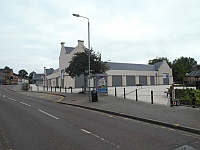
- Cumnock Town Hall in Glaisnock Street offers an accessible toilet and Cumnock Local Council Offices in Greenholm Road has a Changing Places facility.
- Cumnock Library here also offers an accessible toilet.
- Please refer to the separate access guides for details.
- Some venues along the route may also have their own customer toilet facilities available.
Access Guides Available For (Townhead Street)
-
Shopping
View
- Ayrshire Hospice - To view the access guide please click here (new tab).
- Pathhead Bakery - To view the access guide please click here (new tab).
- Gilliland & Co - To view the access guide please click here (new tab).
- Shaw Eyecare - To view the access guide please click here (new tab).
- Oakhouse Properties - To view the access guide please click here (new tab).
- Knit One Kids Too - To view the access guide please click here (new tab).
- First Sight Opticians - To view the access guide please click here (new tab).
- Prime Cuts - To view the access guide please click here (new tab).
- Timbermills - To view the access guide please click here (new tab).
- Eating and Drinking View
- Other Services View