Access Guide
Introduction
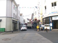
- The Pollet is situated just off the High Street in St Peter Port Guernsey and runs a loop between two section of the High Street and is close to the main harbour for ferries to the Mainland UK and France.
- The main airport is located to the south west of St Peter Port, approximately 3.5miles away.
- The nearest bus stop is on North Esplanade near to the Tourist Information centre. This is approximately 100 metres from The Pollet.
- Taxis are available from the Town Taxi rank.
- The length of the route of The Pollet is 370 metres in total.
Parking
- Blue Badge Parking (2*)
- There are several Blue Badge parking bays throughout the route with 1 Blue Badge bay available on The Pollet close to the junction with Le Truchot, opposite Le Petit Bistro. There are several Blue Badge parking bays on the High Street located by Mountain Warehouse and Healthspan near to the southern end of the High Street where it meets Fountain Street.
- Parking is free for Blue Badge holders displaying a valid Blue Badge.
- Public Car Parks (1*)
- There is a public car park on Albert Pier roughly 350 metres from The Pollet and the routes end point where is meets the junction with Smith Street and the High Street.
- There are several public parking bays on The Pollet road between Thomas de La Rue and Le Truchot.
- There is a public car park on Victoria (Crown) Pier within 50m of the south end of The Pollet.
- There is a public car park called North Beach Car Park within 150m of the north end of The Pollet.
The Pollet Overview
- The Pollet in St Peter Port Guernsey runs from the junction with Le Truchot (north) and the junction with the High Street and Smith Street (south).
- The route has various uphill slopes ranging from easy to steep.
- The pathway is on both sides of the road with some uneven sections throughout the route with limited dropped kerbs and no tactile paving.
- There are some raised manhole covers throughout the route.
- The lighting along the The Pollet is mostly modern bright white lighting attached to the buildings on both sides.
- The street plan is divided up into sections along with a junction to start and end the route:-
- Junction - Le Truchot and The Pollet.
- Le Truchot to La Tourgan.
- Junction - La Tourgan and The Pollet.
- La Tourgan to La Plaiderie.
- Junction - La Plaiderie and The Pollet.
- La Plaiderie to High Street/Smith Street.
- Junction - High Street/Smith Street and The Pollet.
- The length of the route is roughly 370 metres.
Junction - Le Truchot and The Pollet
- This is where The Pollet begins at the junction with Le Truchot.
- The pathways in this section are over 100cm in width.
- The surface of the pathways is concrete and block paving and are on an easy uphill slope as you access The Pollet or Le Truchot.
- There are no dropped kerbs or tactile paving at the crossing points.
- Le Truchot is a one way road with traffic coming from the left as you face The Pollet.
- The Pollet is also a one way road with traffic coming from Le Truchot (behind you) only and is for commercial vehicles and Blue Badge holders only.
Le Truchot to La Tourgand
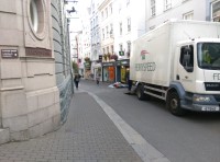
- The pathway as you head along The Pollet is on both sides of the road which has traffic coming from behind you.
- This area is for commercial vehicles and Blue Badge holders only.
- The pathways are on an easy uphill slope throughout this section and have a surface of concrete and block paving.
- The pathways are over 100cm in width for most of the section but become 90cm in places as you pass buildings (shown in photographs 2, 3, 5 and 7).
- The pathway can be uneven in places as you pass over raised manhole covers and loose block paving.
- The length of this section is roughly 89 metres.
Junction - La Tourgand and The Pollet
- This junction is on the left and has no dropped kerbs or tactile paving to cross either The Pollet or La Tourgand.
- The surface of the pathways is block paving.
- The pathway is on a steep uphill slope as you pass the junction with La Tourgand, then becoming a steep downhill slope leading into La Tourgand.
- The width of the pathways at this junction are 90cm as you go to cross La Tourgand.
- La Tourgand is a one way road with traffic coming from the The Pollet.
La Tourgand to La Plaiderie
- There is a path on both sides of the road, where traffic will come from behind you.
- This area is for commercial vehicles and Blue Badge holders only.
- The surface of the paths is concrete and block paving. The paths in this area are on a steep uphill slope.
- The width of the paths is over 100cm in most areas, with areas becoming 70cm in some parts when passing buildings.
- The pathway can be uneven in places as you pass over raised manhole covers and loose block paving.
- The length of this section is roughly 40 metres.
Junction - La Plaiderie and The Pollet
- This junction is where The Pollet and La Plaiderie meet, by the Best Western Hotel (shown in photograph 7).
- The surface of the pathways is block paving. The pathways are on a steep uphill slope as you pass the junction with La Plaiderie and on a steep uphill slope leading into La Plaiderie.
- There are no dropped kerbs or tactile paving at this junction.
La Plaiderie to High Street/Smith Street
- There are paths on both sides of the road with traffic coming from behind you.
- This area is for commercial vehicles and Blue Badge holders only.
- The pathways are on a steep uphill slope and have a surface of concrete and block paving.
- The width of the paths is 100cm for most of the section but do narrow to 80cm in parts when passing buildings.
- The pathway can be uneven in places as you pass over raised manhole covers and loose block paving.
- Roughly 20 metres into this section the pathways merge with the roadway and become uneven.
- The length of this section is roughly 55 metres.
Junction - High Street/Smith Street and The Pollet
- This is where the High Street, The Pollet and Smith Street merge.
- The surface of the paths in this section are concrete and block paving.
- This area is for commercial vehicles and Blue Badge users only.
- Traffic will come towards you from The Pollet and both ways from Smith Street.
- The pathways are on a steep uphill slope going up Smith Street and steep downhill slope going into the High Street and The Pollet.
- There are no dropped kerbs at this junction, but the kerbs are very low.
Access Guides Available For (The Pollet)
-
Shopping
View
- Collections 31 - To view the DisabledGo access guide please click here (new tab).
- Cook - To view the DisabledGo access guide please click here (new tab).
- Dorothy Perkins - To view the DisabledGo access guide please click here (new tab).
- Gwyneth & Grey - To view the DisabledGo access guide please click here (new tab).
- HS2 - To view the DisabledGo access guide please click here (new tab).
- Joules - To view the DisabledGo access guide please click here (new tab).
- Land of Green Ginger - To view the DisabledGo access guide please click here (new tab).
- Larbalestier Opticians - To view the DisabledGo access guide please click here (new tab).
- The Lexicon - To view the DisabledGo access guide please click here (new tab).
- Little Ginger - To view the DisabledGo access guide please click here (new tab).
- Machon's - To view the DisabledGo access guide please click here (new tab).
- Millets - To view the DisabledGo access guide please click here (new tab).
- Paperchase - To view the DisabledGo access guide please click here (new tab).
- Plaisirs - To view the DisabledGo access guide please click here (new tab).
- Rocks By Paul Gallienne - To view the DisabledGo access guide please click here (new tab).
- Trésors - To view the DisabledGo access guide please click here (new tab).
- United Colors Of Benetton. - To view the DisabledGo access guide please click here (new tab).
- White Stuff - To view the DisabledGo access guide please click here (new tab).
- WHSmith - To view the DisabledGo access guide please click here (new tab).
- Wink - To view the DisabledGo access guide please click here (new tab).
- N St J Paint & Sons - To view the DisabledGo access guide please click here (new tab).
- N St J Paint & Sons - To view the DisabledGo access guide please click here (new tab).
-
Eating and Drinking
View
- Cafe Emilia - To view the DisabledGo access guide please click here (new tab).
- Woodies - To view the DisabledGo access guide please click here (new tab).
- Christies - To view the DisabledGo access guide please click here (new tab).
- Da Nello - To view the DisabledGo access guide please click here (new tab).
- Red - To view the DisabledGo access guide please click here (new tab).
- Pasty Presto - To view the DisabledGo access guide please click here (new tab).
- White Hart - To view the DisabledGo access guide please click here (new tab).
- Other Services View


