
Access Guide
Introduction
- This guide is based in Ipswich Town Centre and Waterfront.
- This guide covers the main shopping area of Ipswich along with the waterfront area and covers some independent shops.
- This guide runs from the Wolsey Theatre to the north west of the town centre and runs along Westgate Street towards the main town centre and passes venues such as shopping centres and the main shops before heading south and passing St Stephens Church and passing various independent shops before running south towards the waterfront and finishing at the Duke Orwell Quay Car Park
- The route is roughly around 1.5 miles (2424 metres) and would take roughly 35-40 minutes to walk on average but this is just a guide.
- The route has some slight and steep slopes along the route.
- Pathway surfaces are concrete paving slabs and block paving.
- The pathways have some uneven sections, which include some raised manhole covers.
- The road surfaces are tarmac, with dropped kerbs and tactile paving at most crossing points.
- There are opportunities to sit and rest.
Getting Here
- By Car
- The A14 is approximately 2.0 miles away from the New Wolsey Theatre at the northwest area of the route via Sproughton Road, Bramford Road (B1067), Norwich Road (A1156), St Matthews Street (A1156) and Civic Drive.
- Parking
- There is limited street Blue Badge parking and standard parking available in the High Street and side roads throughout the route.
- Several public car parks are also available throughout the route.
- By Bus
- There are several bus stops along most of the route with direct services available to Ipswich, Norwich, Felixstowe, Hadleigh, Bury St Edmunds and many more locations.
- For more information on Ipswich Buses please see the following link:-https://www.ipswichbuses.co.uk/
- For more information on First Buses please see the following link:-https://www.firstbus.co.uk/norfolk-suffolk
- By Train
- Ipswich Station is located on Station Yard, approximately 0.6 miles from the Southern edge of the route plan (waterfront area).
- There is step-free access to all platforms at this station via lift.
- There are direct train services available to Norwich, Lowestoft, Peterborough, Ely, Cambridge, London Liverpool Street and Felixstowe
- For more information on Greater Anglia Train please see the following link:-https://www.greateranglia.co.uk/.
Parking
- On Street Parking
- There are limited Blue Badge and standard on street parking bays on surrounding side roads such as the High Street, Common Quay and St Peters Street.
- There is no charge for these parking bays.
- Parking is limited to 60 minutes for non-Blue Badge holders depending on the parking area.
- Blue Badge holders may park in any of the bays for a maximum of 2 hours.
- Photographs below show examples of this parking.
- Photographs 1 -4 shows the parking along St Peters Street.
- Photographs 5-7 shows the parking along Common Quay.
- Public Car Parks
- St Peters Dock Car Park
- This is a pay and display car park.
- For more information on this car park please click here: -https://www.ipswich.gov.uk/content/st-peters-dock-car-pa
- Photographs 8 - 13 shows the parking at St Peters Dock Car Park - St Peters Wharf.
- Buttermarket Shopping Centre Car Park
- This is a pay and display car park.
- For more information on this car park please click here: -https://www.buttermarketipswich.com/Parking/
- Photographs 14 -17 shows the parking at Buttermarket Shopping Centre Car Park.
- Wolsey Car Park
- This is a pay and display car park.
- For more information on this car park please click here: -http://www.napierparking.co.uk/our-car-parks/
- Photographs 18 -21 shows the parking at Wolsey Car Park.
- Spiral Car Park
- This is a pay and display car park.
- For more information on this car park please click here: -https://www.parkme.com/en-gb/lot/137369/the-spiral-car-park-ipswich-uk
- Photographs 22 - 25 shows the parking at Spiral Car Park.
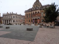
New Wolsey Theatre to Junction of St Matthews Street (A1156) via Civic Drive (A1022)
- The road is a dual carriageway and will be difficult to cross except for allocated crossing places.
- The surface of the road at all crossings is tarmac.
- The pathways on both sides of the road in this section are formed of concrete tiles/block paving.
- The pathways on both sides are wide.
- There is a slight uphill slope running past New Wolsey Theatre towards St Matthews Street (A1156).
- The pathway on the same side as New Wolsey Theatre has direct links to the New Wolsey Theatre via ramps and steps.
- Photograph 3 show example of this.
- There are some uneven areas on the pathways throughout this section.
- There are some obstructions along the pavement on both sides such as, railings, cycle racks, bus stops, bins and signboards.
- There is a bus stop opposite the New Wolsey Theatre on both sides of the road.
- Photograph 5 show the bus stops.
- The pedestrian underpass on both side of Civic Drive is steep with no handrails.
Junction – Civic Drive (A1022) and St Matthews Street (A1156) Roundabout
- There are several crossings at this junction to cross Civic Drive (A1022) and Matthews Street (A1156). These crossing are in the form of a subway going under the roadway.
- The subways have steep ramps with no handrails, leading under the road and you can then access all sides of the road.
- The subways have step access with handrails on both sides, leading under the road and you can then access all sides of the road.
- The steps are clearly marked and the depth of the steps is between 18-24cm.
- There is signage at each entrance of the underpass.
- The pathways are concrete.
- The surface of the road at all crossings is tarmac.
- The pathways are wide and are uneven in places.
- There are some obstructions along the pavement on both sides such as, railings, cycle racks, bus stops, bins and signboards.
- Photographs 7 - 15 shows access to the pedestrian underpass (subway) via ramp or steps.
Civic Drive (A1022) to Westgate Street via St Matthews Street/Crown Street (A1156)
- The pathways on both sides of the road in this section are formed of concrete tiles/block paving.
- The pathways on both sides are wide.
- There is a slight downhill slope running from Civic Drive (A1022) towards Westgate Street.
- There is a pedestrian crossing opposite Westgate Street.
- The crossing has tactile paving and drop kerbs on both sides.
- There are bus stops available on both sides of the road.
- Photographs show examples of the bus stops.
- The surface of the road is tarmac at this crossing.
- There are some obstructions along the pavement on both sides such as bus stops, bins and signboards.
Junction – St Matthews Street/Crown Street (A1156) and Westgate Street
- There are several crossings at this junction to cross Westgate Street and St Matthews Street (A1156).
- There is a pedestrian crossing to cross St Matthews Street (A1156).
- This crossing has dropped kerbs and tactile paving on both sides.
- The pedestrian crossing is push button controlled with visual signals.
- There is a crossing to cross Westgate Street.
- This crossing has dropped kerbs and tactile paving.
- The surface of the road at all crossings is tarmac.
- The surface of the pathway is block paving and Concrete at all crossings.
- There is a slight slope downhill leading into Westgate Street from St Matthews Street (A1156)
- There is a steep slope leading from Westgate Street into Crown Street (A1156).
- The surface of the road is tarmac at all crossings.
St Matthews Street/Crown Street (A1156) to High Street/Museum Street via Westgate Street
- This section of the route is for pedestrians and cyclists only and some limited deliveries.
- The pathways in this section are formed of concrete tiles/block paving.
- The pathway is wide.
- There is a slight downhill slope running from St Matthews Street (A1156) along Westgate Street and does vary from being downhill to uphill throughout the section.
- You will pass High Street branded shops such as Trespass, Greggs, Bonmarche and many more.
- There are some uneven areas on the pathways throughout this section.
- There are some obstructions along the pavement on both sides such as signs, cash points, railings, cycle racks, , bins and signboards.
- There are some Blue Badge parking bays available on nearby side roads
- These Blue Badge parking bays are limited to 2 hours.
- Photograph 8 shows this parking area.
- There are several bus stops available on both sides of the road.
Junction – Westgate Street, Museum Street and High Street
- There are two pedestrian crossings at this junction to cross Museum Street and High Street.
- These crossings have dropped kerbs on both sides.
- The pedestrian crossings are push button controlled with visual signals.
- The surface of the road at all crossings is tarmac.
- The surface of the pathway are block paving and tarmac at all crossings.
- There is a slight slope downhill leading into Museum Street from Westgate Street.
- There is a slight slope uphill leading into High Street from Westgate Street
- Westgate Street is level at this point
- The surface of the road is tarmac at all crossings.
- The roadway is one way with traffic coming from the High Street to Museum Street passing Westgate Street.
Museum Street/High Street to Dial Lane via Westgate Street/Tavern Street
- This section of the route is for pedestrians and cyclists only and some limited deliveries.
- The pathways in this section are formed of concrete tiles/block paving.
- The pathway is wide.
- The pathway is level as you exit the junction of High Street, Museum Street and Westgate Street.
- You will pass many High Street branded shops such as Marks and Spencer, Card Factory, Primark, JD Sports, Clarks, Sailmakers Shopping Centre and Buttermarket Shopping Centre.
- Close to the Dial Lane area of the route is the entrance to Sailmakers Shopping Centre which has automatic double doors that open away from you to enter.
- Close to the Dial Lane area of the route is the entrance to the Walk which leads to Buttermarket Shopping Centre.
- There are some uneven areas on the pathways throughout this section.
- There are some obstructions along the pavement on both sides such as signs, cash points, railings, cycle racks, bins and signboards.
Junction – Tavern Street and Dial Lane
- This junction is all level and has no crossings at all.
- The surface of paths is block paving.
- There are some obstructions along the pavement on both sides such as signs, cash points, railings, cycle racks, bins and signboards.
- There is a slight slope downhill leading from Tavern Street into Dial Lane.
Tavern Street to Buttermarket/St Stephens Lane via Dial Lane
- This section of the route is for pedestrians and cyclists only.
- The pathways in this section are formed of concrete tiles/block paving.
- The pathway is wide.
- The pathway is level as you exit the junction of Tavern Street into Dial Lane and then becomes a slight slope downhill leading from Tavern Street into Dial Lane and towards Buttermarket.
- You will pass St Lawrence Church and Café midway between Tavern Street and Buttermarket.
- There are some uneven areas on the pathways throughout this section.
- There are some obstructions along the pavement on both sides such as signs, cash points, railings, cycle racks, bins and signboards.
Junction – Buttermarket, St Stephens Lane and Dial Lane
- This junction is all level and has no crossings at all.
- The surface of paths is block paving.
- There are some obstructions along the pavement on both sides such as signs, cash points, railings, cycle racks, bins and signboards.
- The width between the bollards is 110cm - 120cm.
- There is a slight slope downhill leading from Dial Lane into Buttermarket and St Stephens Lane.
- Buttermarket is level leading from Dial Lane and St Stephens Lane.
Buttermarket/Dial Lane to Dogs Head Street via St Stephens Lane
- This section of the route is for pedestrians and cyclists only.
- The pathways in this section are formed of concrete tiles/block paving.
- The pathway is wide.
- The pathway is level as you exit the junction of Tavern Street into Dial Lane and then becomes a slight slope downhill leading from Tavern Street into Dial Lane and towards Buttermarket.
- You will pass St Stephens Church and an entrance to Buttermarket Shopping Centre midway between Buttermarket Dogs Head Street.
- There is a slight ramp or three steps to reach the entrance to the Buttermarket Shopping Centre. The entrance to the Buttermarket Shopping Centre has automatic double doors that open towards you as shown in photographs.
- There are some uneven areas on the pathways throughout this section.
- There are some obstructions along the pavement on both sides such as signs, cash points, railings, cycle racks, , bins and signboards.
- There is seating available next to St Stephens Church and opposite the Buttermarket Shopping Centre entrance as shown in photographs.
- At the time of the survey being carried out this entrance is closed due to construction works (3.07.23).
Junction – Dogs Head Street, St Stephens Lane and Turret Lane
- There are two zebra crossings crossings at this junction to cross Dogs Head Street and Turret Lane.
- These crossings have dropped kerbs and tack tile paving both sides.
- The surface of the road at all crossings is tarmac.
- The surface of the pathway are block paving and tarmac at all crossings.
- There is a slight slope downhill leading into Turret Lane from Dogs Head Street.
- There is a slight slope uphill leading into St Stephens Lane from Dogs Head Street.
- Dogs Head street has a slight slope downhill as you look left and right if you exit St Stephens Lane.
- The surface of the road is tarmac at all crossings.
- There is a small area just south of the junction leading from Turret Lane where there are several bus stops as shown in photographs.
- There is seating available here also as shown in photographs.
- There are some obstructions along the pavement on both sides such as signs, cash points, railings, cycle racks, , bins and signboards.
St Stephens Lane/Turret Lane to Silent Street via Dogs Head Street
- The road is a two-way road and can be crossed near the junction with Turret Lane and St Stephens Lane or close to junction with Silent Street.
- The surface of the road at all crossings is tarmac.
- The pathways on both sides of the road in this section are formed of concrete tiles/block paving.
- The pathways on both sides are wide.
- There is a slight downhill slope running from St Stephens Lane towards Silent Street.
- There are some uneven areas on the pathways throughout this section.
- There are some obstructions along the pavement on both sides such as, railings, cycle racks, bus stops, bins, and signboards.
- There is seating available close to the junction with St Stephens Lane and opposite Revolution Restaurant.
- There are some side entrances to cross, and most have dropped kerbs but not all have tactile paving.
Junction – Dogs Head Street, Silent Street and Falcon Street
- There are just standard crossings at this junction to cross Dogs Head Street, Silent Street and Falcon Street.
- These crossings have dropped kerbs and tactile paving on both sides.
- The crossing over Silent Street is level with the roadway.
- The surface of the road at all crossings is tarmac and block paving.
- The surface of the pathway is block paving at all crossings.
- There is a slight slope uphill leading into Falcon Street from Dogs Head Street.
- Dogs Head Street has a slight slope downhill as you look left and right if you exit from Silent Street.
- The surface of the road is tarmac at all crossings.
Dogs Head Street/Falcon Street to St Peters Street/St Nicholas Street via Silent Street
- The road is a one-way road with traffic coming towards you if you were walking from Dogs Head Street towards St Peters Street.
- The surface of the road at all crossings is tarmac.
- The pathways on both sides of the road in this section are formed of concrete tiles/block paving.
- The pathways on both sides are narrow and may require single file walking.
- There is a slight downhill slope running from Dogs Head Street towards St Peters Street.
- There are some uneven areas on the pathways throughout this section.
- There are some obstructions along the pavement on both sides such as, railings, cycle racks, bus stops, bins and signboards.
- There are some side entrances to cross, and most have dropped kerbs but not all have tactile paving.
- At the time of the survey being carried out there was construction works being carried out along Silent Street (3.07.23).
Junction – St Peters Street/St Nicholas Street and Silent Street
- There are just standard crossings at this junction to cross Silent Street, St Nicholas Street and St Peters Street.
- These crossings are level with the roadway.
- The surface of the road at all crossings is tarmac and block paving.
- The surface of the pathway is block paving at all crossings.
- There is a slight slope downhill leading into St Peters Street from Silent Street.
- There is a slight slope uphill leading into St Peters Street from St Nicholas Street.
- St Peters Street is level where it meets Silent Street and St Nicholas Street.
- The surface of the road is tarmac at all crossings.
- There are some obstructions along the pavement on both sides such as signs, cash points, bollards, cycle racks, bins and signboards.
St Nicholas Street/Silent Street to Star Lane/College Street via St Peters Street
- The road is a two-way road and can be crossed near the junction with Silent Street and St Nicholas Street.
- The surface of the road at all crossings is tarmac.
- The pathways on both sides of the road in this section are formed of concrete tiles/block paving.
- The pathways on both sides are wide but does narrow in sections throughout.
- The route is mainly level but there is a slight uphill slope running from the direction of Rose Lane towards Star Lane.
- There are some uneven areas on the pathways throughout this section.
- There are some obstructions along the pavement on both sides such as, railings, cycle racks, bus stops, bins and signboards.
- There are some side entrances and side roads to cross and most have dropped kerbs but not all have tactile paving.
- There is limited on street parking available on St Peters Street which is for 1 hour maximum and no return within 2 hours as shown in photographs.
Junction – St Peters Street, Star Lane and College Street
- There are several crossings at this junction.
- A pedestrian crossing to cross Star Lane.
- A pedestrian crossing to cross College Street.
- These crossings have dropped kerbs and tactile paving on both sides.
- The pedestrian crossings have push button controlled with visual signals.
- There is a standard crossing to cross St Peters Street which is level with the roadway.
- The surface of the road at all crossings is tarmac.
- The surface of the pathway is block paving and tarmac at all crossings.
- There is a slight slope downhill leading into St Peters Street from Star Lane.
- There is a slight slope downhill on Star Lane, right to left as you exit St Peters Street leading towards Star Lane.
- There is a slight slope downhill on College Street, right to left as you walk from Star Lane leading towards College Street.
- The surface of the road is tarmac at all crossings.
- The roadway is one way traffic with traffic coming from roundabout towards St Peters Street on Star Lane and traffic coming from Foundry Lane towards roundabout on College Street.
- There are some obstructions along the pavement on both sides such as, railings, cycle racks, bus stops, bins and signboards.
- St Peters Church can be accessed from this junction.
Star Lane to Foundry Lane via College Street
- The pathways on both sides of the road in this section are formed of concrete tiles/block paving.
- The pathways on both sides are wide.
- There is a slight uphill slope running from left to right as you exit Foundry Lane onto College Street.
- The pathways on both sides of the road in this section are formed of concrete tiles/block paving.
- There is a slight to steep downhill slope into Foundry Lane from College Street.
- There are bus stops available on the side of the road closest to the junction of Foundry Lane.
- Photographs show examples of the bus stops.
- The surface of the road is tarmac.
- There are some obstructions along the pavement on both sides such as bus stops, bins and signboards.
- Cardinal Lofts Car Park, St Peters Church and Wolsey’s Gate are located on this section between Foundry Lane and Star Lane.
Junction – College Street and Foundry Lane
- There is standard crossing at this junction to cross Foundry Lane.
- This crossing has dropped kerbs and tactile paving on both sides.
- The surface of the road at all crossings is tarmac and block paving.
- The surface of the pathway is block paving.
- There is a slight slope downhill leading into Foundry Lane from College Street.
- There is a slight slope uphill along College Street as you exit Foundry Lane going left to right.
- The surface of the road is tarmac at the crossing.
- There are some obstructions along the pavement on both sides such as signs, cash points, cycle racks, bins and signboards.
College Street to St Peters Dock via Foundry Lane
- The pathways on both sides of the road in this section are formed of concrete tiles/block paving.
- The pathways on both sides are wide.
- There is a slight downhill slope running from College Street to St Peters Dock.
- The pathways on both sides of the road in this section are formed of concrete tiles/block paving.
- The roadway is one-way with traffic coming from St Peters Dock to College Street.
- The surface of the road is tarmac.
- There are some obstructions along the pavement on both sides such as bus stops, bollards, bins and signboards.
- There is limited on street parking available on this section throughout.
Junction – Foundry Lane and St Peters Dock
- There is a standard crossing at this junction to cross Foundry Lane.
- This crossing is level with the roadway.
- There is a standard crossing to cross St Peters Dock.
- This crossing has dropped kerbs and tactile paving on both sides.
- The surface of the road at all crossings is tarmac and block paving.
- The surface of the pathway is block paving at all crossings.
- There is a slight slope uphill along St Peters Dock from right to left as you exit Foundry Lane.
- There are some obstructions along the pavement on both sides such as signs, cash points, bollards, cycle racks, bins and signboards.
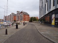
St Peters Dock to Common Quay/Key Street Via River Footpath
- This section of the route is for pedestrians and cyclists only.
- The pathway in this section are formed of concrete tiles/block paving.
- The pathway is wide.
- The pathway is mainly level throughout but does have some areas that have slight slopes.
- There are some uneven areas on the pathways throughout this section.
- There are some obstructions along the pavement on both sides such as signs, cash points, railings and bollards, cycle racks, bins and signboards.
- There is seating available along the route.
- The route runs past some quay side stores and also the quay/riverside.
- Photograph 1 shows the portable bollards at the junction of the river footpath and Common Quay/Key Street.
- The width between the bollards is 110cm.
Junction – Common Quay/Key Street and River Footpath
- There is a standard crossing at this junction to Common Quay.
- There are dropped kerbs and tactile paving on both sides.
- The surface of the road at all crossings is tarmac and block paving.
- The surface of the pathway is block paving at the crossing
- There is a slight slope uphill leading from river footpath into Common Quay
- There are some obstructions along the pavement on both sides such as signs, cash points, railings and bollards, cycle racks, bins and signboards.
- Photograph 1 shows the portable bollards at the junction of the River Footpath and Common Quay/Key Street.
- The width between the bollards is 110cm.
River Footpath to Coprolite Street via Common Quay/Wherry Quay and Neptune Quay
- This section of the route is for pedestrians and cyclists only, but there is access available for port deliveries and store deliveries.
- The pathways in this section are formed of concrete tiles/block paving.
- The pathway is wide but does narrow in various sections.
- The pathway is mainly level throughout but does have some areas that have slight to steep slopes.
- There are some uneven areas on the pathways throughout this section.
- There are some obstructions along the pavement on both sides such as signs, cash points, railings, cycle racks, bins and signboards.
- There is seating available along the route.
- The route runs past some quay side stores and also the quay/riverside.
- There is limited on-street parking available along this section throughout.
Junction – Neptune Quay and Coprolite Street
- This is where the roadway and pathways become just a pathway as you reach Coprolite Street, then continues along the quayside.
- The surface of the pathway is block paving .
- The surface is level here.
- There are some obstructions along the pavement on both sides such as signs, cash points, railings and bollards, cycle racks, bins and signboards.
Accessible Toilet
- Accessible toilet facilities are not available.
-
Comments
View
- There are shops, restaurants and Shopping Centres with toilet facilities available.
Standard Toilet(s)
-
Availability and Location of Standard Toilets
View
- Standard toilet facilities are not available.
-
Comments
View
- There are shops, restaurants and Shopping Centres with toilet facilities available.
Access Guides Available For
-
Shopping
View
- Buttermarket Shopping Centre - To view the access guide please click here (new tab).
- Buttermarket Shopping Centre Management - To view the access guide please click here (new tab).
- Buttermarket Shopping Centre First Floor - To view the access guide please click here (new tab).
- Buttermarket Shopping Centre Ground Floor - To view the access guide please click here (new tab).
- Tesco Express - To view the access guide please click here (new tab).
- Eating and Drinking View
- Car Parks View
- Toilets View
- Other Services View