Access Guide
Introduction
- This guide describes part of the shopping and leisure area in Richmond Town Centre.
It covers the area from Kew Road next to the Orange Tree Hotel in the north, from the junction with Church Road, through The Quadrant and George Street to the junction with Red Lion Street in the south.
The street is approximately 650m (0.4 miles) long and It takes approximately 10 minutes to walk.
There are shops and restaurants on both sides of the shopping street.
There are several crossings along the route.
There is several slight and steep slopes throughout the route.
The pathways have some uneven sections throughout the route.
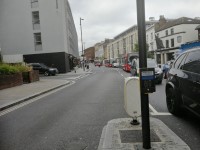
There are raised manhole covers on the pathway in many sections throughout.
There are several bus stops along the route.
Getting Here
- By Car
- The shopping area described is in Richmond, southwest London.
- All the streets described form part of the A307 which continues north becoming Kew Road towards Kew Bridge.
- It also connects to the A316 Twickenham Road which connects to the Thames to the west.
- To the south the A307 continues as Petersham Road parallel with the Thames.
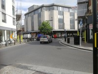
- Note that the southern section of George Street and The Quadrant is one-way traffic, south to north.
- By Bus
- The shopping area is served by multiple bus routes connecting with Richmond Station and surrounding areas.
- For help with planning your route please click here (opens in new tab)
- By Train
- TFL Overground - Richmond Station is the south-western terminus of the line which connects with Stratford through Highbury and Islington.
- Southwestern Rail - Richmond station is served by services from Waterloo through Clapham Junction towards Windsor and the southwest.
- There is step-free access to all platforms by lift.
- Staff are available to assist with boarding ramps.
- By Underground
- Richmond Station is also a terminus of the District Line.
- There is step-free access to all platforms by lift.
- Staff are available to assist with boarding ramps.
Parking
- Car Parks
- There is long-stay parking at Richmond railway station car park, TW9 1EZ (photographs 1 to 5)>
- There is long-stay parking on Drummond Place and is operated by NCP, postcode TW9 1DN (photograph 6).
There is short-stay parking (up to 2 hours) at Richmond Riverside car park, TW9 1TH. - On-street Parking
- Most of the roads in the shopping area have double yellow lines where parking is not permitted, except for limited times in marked bays.
- There is a Blue Badge parking bay on The Quadrant next to Tesco Express (photograph 7).
- Refer to local signs for further details on parking areas.
Junction - Kew Road and Church Road
- There is a pedestrian controlled crossing point on Kew Road, near to Carluccio's and the Orange Tree Hotel Orange Tree Hotel (photograph 3).
- There are dropped kerbs on both sides of the road and a central refuge with a level surface, marked with tactile paving (photographs 1, 2, 4 and 5).
- The crossing has audible and visual signals, with rotating cones underneath the controls for visually impaired users.
- The road can be crossed in two consecutive stages with a refuge in the middle.
- The pavement on both sides of the road in this section are formed of concrete tiles, and is wide and level.
Church Road to Richmond Train Station Via Kew Road
- The pavement on both sides of the road here is formed of concrete tiles with wide pavements and a slope on a very easy incline upwards from Church Road to Richmond railway station.
- There are some uneven areas around the bases of the street trees (photograph 5).
- There are some obstructions along the pavement on both sides including pillar boxes, sign posts, an ATM, railings, cycle racks and signboards (photographs 4, and 7 to 13).
- There is a side road crossing on the left-hand pavement just before Subway, opposite Carluccio's (photograph 3).
- The side road crossing has dropped kerbs and tactile paving on both sides.
- There are several bus stops available on both sides of the road (photographs 12, 16 and 18).
- Richmond Station Stops Z, D and E serve Transport for London (TfL) routes 110, 190, 371, 419, 490, H37, N22, R68 and R70.
- There is a taxi rank opposite the train station on Kew Road (photograph 21).
Richmond Train Station to Drummonds Place via Kew Road
- There is a bus stop directly outside Richmond Train Station, Richmond Station Stop E.
- There is a pedestrian controlled crossing point on Kew Road, opposite the train station and Sainsbury's.
- There are dropped kerbs on both sides of the road marked with tactile paving.
- The crossing has audible and visual signals and rotating cones underneath the controls for visually impaired users (shown in photographs 7 to 11).
- The pavement on both sides of the road in this section are formed of concrete tiles.
- The pavement on both sides are wide and on an easy slope uphill as you pass Richmond Train Station and then becomes an easy slope downhill towards Drummonds Place.
- There are steps on the pathway on the left side of the road next to Richmond Train Station which form a short cut to Sainsbury's, Costa and Foxton.
- There are 5 medium height steps that have a handrail on both sides (photographs 1 and 2).
- The pathway next to the steps allows you to bypass these steps using an easy slope (photograph 3).
- There is a crossing on the left pathway as you reach Drummonds Place.
- This crossing has dropped kerbs and tactile paving on both sides (photographs 14 and 15).
.
Drummonds Place to The Quadrant via The Quadrant A307
- The pavement on both sides of the road here is formed of concrete tiles.
- The pavement on both sides of the road here are on a slope with a very easy incline, tending towards a slope on a steep incline downwards from Drummonds Place towards The Quadrant.
- The width of the slope is 154cm.
- The pavement on the left-hand side approaching The Railway Tavern becomes narrow on a slope with a steep incline downwards (photographs 1 and 2).
- The pavement tends towards a slope with a very easy incline outside McDonalds.
- There are obstructions along the pavement on both sides, including sign posts, bins, railings and signboards (photographs 4, 5, 7, 8 and 10).
- There is a side road crossing on the right-hand pavement to cross Quadrant Road between Lloyds Bank and Specsavers.
- The crossing here has dropped kerbs with tactile paving on both sides (photographs 8 and 9).
Junction - The Quadrant
- The pavement on both sides of the road here tends towards level access, and are formed of concrete tiles.
- There is a three-way junction at the convergence of The Quadrant, Sheen Road (The Square), and Duke Street.
- There is a large triangular pedestrian refuge at the centre of the junction.
- There are pedestrian controlled crossing points between the pedestrian refuge and both sides of The Quadrant (outside Lululemon, and Marsh and Parsons).
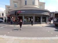
- There is also a crossing between the pedestrian refuge and George Street, outside Itsu.
- There is also a crossing outside Itsu connecting both sides of George Street (photographs 5 and 6).
- All crossing points have a flush surface or slight dropped kerbs marked by tactile paving.
- The crossings have audible and visual signals with rotating cones beneath the controls for visually impaired users (photographs 1 to 8).
The Quadrant Triangle Shopping Area
- The pavement on both sides of the road here is formed of concrete tiles, and is level with some slopes on a very easy include throughout.
- There are some obstructions along the pavement on both sides including sign posts, an ATM, railings, cycle racks, signboards and outdoor seating (photographs 4, and 6 to 9).
- The Quadrant is largely pedestrianised with several popular high street shops and restaurants such as Tesco Express, Pret A Manger, Leon and Whole Foods Market.
The Quadrant to Victoria Place via George Street A307
- The pavement on both sides of the road here is formed of concrete tiles with some pedestrianised sections also allocated as a taxi rank and disabled parking bays set to cobble stones.
- The pavement on both sides of the road here is level with some slopes on a very easy incline throughout.
- There are some obstructions along the pavement on both sides of the road including signs, an ATM, railings, cycle racks and signboards (photographs 4, 5, 8 and 9).
- George Street bus stop (Stop B) is on the North (right hand) side of the road.
- Victoria Place is on the left just before George Street bus Stop A on the opposite (right) side of the road (photographs 11 and 12).
- The bus stops here serve Transport for London (TfL) routes 65, 190, 371, 391, 419, 490, 493, 969, H22, H37, R68, R70, N22 and N65.
Victoria Place to Red Lion Street via George Street A307
- The pavement on both sides of the road here is formed of concrete tiles and is level with some slopes on a very easy incline throughout.
- On the north (right hand) side off George Street is George Street (Stop A) served by Transport for London (TfL) routes 33, 337, 493 and N33.
- There are some obstructions along the pavement on both sides including signs, signboards and bins (photograph 4).
- There was scaffolding on the right hand side from HSBC to REISS, and again from Golden Court to King Street at the time of survey (20/06/23) (photographs 3, 6, 9 and 10).
- The scaffolding served to form a width restriction of 126cm (photograph 10).
- There is a pedestrian crossing at Golden Court, 9 George Street (photographs 5 to 8).
- There are dropped kerbs on both sides of the pedestrian crossing, with marked with tactile paving and a level crossing.
- The pedestrian crossing has audible and visual signals and rotating cones underneath the controls for visually impaired users.
Junction - Red Lion Street, George Street, King Street and Water Lane
- The level pavement on both sides of the road here is formed of concrete tiles, becoming a slope with a very easy incline on the approach to Red Lion Street.
- There is a three way junction at the convergence of George Street and Red Lion Street (photographs 1 to 7).
- There is a large triangular pedestrian refuge at the centre of the junction.
- There are pedestrian controlled crossing points between the pedestrian refuge and both sides of George Street and Red Lion Street.
- All crossing points have a flush surface or slight dropped kerbs marked by tactile paving.
- The pedestrian crossings have audible and visual signals with rotating cones beneath the controls for visually impaired users.
- There is a crossing on Water Lane that has dropped kerbs but no tactile paving (photograph 9).
- There is a zebra crossing on King Street by the Old Ship Saloon (photographs 10 to 12).
- The crossing here has dropped kerbs and tactile paving on both sides.
Accessible Toilet
- Accessible toilet facilities are not available.
-
Comments
View
- There are no public toilets in Richmond Town Centre.
- There is an accessible toilet in Richmond railway station.
- Other shops and restaurants may have facilities for customer use, refer to related access guides for details.
- There are no public toilets in Richmond Town Centre.
Standard Toilet(s)
-
Availability and Location of Standard Toilets
View
- Standard toilet facilities are not available.
-
Comments
View
- There are no public toilets in Richmond town centre.
- There are standard toilets in Richmond railway station.
- Other shops and restaurants may have facilities for customer use, refer to related access guides for details.
- There are no public toilets in Richmond town centre.
Access Guides Available For (Richmond Shopping Area)
-
Shopping
View
- Barnard Marcus - To view the access guide please click here (new tab).
- Boots - To view the access guide please click here (new tab).
- Flight Centre - To view the access guide please click here (new tab).
- Gant - To view the access guide please click here (new tab).
- Holland & Barrett - To view the access guide please click here (new tab).
- O2 - To view the access guide please click here (new tab).
- Russell & Bromley - To view the access guide please click here (new tab).
- Sainsbury's Local - To view the access guide please click here (new tab).
- Specsavers - To view the access guide please click here (new tab).
- Tesco Metro - To view the access guide please click here (new tab).
- Zara Home - To view the access guide please click here (new tab).
- WHSmith Express - To view the access guide please click here (new tab).
- EE - To view the access guide please click here (new tab).
- Lululemon Athletica - To view the access guide please click here (new tab).
-
Eating and Drinking
View
- Carluccio's - To view the access guide please click here (new tab).
- The Railway Tavern - To view the access guide please click here (new tab).
- Starbucks Coffee - To view the access guide please click here (new tab).
- The Old Ship - To view the access guide please click here (new tab).
- McDonald's - To view the access guide please click here (new tab).
- Leon - To view the access guide please click here (new tab).
- Greggs - To view the access guide please click here (new tab).
- Other Services View


