Access Guide
Introduction
- This guide, and its linked guides, describes the shopping and leisure area of Upper Richmond Road West in Sheen, south west London.
The guide describes the section of Upper Richmond Road West which runs from Graemesdyke Avenue in the west to Sheen Lane in the east.
This section is approximately 700m (0.4 miles) long and will take approximately 9 minutes to walk.
The shopping area is generally level or with slight slopes.
Potential hazards include; A-board signs, parked cycles on the pavement, uncovered tree bases and uncontrolled crossing points at side roads.
Getting Here
- By Car
- Sheen is located in southwest London, south of the Thames.
- From the east, the A205 connects with the A3 at Wandsworth through Putney.
- To the west, the A205 connects with the A305 Upper Richmond Road West and Richmond town centre.
- The A205 itself turns north to cross the river at Kew Bridge.
- Just north of the river there is a connection to the M4.
- Parking
- The A205 is a Red Route where stopping is not permitted except for limited times in marked bays.
- By Bus
- There are bus stops on both sides of Upper Richmond Road West served by routes 33, 337, 493 and 969 connecting with surrounding areas.
- By Train
- The nearest train station is Mortlake.
- This station is located about 400m to the north of Upper Richmond Road, off Sheen Lane.
- The station is served by South Western Railway.
- There is step-free access to each of the platforms at this station from Sheen Lane.
Parking
- Car Parks
- The nearest public car park is the Sheen Lane pay and display car park, accessed off Sheen Lane.
- This is about 140m from the shopping street.
- There is also a customer car park attached to the Waitrose store which is entered from Upper Richmond Road West (shown in photographs 1 and 2. Please see the access guide for details).
- On-street parking
- There is one on-street Blue Badge bay on the north side of the road near to Robert Dyas.
- This is restricted to a maximum of 3 hours between 10.00 and 16.00.
- There is also one free Blue Badge bay in Temple Sheen Road to the south of the main road.
- This is 246cm x 570cm (shown in photograph 3).
- Other strips of on-street parking are restricted to 30 minutes 07.00 to 19.00.
- There is one space for an electric vehicle to park as part of the standard parking outside of Carpetright (shown in photographs 5 and 6).
Upper Richmond Road West and Sheen Lane Crossroads
- There is a pedestrian controlled crossing on Upper Richmond Road West, just to the west of the crossroads with Sheen Lane.
- The crossing point has dropped kerbs with tactile paving to both sides of the road.
- The crossing has audible and visual signals.
- There are rotating cones for visually impaired users on both sets of controls to each side of the road.
- There is a central refuge in the middle of the road.
- The refuges have flush surfaces with tactile paving.
- The controls are timed so that the road is crossed in two stages.
- There is a similar crossing point to the east of the crossroads and on Sheen Lane to the north and south of the junction.
Upper Richmond Road West - Overview
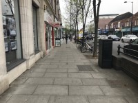
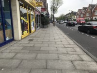
- The footpaths in the area are formed of concrete paving slabs.
- The paths are wide and generally level or with slight slopes throughout the area.
- There is bench seating at intervals on both sides of the street.
- Throughout the street there are trees close to the edge of the pavement.
- There are some unmade and uneven surfaces around the trees.
- Seasonally, some cafés have outside seating and tables on the pavement.
Crossing Point - Upper Richmond Road near to Waitrose / Toni and Guy
- There is a push-button, pedestrian controlled crossing on Upper Richmond Road West, close to Waitrose on the north side of the road and Toni and Guy on the south side.
- There is a slight dropped kerb with tactile paving on both sides of the road.
- There is also a central refuge which has slight dropped kerbs and tactile paving.
- The refuge is off set so that the road is crossed in two stages.
- The crossing controls have audible and visual signals.
- The ones to each side of the road also have a rotating cone for visually impaired users but the ones on the refuge do not.
Upper Richmond Road South Side
- There are several side roads which join Upper Richmond Road West from the south.
- There are similar uncontrolled crossings with a level surface and tactile paving on the side roads at all the junctions.
- The photographs show the junctions with Penrhyn Crescent, Sheen Gate Gardens and Temple Sheen Road.
Crossing Point - Upper Richmond Road, near Connaught Avenue
- There is a zebra crossing to cross the main road close to Connaught Avenue and Temple Sheen Road.
- There is a dropped kerb with tactile paving on both sides of the road.
- There is also a level surface central refuge with tactile paving so that the road can be crossed in two stages.
Upper Richmond Road North Side
- There are several side roads joining the north side of Upper Richmond Road.
- There are uncontrolled crossing points on the side roads at the junctions.
- All the crossings are level and have tactile paving to both sides of the road.
- The photographs show the junctions with Connaught Avenue, Leinster Avenue and Elm Road.
Accessible Toilet
- Some of the shops and restaurants in the area have accessible toilets for customer use. Please see the related access guides for details.
Standard Toilet(s)
- Some of the shops and restaurants in the area have toilets for customer use. Please see the related access guides for details.
Access Guides Available For (Sheen Shopping Area)
-
Shopping
View
- A Party Palace - To view the access guide please click here (new tab).
- Feather and Black London - To view the access guide please click here (new tab).
- Flight Centre - To view the access guide please click here (new tab).
- Carpetright - To view the access guide please click here (new tab).
- Princess Alice Hospice - To view the access guide please click here (new tab).
- Sheen Bookshop - To view the access guide please click here (new tab).
- Boots - To view the access guide please click here (new tab).
- Tesco Express - To view the access guide please click here (new tab).
- WH Smith - To view the access guide please click here (new tab).
- Swan Dry Cleaners - To view the access guide please click here (new tab).
- Raymunn Kitchens - To view the access guide please click here (new tab).
- Johnsons Shoes - To view the access guide please click here (new tab).
- Waitrose - To view the access guide please click here (new tab).
- Eating and Drinking View
- Other Services View


