Access Guide
Introduction
- Related link Shopping in Worcester City.
- Http://www.visitworcestershire.org/worcester/Worcester-shopping.aspx
- Related link Worcester City Parking.
- Http://www.worcester.gov.uk/parking
Route Overview
- This route runs from Corn Market, east of the pedestrianised city centre to the junction of Friar Street and College Street (A44) to the south east of the pedestrianised city centre.
- The pedestrianised section covered by this guide runs along Friar Street from Charles Street to Union Street.
- Vehicular access to Friar Street from Charles Street to Union Street is restricted to delivery vehicles and Blue Badge holders.
- New Street is a one-way street, with traffic passing from south to north, from Friar Street to Corn Market.
- The total length of this route is approximately 0.49km (0.3 miles).
- The average width of the pedestrianised section of this route is approximately 6m.
- The average width of the non pedestrianised section of this route is approximately 1.6m.
- This route is divided up into 4 sections in this guide:-
- 1. Corn Market.
- 2. New Street.
- 3. Charles Street to Union Street.
- 4. Union Street to College Street.
- Corn Market, New Street and Friar Street are part of the main shopping and leisure area of the city centre.
- The pedestrianised parts of this route are closed to vehicles between 10:30 – 16.30 daily.
- Also pedestrianised but not forming part of this guide are High Street, Broad Street, Mealcheapen Street, The Shambles, Pump Street and Cathedral Square.
- There is no lighting along the majority of this route.
- There are dropped kerbs without tactile paving at the majority of the crossing points along the route.
Getting Here
- Corn Market is located at the east end of the city centre, just off the A38 (City Walls Road).
- Corn Market, New Street and Friar Street are not pedestrianised.
- There are no bus stops along the route.
- The nearest bus stops are In City Walls Road, near Union Street, and Cathedral Square.
- The nearest railway station is Worcester Foregate Street.
- There is a taxi rank in New Street which is shared with Blue Badge holders.
Parking
- BLUE BADGE PARKING (2*)
- There are Blue Badge bays on Corn Market, New Street and Charles Street.
- The 2 Blue Badge bays in Corn Market are marked into individual bays.
- The bays are 374cm wide and 434cm deep.
- The bays on New Street and Charles Street are not marked into separate bays.
- There is room for up to 3 vehicles in the bay on New Street.
- These bays are shared with taxis.
- There is room for up to 6 vehicles in the bay on Charles Street.
- The bays are approximately 280cm wide.
- PUBLIC PARKING (1*)
- There are 2 public car parks with Blue Badge bays. Parking is not free for Blue Badge holders:-
- 1. Cornmarket Car Park is on Queen Street off St Nicholas Street.
- 2. NCP Cathedral Square Car Park is on Friar Street, off Sidbury (A44).
- ON STREET STANDARD PARKING (0*)
- On street standard parking is available along Friar Street and Union Street.
- Parking is free for all users and is limited to 45 minutes.
- Blue Badge holders are exempt from time restrictions in this parking area.
Access Guides Available For (Corn Market)
Access Guides Available For (New Street)
- Shopping View
-
Eating and Drinking
View
- Bottles Wine Bar & Merchants - To view the access guide please click here (new tab).
- Chesters - To view the access guide please click here (new tab).
- King Charles House - To view the access guide please click here (new tab).
- Old Greyhound - To view the access guide please click here (new tab).
- Papa's Cafe - To view the access guide please click here (new tab).
- Saffrons Bistro - To view the access guide please click here (new tab).
Access Guides Available For (Friar Street)
-
Shopping
View
- 25 Boutique - To view the access guide please click here (new tab).
- Anja Potze - To view the access guide please click here (new tab).
- Emporio - To view the access guide please click here (new tab).
- Felice - To view the access guide please click here (new tab).
- IF Interior Furnishers - To view the access guide please click here (new tab).
- Insitu - To view the access guide please click here (new tab).
- Leila Rae - To view the access guide please click here (new tab).
- Perfections - To view the access guide please click here (new tab).
- Pockets - To view the access guide please click here (new tab).
- Swan - To view the access guide please click here (new tab).
- You - To view the access guide please click here (new tab).
-
Eating and Drinking
View
- Chung Ying Garden - To view the access guide please click here (new tab).
- Conservatory - To view the access guide please click here (new tab).
- Eagle Vaults - To view the access guide please click here (new tab).
- G&Tea - To view the access guide please click here (new tab).
- Sugo - Ristorante Italiano - To view the access guide please click here (new tab).
- Singapore Restaurant - To view the access guide please click here (new tab).
- Thai Gallery - To view the access guide please click here (new tab).
- Leisure and Entertainment View
Section 1 - Corn Market
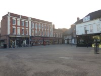
- The length of this section is approximately 34m.
- This section is not pedestrianised.
- Traffic is one way, travelling from south to north and is quiet.
- This section is level.
- The paving is concrete tiles.
- Some cafes and restaurants in this section have outside seating out on the paved areas as part of a street cafe culture.
- Between the pavement and road of this section are bollards at regular intervals.
- Much of the street furniture is painted black with gold banding.
Section 2 - New Street
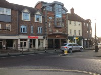
- The length of this section is approximately 217m.
- This section is not pedestrianised.
- Traffic is one way, travelling from south to north and is quiet.
- The majority of this section is level.
- There are some easy slopes created by dropped kerbs for access routes to private parking for some of the buildings along this section, and a passageway leading across City Walls Road to Spring Gardens.
- There are some ribbed gutters along this section creating an uneven surface.
- The paving is concrete tiles and block paving and is uneven in places.
- Some of the businesses along this section have advertising boards on the street which reduce the width of the footpath.
- Between the pavement and road of this section are bollards at regular intervals.
- There is directional signage along this section of the route.
- Much of the street furniture is painted black with gold banding.
Crossing Charles Street
- There is not a designated crossing point at the junction of New Street with Charles Street.
- At the edge of the pavements is a dropped kerb without tactile paving.
- Charles Street has traffic travelling in both directions.
- Traffic may be busy during peak times.
Section 3 - Charles Street to Union Street
- The length of this section is approximately 92m.
- This section is pedestrianised.
- This section is on an easy downhill gradient.
- The surface of the ground is block paving and concrete tiles and is uneven in places.
- Between the concrete tiles and block paving of this section are bollards at regular intervals.
- Some of the cafes and restaurants in this section have outside seating on the paved areas as part of a street cafe culture.
- There are directional signs, benches and black refuse bins along this section.
- Much of the street furniture is painted black with gold banding.
Crossing Union Street
- There is not a designated crossing point at the junction of Friar Street and Union Street.
- At the edge of the pavements is a dropped kerb without tactile paving.
- Union Street has traffic coming from both directions.
- Traffic may be busy during peak times.
- To avoid the 2 way traffic, it is possible to cross from the east to west side of the pedestrianised area of Friar Street and continue straight on to the next section of the route.
Section 4 - Union Street to College Street
- The length of this section is approximately 155m.
- This section is not pedestrianised.
- This section is level.
- The surface of the ground is concrete tiles and block paving and is uneven in places.
- Traffic along this section is both ways and travels between north and south and may be busy at peak times.
- Between the pavement and road for the first 18m of this section are bollards at regular intervals.
- After approximately 65m the footpath on the west side of the street crosses the entrance and exit to the NCP Cathedral Square Car Park.
- The car park entrance may be busy at peak times.
- There is directional signage at the south end of this section, on the junction of Friar Street and College Street.
- Much of the street furniture is painted black with gold banding.
- There is a designated crossing point at the south end of this section, at the junction of Friar Street and College Street.
- The crossing point has dropped kerbs with tactile paving.
- The crossing point does not have pedestrian controls.
Toilet Facilities
- Accessible and standard public toilets at the north end may be found in the Cornmarket Car Park.
- Many cafes and shops also have toilets but they may not be accessible.

